Directions to Paradise Liquor (Barnstable Town) with public transportation
The following transit lines have routes that pass near Paradise Liquor
How to get to Paradise Liquor by bus?
Click on the bus route to see step by step directions with maps, line arrival times and updated time schedules.
Bus stops near Paradise Liquor in Barnstable Town
Train station near Paradise Liquor in Barnstable Town
- Hyannis, 45 min walk,VIEW
Bus lines to Paradise Liquor in Barnstable Town
- H2O HYANNIS-ORLEANS, H2O Hyannis-Orleans,VIEW
- HYANNIS CROSSTOWN, Hyannis Crosstown,VIEW
- SANDWICH LINE, Sandwich Line,VIEW
- SEALINE HYANNIS-FALMOUTH/WOODS HOLE, Sealine Hyannis-Falmouth/Woods Hole,VIEW
- PATRIOT LTD, Patriot Square, South Dennis,VIEW
- PETER PAN, CAPE COD - PROVIDENCE - NEW YORK,VIEW
- PETER PAN, BOSTON LOGAN AIRPORT - BOSTON - HYANNIS,VIEW
- PETER PAN, PROVINCETOWN - HYANNIS,VIEW
- PETER PAN, NEW YORK - PROVIDENCE - CAPE COD,VIEW
- PETER PAN, HYANNIS - PROVINCETOWN,VIEW
- PETER PAN, HYANNIS - BOSTON - BOSTON LOGAN AIRPORT,VIEW
- HYANNIS - SOUTH SHORE TO LOGAN AIRPORT, Hyannis Transportation Center,VIEW
- BARNSTABLE VILLAGER, Cape Cod Community College, West Barnstable,VIEW
- HYANNIS AREA TROLLEY, Hyannis Transportation Center (Htc),VIEW
What are the closest stations to Paradise Liquor?
The closest stations to Paradise Liquor are:
- Sturgis Charter School -- Main Street, Hyannis is 285 yards away, 4 min walk.
- Sturgis Charter School @ South Street, Hyannis is 449 yards away, 6 min walk.
- Transportation Center Hyannis is 966 yards away, 12 min walk.
- Hyannis Transportation Center is 1042 yards away, 13 min walk.
- Hyannis Transportation Center (Htc) is 1044 yards away, 13 min walk.
- Hyannis is 3837 yards away, 45 min walk.
Which bus lines stop near Paradise Liquor?
These bus lines stop near Paradise Liquor: PETER PAN, SEALINE HYANNIS-FALMOUTH/WOODS HOLE.
What’s the nearest bus station to Paradise Liquor in Barnstable Town?
The nearest bus station to Paradise Liquor in Barnstable Town is Sturgis Charter School -- Main Street, Hyannis. It’s a 4 min walk away.
What time is the first bus to Paradise Liquor in Barnstable Town?
The HYANNIS - SOUTH SHORE TO LOGAN AIRPORT is the first bus that goes to Paradise Liquor in Barnstable Town. It stops nearby at 3:00 AM.
What time is the last bus to Paradise Liquor in Barnstable Town?
The HYANNIS - SOUTH SHORE TO LOGAN AIRPORT is the last bus that goes to Paradise Liquor in Barnstable Town. It stops nearby at 1:35 AM.
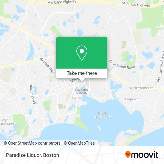
See Paradise Liquor, Barnstable Town, on the map
Public Transit to Paradise Liquor in Barnstable Town
Wondering how to get to Paradise Liquor in Barnstable Town? Moovit helps you find the best way to get to Paradise Liquor with step-by-step directions from the nearest public transit station.
Moovit provides free maps and live directions to help you navigate through your city. View schedules, routes, timetables, and find out how long does it take to get to Paradise Liquor in real time.
Looking for the nearest stop or station to Paradise Liquor? Check out this list of stops closest to your destination: Sturgis Charter School -- Main Street; Sturgis Charter School @ South Street; Transportation Center Hyannis; Hyannis Transportation Center; Hyannis Transportation Center (Htc); Hyannis.
Bus: PETER PAN, SEALINE HYANNIS-FALMOUTH/WOODS HOLE, H2O HYANNIS-ORLEANS, HYANNIS CROSSTOWN, SANDWICH LINE, PATRIOT LTD, BARNSTABLE VILLAGER, HYANNIS AREA TROLLEY, HYANNIS - SOUTH SHORE TO LOGAN AIRPORT.Train: CAPEFLYER.
Want to see if there’s another route that gets you there at an earlier time? Moovit helps you find alternative routes or times. Get directions from and directions to Paradise Liquor easily from the Moovit App or Website.
We make riding to Paradise Liquor easy, which is why over 1.7 million users, including users in Barnstable Town, trust Moovit as the best app for public transit. You don’t need to download an individual bus app or train app, Moovit is your all-in-one transit app that helps you find the best bus time or train time available.
For information on prices of bus and ferry, costs and ride fares to Paradise Liquor, please check the Moovit app.
Use the app to navigate to popular places including to the airport, hospital, stadium, grocery store, mall, coffee shop, school, college, and university.
Paradise Liquor Address: 66 School St street in Barnstable Town
- Bayside Cottage,
- 1199seiu,
- Veritas Direct Care,
- Lindsay Lacorte, do, MPH, Facoog,
- Richard J. Angelo, MD,
- Tara Chute, MD,
- Nisha David, MD,
- Hyannis Terminal,
- Home + Garden Pet Care + Services,
- Law Office of David E Sorensen,
- McEvoy Maurice M,
- Cape Cod Limousine Service,
- Larry Doughty House,
- Pier Recovery Center of Cape Cod,
- Dream Beauty,
- Budget Car Rental,
- Nantucket Windmill Auto Rental,
- Woods Hole, Martha's,
- Matthew A. Kalliath, do,
- Anthony R Prizzi MD PC
Places Near Paradise Liquor (Barnstable Town)
- Faneuil Hall, Boston,
- Isabella Stewart Gardner Museum, Boston,
- Boston Medical Center, Boston,
- Massachusetts General Hospital, Boston,
- Prudential Center, Boston,
- House Of Blues, Boston,
- North End, Boston,
- Cheers, Boston,
- Quincy Market, Boston,
- Mgm Music Hall, Boston,
- Boston Convention & Exhibition Center, Boston,
- Leader Bank Pavilion (Leader Bank Pavillion), Boston,
- Museum Of Science, Boston,
- Wilbur Theatre, Boston,
- Wang Theater, Boston,
- Boston Children's Hospital, Boston,
- Td Garden, Boston,
- Seaport District, Boston,
- Boston Common, Boston,
- Castle Island, Boston
How to get to popular places in Boston with public transit
Get around Barnstable Town by public transit!
Traveling around Barnstable Town has never been so easy. See step by step directions as you travel to any attraction, street or major public transit station. View bus and train schedules, arrival times, service alerts and detailed routes on a map, so you know exactly how to get to anywhere in Barnstable Town.
When traveling to any destination around Barnstable Town use Moovit's Live Directions with Get Off Notifications to know exactly where and how far to walk, how long to wait for your line, and how many stops are left. Moovit will alert you when it's time to get off — no need to constantly re-check whether yours is the next stop.
Wondering how to use public transit in Barnstable Town or how to pay for public transit in Barnstable Town? Moovit public transit app can help you navigate your way with public transit easily, and at minimum cost. It includes public transit fees, ticket prices, and costs. Looking for a map of Barnstable Town public transit lines? Moovit public transit app shows all public transit maps in Barnstable Town with all Bus, Train, Subway and Ferry routes and stops on an interactive map.
Boston has 4 transit type(s), including: Bus, Train, Subway and Ferry, operated by several transit agencies, including MBTA, Southeastern Regional Transit Authority, MetroWest Regional Transit Authority, Rhode Island Public Transit Authority, WRTA, Lowell Regional Transit Authority, Merrimack Valley Transit, Montachusett Regional Transit Authority, Cape Cod Regional Transit Authority, Brockton Area Transit Authority, Martha's Vineyard Transit Authority, the WAVE - Nantucket Regional Transit Authority, GATRA, Cape Ann Transportation Authority and Massport