See Paradise Pier, Anaheim, on the map
Directions to Paradise Pier (Anaheim) with public transportation
The following transit lines have routes that pass near Paradise Pier
 Bus:
Bus: - Train:
How to get to Paradise Pier by bus?
Click on the bus route to see step by step directions with maps, line arrival times and updated time schedules.
Bus stations near Paradise Pier in Anaheim
- Convention Center - Katella,5 min walk,
- Toy Story Bus Stop,7 min walk,
- Disneyland Main Transportation Center - 04,8 min walk,
- Disneyland Main Transportation Center - 15,8 min walk,
- Katella-Harbor,8 min walk,
- Disneyland Main Transportation Center - 03,10 min walk,
- Disneyland Main Transportation Center - 12,10 min walk,
- Best Western Stovall's Inn,11 min walk,
Train stations near Paradise Pier in Anaheim
- Anaheim-Artic Metrolink Station,61 min walk,
Bus lines to Paradise Pier in Anaheim
- 09,Four Points Sheraton Anaheim,
- 11,Disneyland Main Transportation Center - 11,
- 20,Toy Story Parking,
- 03,Grove District / Harbor Line,
- 04,Harbor Line,
- 15,Disneyland Main Transportation Center - 15,
- 15,Embassy Suites North,
- 03,Harbor NB & Convention Way,
- 06,Hotel Fera,
- 12,Disneyland Main Transportation Center - 12,
- 50,The Village at Orange,
- 09,Ball & Flore,
What are the closest stations to Paradise Pier?
The closest stations to Paradise Pier are:
- Convention Center - Katella is 31 yards away, 5 min walk.
- Toy Story Bus Stop is 75 yards away, 7 min walk.
- Disneyland Main Transportation Center - 04 is 103 yards away, 8 min walk.
- Disneyland Main Transportation Center - 15 is 149 yards away, 8 min walk.
- Disneyland Main Transportation Center - 03 is 291 yards away, 10 min walk.
- Disneyland Main Transportation Center - 12 is 317 yards away, 10 min walk.
- Katella-Harbor is 326 yards away, 8 min walk.
- Best Western Stovall's Inn is 897 yards away, 11 min walk.
- Anaheim-Artic Metrolink Station is 5241 yards away, 61 min walk.
Which bus lines stop near Paradise Pier?
These bus lines stop near Paradise Pier: 43, 50, 543, 83.
What’s the nearest bus stop to Paradise Pier in Anaheim?
The nearest bus stop to Paradise Pier in Anaheim is Convention Center - Katella. It’s a 5 min walk away.
What time is the first train to Paradise Pier in Anaheim?
The ORANGE COUNTY LINE is the first train that goes to Paradise Pier in Anaheim. It stops nearby at 4:38 AM.
What time is the last train to Paradise Pier in Anaheim?
The PACIFIC SURFLINER is the last train that goes to Paradise Pier in Anaheim. It stops nearby at 11:10 PM.
What time is the first bus to Paradise Pier in Anaheim?
The 20 is the first bus that goes to Paradise Pier in Anaheim. It stops nearby at 3:04 AM.
What time is the last bus to Paradise Pier in Anaheim?
The 20 is the last bus that goes to Paradise Pier in Anaheim. It stops nearby at 2:52 AM.
How much is the bus fare to Paradise Pier?
The bus fare to Paradise Pier costs about $2.00.
See Paradise Pier, Anaheim, on the map
Public Transit to Paradise Pier in Anaheim
Wondering how to get to Paradise Pier in Anaheim, United States? Moovit helps you find the best way to get to Paradise Pier with step-by-step directions from the nearest public transit station.
Moovit provides free maps and live directions to help you navigate through your city. View schedules, routes, timetables, and find out how long does it take to get to Paradise Pier in real time.
Looking for the nearest stop or station to Paradise Pier? Check out this list of stops closest to your destination: Convention Center - Katella; Toy Story Bus Stop; Disneyland Main Transportation Center - 04; Disneyland Main Transportation Center - 15; Disneyland Main Transportation Center - 03; Disneyland Main Transportation Center - 12; Katella-Harbor; Best Western Stovall's Inn; Anaheim-Artic Metrolink Station.
Bus:Train:
Want to see if there’s another route that gets you there at an earlier time? Moovit helps you find alternative routes or times. Get directions from and directions to Paradise Pier easily from the Moovit App or Website.
We make riding to Paradise Pier easy, which is why over 1.5 million users, including users in Anaheim, trust Moovit as the best app for public transit. You don’t need to download an individual bus app or train app, Moovit is your all-in-one transit app that helps you find the best bus time or train time available.
For information on prices of bus, costs and ride fares to Paradise Pier, please check the Moovit app.
Use the app to navigate to popular places including to the airport, hospital, stadium, grocery store, mall, coffee shop, school, college, and university.
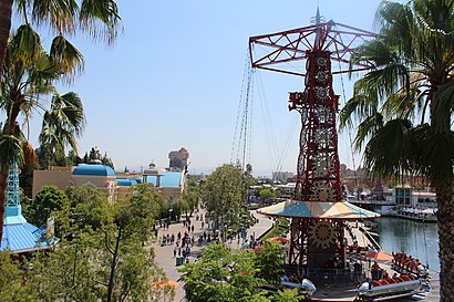
Paradise Pier Address: Disney California Adventure (at Disneyland Resort) street in Anaheim
Attractions near Paradise Pier
The Little Mermaid ~ Ariel's Undersea Adventure,Pixar Pier,California Screamin',Radiator Springs - Carburetor County,Cars Land,Eureka Fitness Center,Radiator Springs Racers,Radiator Springs Racers,Disney's Grand Californian Hotel & Spa,Disney California Adventure Park,Luigi's Admin Building,Avengers Campus,Toy Story Midway Mania!,Anaheim Convention Center Arena,WESTIN Anaheim Resort,Sunglass Icon,Disney's Paradise Pier Hotel,World of Disney,Sunset Boulevard Stop,Disneyland Park (Disney Grand California Hotel)How to get to popular attractions in Anaheim with public transit
Costco Wholesale, Tustin,Pacific View Mall, San Buenaventura (Ventura),Target, Huntington Beach,The NOVO by Microsoft, Downtown, La,East Shuttle Area, Anaheim,Muvico Theaters, Thousand Oaks,Hyatt Regency Orange County, Garden Grove,Eagle Rock, Eagle Rock, La,Disneyland, Anaheim,Anaheim Packing House, Anaheim,Hyatt Regency Century Plaza, Century City, La,Los Olivos Apartment Village, Irvine,City of Los Angeles, Downtown, La,Radiator Springs Racers, Anaheim,California Screamin', Anaheim,Diamond Bar, CA, Diamond Bar,24 Hour Fitness, East Los Angeles,Upland, CA, Upland,Costco Wholesale, Northridge, La,Anaheim Marriott, AnaheimGet around Anaheim by public transit!
Traveling around Anaheim has never been so easy. See step by step directions as you travel to any attraction, street or major public transit station. View bus and train schedules, arrival times, service alerts and detailed routes on a map, so you know exactly how to get to anywhere in Anaheim.
When traveling to any destination around Anaheim use Moovit's Live Directions with Get Off Notifications to know exactly where and how far to walk, how long to wait for your line, and how many stops are left. Moovit will alert you when it's time to get off — no need to constantly re-check whether yours is the next stop.
Wondering how to use public transit in Anaheim or how to pay for public transit in Anaheim? Moovit public transit app can help you navigate your way with public transit easily, and at minimum cost. It includes public transit fees, ticket prices, and costs. Looking for a map of Anaheim public transit lines? Moovit public transit app shows all public transit maps in Anaheim with all bus routes and stops on an interactive map.
Anaheim has 1 transit type(s), including: bus, operated by several transit agencies, including Metro - Los Angeles, Metro - Los Angeles, Metrolink Trains, METRO, Long Beach Transit, LADOT, OCTA, Foothill Transit, Big Blue Bus, Riverside Transit Agency, LAX FlyAway, Airporter Shuttle, Playa Vista Shuttle, Amtrak and OMNITRANS