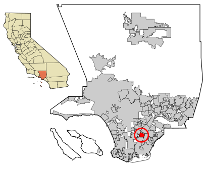
See Paramount, CA on the map
Directions to Paramount, CA with public transportation
The following transit lines have routes that pass near Paramount, CA
 Bus:
Bus:
How to get to Paramount, CA by bus?
Click on the bus route to see step by step directions with maps, line arrival times and updated time schedules.
Bus stations near Paramount, CA
- Downey & Contreras SE,6 min walk,
- Somerset / Downey,10 min walk,
- Rosecrans & Downey NW,11 min walk,
- Rosecrans / Downey,11 min walk,
- Paramount / Rosecrans,21 min walk,
- Paramount & All America City,21 min walk,
Light Rail stations near Paramount, CA
- Lakewood Blvd Station,42 min walk,
Bus lines to Paramount, CA
- 22,22 Downey Ave to Downtown,
- 127,Harbor Freeway Station,
- 71,71 - Orange to Rosecrans at Lakewood,
- 125,El Segundo,
- 265,Pico Rivera,
- 23,23 Cherry to Downtown via Paramount,
What are the closest stations to Paramount, CA?
The closest stations to Paramount, CA are:
- Downey & Contreras SE is 349 yards away, 6 min walk.
- Somerset / Downey is 639 yards away, 10 min walk.
- Rosecrans & Downey NW is 713 yards away, 11 min walk.
- Rosecrans / Downey is 732 yards away, 11 min walk.
- Paramount / Rosecrans is 1570 yards away, 21 min walk.
- Paramount & All America City is 1632 yards away, 21 min walk.
- Lakewood Blvd Station is 3543 yards away, 42 min walk.
Which bus lines stop near Paramount, CA?
These bus lines stop near Paramount, CA: 125, 127, 22.
What’s the nearest bus stop to Paramount, CA?
The nearest bus stop to Paramount, CA is Downey & Contreras SE. It’s a 6 min walk away.
What time is the first light rail to Paramount, CA?
The C LINE is the first light rail that goes to Paramount, CA. It stops nearby at 3:55 AM.
What time is the last light rail to Paramount, CA?
The C LINE is the last light rail that goes to Paramount, CA. It stops nearby at 12:30 AM.
What time is the first bus to Paramount, CA?
The 125 is the first bus that goes to Paramount, CA. It stops nearby at 4:31 AM.
What time is the last bus to Paramount, CA?
The 22 is the last bus that goes to Paramount, CA. It stops nearby at 10:48 PM.
How much is the light rail fare to Paramount, CA?
The light rail fare to Paramount, CA costs about $1.75.
See Paramount, CA on the map
Public Transportation to Paramount, CA
Wondering how to get to Paramount, CA, United States? Moovit helps you find the best way to get to Paramount, CA with step-by-step directions from the nearest public transit station.
Moovit provides free maps and live directions to help you navigate through your city. View schedules, routes, timetables, and find out how long does it take to get to Paramount, CA in real time.
Looking for the nearest stop or station to Paramount, CA? Check out this list of stops closest to your destination: Downey & Contreras SE; Somerset / Downey; Rosecrans & Downey NW; Rosecrans / Downey; Paramount / Rosecrans; Paramount & All America City; Lakewood Blvd Station.
Bus:
Want to see if there’s another route that gets you there at an earlier time? Moovit helps you find alternative routes or times. Get directions from and directions to Paramount, CA easily from the Moovit App or Website.
We make riding to Paramount, CA easy, which is why over 1.5 million users, including users in Paramount, trust Moovit as the best app for public transit. You don’t need to download an individual bus app or train app, Moovit is your all-in-one transit app that helps you find the best bus time or train time available.
For information on prices of bus and light rail, costs and ride fares to Paramount, CA, please check the Moovit app.
Use the app to navigate to popular places including to the airport, hospital, stadium, grocery store, mall, coffee shop, school, college, and university.
Location: Paramount, Los Angeles
Attractions near Paramount, CA
Paramount High School- Senior Campus,Self Storage Place,Extra Space Storage,PHS Pirate Stadium,Million Dollar Spot Barber Shop,8425 1/2 E 2nd St Apts,Paramount Pipeline LLC,Western Union,Paramount High School- West Campus,8136 E 2nd St Apts,15011 1/2 S Downey Ave Apts,Somerset Apartments,Paramount Park Middle School,Angel Tires & Wheels,Elderly Nutrition Center,Somerland Liquor,Gonzalez Sports, Inc.,Business,Bell Haus K9,Hanks Sheet MetalHow to get to popular attractions in Paramount with public transit
City of Los Angeles, Downtown, La,City of San Bernardino, San Bernardino,Universal CityWalk Hollywood, Universal City, La,Corona del Mar State Beach, Newport Beach,City of Calabasas, Calabasas,Citadel Outlets, Commerce,Fry's Electronics, Anaheim,City of Brea, Brea,Diamond Bar, CA, Diamond Bar,Blu Jam Café, Fairfax, La,Fontana, CA, Fontana,The Little Mermaid ~ Ariel's Undersea Adventure, Anaheim,The Water Garden, Santa Monica,Diamond Jamboree Shopping Center, Irvine,LA Fitness, Santa Clarita,City of Rancho Cucamonga, Rancho Cucamonga,Ball Cast Member Parking Lot (BCML), Anaheim,Hyatt Regency Orange County, Garden Grove,SLS Hotel, a Luxury Collection Hotel, Beverly Hills, Beverly Grove, La,City of Murrieta, MurrietaGet around Paramount by public transit!
Traveling around Paramount has never been so easy. See step by step directions as you travel to any attraction, street or major public transit station. View bus and train schedules, arrival times, service alerts and detailed routes on a map, so you know exactly how to get to anywhere in Paramount.
When traveling to any destination around Paramount use Moovit's Live Directions with Get Off Notifications to know exactly where and how far to walk, how long to wait for your line, and how many stops are left. Moovit will alert you when it's time to get off — no need to constantly re-check whether yours is the next stop.
Wondering how to use public transit in Paramount or how to pay for public transit in Paramount? Moovit public transit app can help you navigate your way with public transit easily, and at minimum cost. It includes public transit fees, ticket prices, and costs. Looking for a map of Paramount public transit lines? Moovit public transit app shows all public transit maps in Paramount with all bus or light rail routes and stops on an interactive map.
Paramount has 2 transit type(s), including: bus or light rail, operated by several transit agencies, including Metro - Los Angeles, Metro - Los Angeles, Metrolink Trains, METRO, Long Beach Transit, LADOT, OCTA, Foothill Transit, Big Blue Bus, Riverside Transit Agency, LAX FlyAway, Airporter Shuttle, Playa Vista Shuttle, Amtrak and OMNITRANS