Directions to Paramount Network (New Hempstead) with public transportation
The following transit lines have routes that pass near Paramount Network
 Bus: 91, ROCKLAND COACHES.
- Train: PVL.
How to get to Paramount Network by bus?
Click on the bus route to see step by step directions with maps, line arrival times and updated time schedules.
From Palisades mall, West Nyack
81 minFrom Regeneron Pharmaceuticals Inc, Tarrytown
119 minFrom St. John's Riverside Hospital, Yonkers
143 minFrom Peekskill, NY, Peekskill
224 minFrom Bergen Community College, Paramus
194 minFrom Westfield Garden State Plaza, Paramus
183 minFrom Paramus, NJ, Paramus
130 minFrom IKEA Paramus, Paramus
183 minFrom Ridge Hill Mall, Yonkers
263 min
Bus stop near Paramount Network in New Hempstead
- New Square @ Hwy 45, 18 min walk,VIEW
Train station near Paramount Network in New Hempstead
- Spring Valley, 62 min walk,VIEW
Bus lines to Paramount Network in New Hempstead
- 91, Palisades Ctr,VIEW
What are the closest stations to Paramount Network?
The closest stations to Paramount Network are:
- New Square @ Hwy 45 is 1514 yards away, 18 min walk.
- Spring Valley is 5270 yards away, 62 min walk.
Which bus lines stop near Paramount Network?
These bus lines stop near Paramount Network: 91, ROCKLAND COACHES.
What time is the first train to Paramount Network in New Hempstead?
The PVL is the first train that goes to Paramount Network in New Hempstead. It stops nearby at 5:10 AM.
What time is the last train to Paramount Network in New Hempstead?
The PVL is the last train that goes to Paramount Network in New Hempstead. It stops nearby at 12:22 AM.
What time is the first bus to Paramount Network in New Hempstead?
The 91 is the first bus that goes to Paramount Network in New Hempstead. It stops nearby at 5:45 AM.
What time is the last bus to Paramount Network in New Hempstead?
The 91 is the last bus that goes to Paramount Network in New Hempstead. It stops nearby at 8:15 PM.
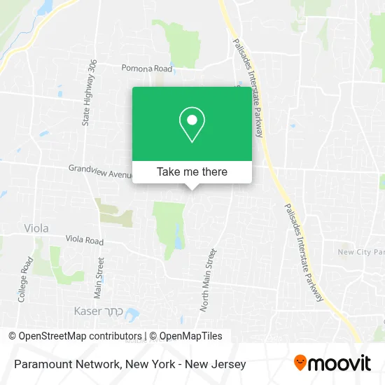
See Paramount Network, New Hempstead, on the map
Public Transit to Paramount Network in New Hempstead
Wondering how to get to Paramount Network in New Hempstead? Moovit helps you find the best way to get to Paramount Network with step-by-step directions from the nearest public transit station.
Moovit provides free maps and live directions to help you navigate through your city. View schedules, routes, timetables, and find out how long does it take to get to Paramount Network in real time.
Looking for the nearest stop or station to Paramount Network? Check out this list of stops closest to your destination: New Square @ Hwy 45; Spring Valley.
Bus: 91, ROCKLAND COACHES.Train: PVL.
Want to see if there’s another route that gets you there at an earlier time? Moovit helps you find alternative routes or times. Get directions from and directions to Paramount Network easily from the Moovit App or Website.
We make riding to Paramount Network easy, which is why over 1.5 million users, including users in New Hempstead, trust Moovit as the best app for public transit. You don’t need to download an individual bus app or train app, Moovit is your all-in-one transit app that helps you find the best bus time or train time available.
For information on prices of bus and train, costs and ride fares to Paramount Network, please check the Moovit app.
Use the app to navigate to popular places including to the airport, hospital, stadium, grocery store, mall, coffee shop, school, college, and university.
Paramount Network Address: 124 Hempstead Rd street in New Hempstead
- Rps/Medic 25,
- Rn Consulting Of Greater NY,
- East Ramapo Central School District,
- Carmita's Garage Shop,
- Tower Legends,
- St. George Syrian Orthodox Church,
- Tri-County Care,
- Hamaspik Medicare Plans,
- Monsey Shatnez Lab,
- Ateres Charna Wedding Hall,
- USPS Collection Box - Blue Box,
- Hillcrest Nursing and Rehabilitation Center,
- Pine Valley Rehab,
- Monsey Trails,
- Uptop Studios,
- Neil P. Shah,
- Monsey Trails Corporation,
- Wickes / Arborists, A Davey Company,
- Refuah Health Center,
- Adhd Family Coach
Places Near Paramount Network (New Hempstead)
- 376 Hudson Street, Manhattan,
- 66 John Street, Manhattan,
- Mountainside Hospital, Glen Ridge,
- 911 Memorial, Manhattan,
- 26 Federal Plaza, Manhattan,
- Hudson Yards, Manhattan,
- qqqq, Manhattan,
- Pier 83, Manhattan,
- Chinatown, Manhattan,
- Queens Center Mall, Queens,
- Bellevue Hospital, Manhattan,
- Rockefeller Center, Manhattan,
- Times Square, Manhattan,
- 111 Centre New York City Supreme Court, Manhattan,
- SoHo, Manhattan,
- Katz's Deli, Manhattan,
- Wall Street, Manhattan,
- 1 Police Plaza, Manhattan,
- San Gennaro Feast, Manhattan,
- 3 Stone St, Manhattan
How to get to popular places in New York - New Jersey with public transit
Get around New Hempstead by public transit!
Traveling around New Hempstead has never been so easy. See step by step directions as you travel to any attraction, street or major public transit station. View bus and train schedules, arrival times, service alerts and detailed routes on a map, so you know exactly how to get to anywhere in New Hempstead.
When traveling to any destination around New Hempstead use Moovit's Live Directions with Get Off Notifications to know exactly where and how far to walk, how long to wait for your line, and how many stops are left. Moovit will alert you when it's time to get off — no need to constantly re-check whether yours is the next stop.
Wondering how to use public transit in New Hempstead or how to pay for public transit in New Hempstead? Moovit public transit app can help you navigate your way with public transit easily, and at minimum cost. It includes public transit fees, ticket prices, and costs. Looking for a map of New Hempstead public transit lines? Moovit public transit app shows all public transit maps in New Hempstead with all Bus, Train, Subway, Light Rail, Ferry and Cable Car routes and stops on an interactive map.
New York - New Jersey has 6 transit type(s), including: Bus, Train, Subway, Light Rail, Ferry and Cable Car, operated by several transit agencies, including MTA Subway, Metro-North Railroad, LIRR, PATH, MTA New York City Transit - Express routes, MTA Bus, NJ Transit, NYC Ferry, NICE bus, Bee-Line Bus, NJ Transit Rail, Norwalk Transit District, Hartford Line, River Valley Transit and HART