Directions to Park 151 (Cambridge) with public transportation
The following transit lines have routes that pass near Park 151
 Bus: 69, 80, EZRIDE, GREEN LINE SHUTTLE, GREEN LINE SHUTTLE.
- Train: FAIRMOUNT, FITCHBURG, FRAMINGHAM/WORCESTER, PROVIDENCE/STOUGHTON.
- Subway: GREEN LINE D, GREEN LINE E, ORANGE LINE, GREEN LINE B, GREEN LINE C.
How to get to Park 151 by bus?
Click on the bus route to see step by step directions with maps, line arrival times and updated time schedules.
From Stone Zoo, Stoneham
79 minFrom The Mall At Chestnut Hill, Newton
84 minFrom Roxbury Community College, Boston
70 minFrom Warrior Ice Arena, Boston
46 minFrom the mall at rockingham park mall, Boston
62 minFrom Washington St, Boston
108 minFrom Belle Isle Lobster & Seafood, Winthrop Town
68 minFrom Heartbreak Hill, Newton
72 minFrom McLean Hospital, Belmont
68 min
How to get to Park 151 by train?
Click on the train route to see step by step directions with maps, line arrival times and updated time schedules.
How to get to Park 151 by subway?
Click on the subway route to see step by step directions with maps, line arrival times and updated time schedules.
Bus stops near Park 151 in Cambridge
Subway stations near Park 151 in Cambridge
Bus lines to Park 151 in Cambridge
- GREEN LINE SHUTTLE, Union Square - North Station,VIEW
- GREEN LINE SHUTTLE, Union Square - Government Center,VIEW
- 69, Lechmere - Harvard,VIEW
- 80, Lechmere - Arlington Center,VIEW
- 87, Lechmere - Arlington Center,VIEW
- 88, Lechmere - Clarendon Hill,VIEW
- GREEN LINE E SHUTTLE, Government Center - Medford/Tufts (Shuttle),VIEW
- GREEN LINE E SHUTTLE, Medford/Tufts - North Station,VIEW
- GREEN LINE E SHUTTLE, North Station - Medford/Tufts (Shuttle),VIEW
- GREEN LINE SHUTTLE, Medford/Tufts - Government Center via Union Square,VIEW
- GREEN LINE SHUTTLE, Lechmere - North Station,VIEW
- GREEN LINE SHUTTLE, North Station - Sullivan Square via East Somerville,VIEW
- EZRIDE, Weekend Shuttle Outbound,VIEW
- EZRIDE, Morning Shuttle Inbound,VIEW
- EZRIDE, After 11:30 AM Shuttle Outbound,VIEW
- EZRIDE, Weekend Shuttle Inbound,VIEW
- EZRIDE, Morning Shuttle Outbound,VIEW
- EZRIDE, After 11:30 AM Shuttle Inbound,VIEW
- ORANGE LINE SHUTTLE, State (Shuttle),VIEW
- ORANGE LINE SHUTTLE, Wellington (Local Shuttle),VIEW
What are the closest stations to Park 151?
The closest stations to Park 151 are:
- Lechmere - Water St @ Lechmere Busway is 116 yards away, 2 min walk.
- Lechmere is 330 yards away, 5 min walk.
- Science Park / West End is 806 yards away, 10 min walk.
- Community College - Rutherford Ave @ Austin St is 938 yards away, 11 min walk.
- Community Collge is 1815 yards away, 22 min walk.
Which bus lines stop near Park 151?
These bus lines stop near Park 151: 69, 80, EZRIDE.
Which train lines stop near Park 151?
These train lines stop near Park 151: FAIRMOUNT, FITCHBURG, FRAMINGHAM/WORCESTER, PROVIDENCE/STOUGHTON.
Which subway lines stop near Park 151?
These subway lines stop near Park 151: GREEN LINE D, GREEN LINE E, ORANGE LINE.
What’s the nearest subway station to Park 151 in Cambridge?
The nearest subway station to Park 151 in Cambridge is Science Park / West End. It’s a 10 min walk away.
What’s the nearest bus station to Park 151 in Cambridge?
The nearest bus station to Park 151 in Cambridge is Lechmere - Water St @ Lechmere Busway. It’s a 2 min walk away.
What time is the first subway to Park 151 in Cambridge?
The GREEN LINE E is the first subway that goes to Park 151 in Cambridge. It stops nearby at 4:49 AM.
What time is the last subway to Park 151 in Cambridge?
The GREEN LINE E is the last subway that goes to Park 151 in Cambridge. It stops nearby at 2:34 AM.
What time is the first bus to Park 151 in Cambridge?
The 80 is the first bus that goes to Park 151 in Cambridge. It stops nearby at 5:23 AM.
What time is the last bus to Park 151 in Cambridge?
The 69 is the last bus that goes to Park 151 in Cambridge. It stops nearby at 1:22 AM.
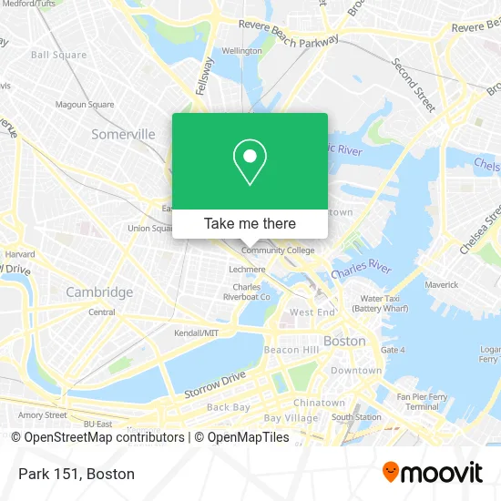
See Park 151, Cambridge, on the map
Public Transit to Park 151 in Cambridge
Wondering how to get to Park 151 in Cambridge? Moovit helps you find the best way to get to Park 151 with step-by-step directions from the nearest public transit station.
Moovit provides free maps and live directions to help you navigate through your city. View schedules, routes, timetables, and find out how long does it take to get to Park 151 in real time.
Looking for the nearest stop or station to Park 151? Check out this list of stops closest to your destination: Lechmere - Water St @ Lechmere Busway; Lechmere; Science Park / West End; Community College - Rutherford Ave @ Austin St; Community Collge.
Bus: 69, 80, EZRIDE, GREEN LINE SHUTTLE, GREEN LINE SHUTTLE, 87, 88, GREEN LINE E SHUTTLE, ORANGE LINE SHUTTLE, ORANGE LINE SHUTTLE, ORANGE LINE SHUTTLE.Train: FAIRMOUNT, FITCHBURG, FRAMINGHAM/WORCESTER, PROVIDENCE/STOUGHTON.Subway: GREEN LINE D, GREEN LINE E, ORANGE LINE, GREEN LINE B, GREEN LINE C.
Want to see if there’s another route that gets you there at an earlier time? Moovit helps you find alternative routes or times. Get directions from and directions to Park 151 easily from the Moovit App or Website.
We make riding to Park 151 easy, which is why over 1.7 million users, including users in Cambridge, trust Moovit as the best app for public transit. You don’t need to download an individual bus app or train app, Moovit is your all-in-one transit app that helps you find the best bus time or train time available.
For information on prices of bus, subway and train, costs and ride fares to Park 151, please check the Moovit app.
Use the app to navigate to popular places including to the airport, hospital, stadium, grocery store, mall, coffee shop, school, college, and university.
Park 151 Address: 151 N 1st St street in Cambridge
- Cambridge Crossing,
- Geppetto,
- The Lexington,
- REI,
- Boston Engine Terminal - CRMF,
- Passage To India,
- Ava North Point (Avalon North Point),
- MBTA-Lechmere,
- Lechmere Station,
- Green Line (Lechmere),
- Hampton Inn-Cambridge,
- Hampton Inn by Hilton Boston Cambridge,
- Zinc,
- Entrata, Inc.,
- Hampton Inn Boston/Cambridge,
- 2 Canal Park,
- CarGurus,
- Spira Yoga Shala,
- Avalon,
- Twenty20
Places Near Park 151 (Cambridge)
- Museum Of Science, Boston,
- Castle Island, Boston,
- Massachusetts General Hospital, Boston,
- Wang Theater, Boston,
- Mgm Music Hall, Boston,
- Quincy Market, Boston,
- Boston Children's Hospital, Boston,
- Boston Convention & Exhibition Center, Boston,
- Prudential Center, Boston,
- Boston Common, Boston,
- Boston Medical Center, Boston,
- Isabella Stewart Gardner Museum, Boston,
- Seaport District, Boston,
- Faneuil Hall, Boston,
- Cheers, Boston,
- North End, Boston,
- Wilbur Theatre, Boston,
- Leader Bank Pavilion (Leader Bank Pavillion), Boston,
- House Of Blues, Boston,
- Td Garden, Boston
How to get to popular places in Boston with public transit
Get around Cambridge by public transit!
Traveling around Cambridge has never been so easy. See step by step directions as you travel to any attraction, street or major public transit station. View bus and train schedules, arrival times, service alerts and detailed routes on a map, so you know exactly how to get to anywhere in Cambridge.
When traveling to any destination around Cambridge use Moovit's Live Directions with Get Off Notifications to know exactly where and how far to walk, how long to wait for your line, and how many stops are left. Moovit will alert you when it's time to get off — no need to constantly re-check whether yours is the next stop.
Wondering how to use public transit in Cambridge or how to pay for public transit in Cambridge? Moovit public transit app can help you navigate your way with public transit easily, and at minimum cost. It includes public transit fees, ticket prices, and costs. Looking for a map of Cambridge public transit lines? Moovit public transit app shows all public transit maps in Cambridge with all Bus, Train, Subway and Ferry routes and stops on an interactive map.
Boston has 4 transit type(s), including: Bus, Train, Subway and Ferry, operated by several transit agencies, including MBTA, Southeastern Regional Transit Authority, MetroWest Regional Transit Authority, Rhode Island Public Transit Authority, WRTA, Lowell Regional Transit Authority, Merrimack Valley Transit, Montachusett Regional Transit Authority, Cape Cod Regional Transit Authority, Brockton Area Transit Authority, Martha's Vineyard Transit Authority, the WAVE - Nantucket Regional Transit Authority, GATRA, Cape Ann Transportation Authority and Massport