Directions to Parkfairfax (Alexandria) with public transportation
The following transit lines have routes that pass near Parkfairfax
How to get to Parkfairfax by bus?
Click on the bus route to see step by step directions with maps, line arrival times and updated time schedules.
How to get to Parkfairfax by metro?
Click on the metro route to see step by step directions with maps, line arrival times and updated time schedules.
Bus stops near Parkfairfax in Alexandria
- Martha Custis Dr + Mt Eagle Pl, 3 min walk,
- 3700 Martha Custis Dr @ Gunston Rd, 3 min walk,
- N Quaker Ln+32 Rd, 5 min walk,
- Martha Custis Dr & Preston Rd, 5 min walk,
Metro stations near Parkfairfax in Alexandria
- Potomac Yard/Vt Metrorail Station, 16 min walk,
Bus lines to Parkfairfax in Alexandria
- 36A, Mark Center Via W Glebe Rd & Menokin Dr,
- 104, Pentagon Metro Via Cameron Mills Rd & Parkfairfax,
- 36B, Mark Center Via W Glebe Rd & Park Place,
- 103, Braddock Metro Via W Glebe Rd & Russell Rd,
- 23A, West To Tysons,
- 23B, East To Crystal City,
- 22F, East To Pentagon,
- 22A, East To Pentagon,
What are the closest stations to Parkfairfax?
The closest stations to Parkfairfax are:
- Martha Custis Dr + Mt Eagle Pl is 126 yards away, 3 min walk.
- 3700 Martha Custis Dr @ Gunston Rd is 220 yards away, 3 min walk.
- N Quaker Ln+32 Rd is 289 yards away, 5 min walk.
- Martha Custis Dr & Preston Rd is 295 yards away, 5 min walk.
- Potomac Yard/Vt Metrorail Station is 1344 yards away, 16 min walk.
Which bus lines stop near Parkfairfax?
These bus lines stop near Parkfairfax: 103, 22A, 23B.
Which metro lines stop near Parkfairfax?
These metro lines stop near Parkfairfax: METRORAIL BLUE LINE, METRORAIL YELLOW LINE.
What’s the nearest metro station to Parkfairfax in Alexandria?
The nearest metro station to Parkfairfax in Alexandria is Potomac Yard/Vt Metrorail Station. It’s a 16 min walk away.
What’s the nearest bus stop to Parkfairfax in Alexandria?
The nearest bus stops to Parkfairfax in Alexandria are Martha Custis Dr + Mt Eagle Pl and 3700 Martha Custis Dr @ Gunston Rd. The closest one is a 3 min walk away.
What time is the first metro to Parkfairfax in Alexandria?
The METRORAIL YELLOW LINE is the first metro that goes to Parkfairfax in Alexandria. It stops nearby at 5:06 AM.
What time is the last metro to Parkfairfax in Alexandria?
The METRORAIL YELLOW LINE is the last metro that goes to Parkfairfax in Alexandria. It stops nearby at 12:34 AM.
What time is the first bus to Parkfairfax in Alexandria?
The 23B is the first bus that goes to Parkfairfax in Alexandria. It stops nearby at 5:39 AM.
What time is the last bus to Parkfairfax in Alexandria?
The 23B is the last bus that goes to Parkfairfax in Alexandria. It stops nearby at 2:16 AM.
See Parkfairfax, Alexandria, on the map
Public Transit to Parkfairfax in Alexandria
Wondering how to get to Parkfairfax in Alexandria, United States? Moovit helps you find the best way to get to Parkfairfax with step-by-step directions from the nearest public transit station.
Moovit provides free maps and live directions to help you navigate through your city. View schedules, routes, timetables, and find out how long does it take to get to Parkfairfax in real time.
Looking for the nearest stop or station to Parkfairfax? Check out this list of stops closest to your destination: Martha Custis Dr + Mt Eagle Pl; 3700 Martha Custis Dr @ Gunston Rd; N Quaker Ln+32 Rd; Martha Custis Dr & Preston Rd; Potomac Yard/Vt Metrorail Station.
Bus: 103, 22A, 23B, 36A, 104, 36B, 23A, 22F.Metro: METRORAIL BLUE LINE, METRORAIL YELLOW LINE.
Want to see if there’s another route that gets you there at an earlier time? Moovit helps you find alternative routes or times. Get directions from and directions to Parkfairfax easily from the Moovit App or Website.
We make riding to Parkfairfax easy, which is why over 1.5 million users, including users in Alexandria, trust Moovit as the best app for public transit. You don’t need to download an individual bus app or train app, Moovit is your all-in-one transit app that helps you find the best bus time or train time available.
For information on prices of bus and metro, costs and ride fares to Parkfairfax, please check the Moovit app.
Use the app to navigate to popular places including to the airport, hospital, stadium, grocery store, mall, coffee shop, school, college, and university.
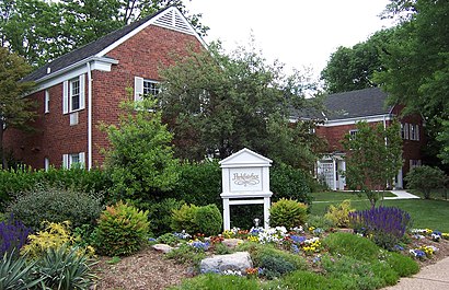
Parkfairfax Address: 3500 - 3600 Martha Custis Dr street in Alexandria
Attractions near Parkfairfax
Bus Boys and Poets,Theatre Signatur,Parkfairfax,Shirlington Bus Station,FMP Consulting,Quility Garage Doors,4000 Campbell Avenue,Great American Restaurants,Carlyle,Green Team Carpet Cleaning,Telemundo Channel 64 (Telemundo Washington DC),WZDC,WETA,Astro Beer Hall,Corso Italian,Kay Houghton & Associates at Exp Realty,Solutions Physical Therapy and Sports Medicine,Quincy Parking Garage,Park Fairfax Fitness Center,Blink ChargingHow to get to popular attractions in Alexandria with public transit
Red Lounge Bar & Grill, Washington,Defense Threat Reduction Agency, Fairfax County,Park Potomac Place, Montgomery County,Cherry Hill Light Rail Station, Baltimore,Hillendale Shopping Center, Baltimore County,Soundcheck, Washington,Parkside Shopping Center, Baltimore,Redland, Maryland, Montgomery County,Dangerously Delicious Pies, Washington,Clipper Mill, Baltimore,Broken Land Parkway, Howard County,Parkdale High School, Prince George's County,Student Services Center (SSRV) - CCBC Essex, Baltimore County,Caboose Brewing Company, Fairfax County,Rome Building - Johns Hopkins SAIS, Washington,BJ's Wholesale Club, Baltimore,MICA Fox Building, Baltimore,Dunkin Donuts, Washington,National Gallery Of Art, Washington,PRTC Transit Center, Prince William CountyGet around Washington, D.C. - Baltimore, MD by public transit!
Traveling around Washington, D.C. - Baltimore, MD has never been so easy. See step by step directions as you travel to any attraction, street or major public transit station. View bus and train schedules, arrival times, service alerts and detailed routes on a map, so you know exactly how to get to anywhere in Washington, D.C. - Baltimore, MD.
When traveling to any destination around Washington, D.C. - Baltimore, MD use Moovit's Live Directions with Get Off Notifications to know exactly where and how far to walk, how long to wait for your line, and how many stops are left. Moovit will alert you when it's time to get off — no need to constantly re-check whether yours is the next stop.
Wondering how to use public transit in Washington, D.C. - Baltimore, MD or how to pay for public transit in Washington, D.C. - Baltimore, MD? Moovit public transit app can help you navigate your way with public transit easily, and at minimum cost. It includes public transit fees, ticket prices, and costs. Looking for a map of Washington, D.C. - Baltimore, MD public transit lines? Moovit public transit app shows all public transit maps in Washington, D.C. - Baltimore, MD with all Bus, Train, Metro, Light Rail and Ferry routes and stops on an interactive map.
Washington, D.C. - Baltimore, MD has 5 transit type(s), including: Bus, Train, Metro, Light Rail and Ferry, operated by several transit agencies, including WMATA, Montgomery County Ride On, Montgomery County MD Ride On, Fairfax Connector, TheBus, PRTC, DC Circulator, DASH - Alexandria, Arlington Transit (ART), DC Streetcar, RTA of Central Maryland, FRED, MDOT MTA, Marc, Virginia Railway Express (VRE)