Directions to Parks & Recreation (Nahant) with public transportation
The following transit lines have routes that pass near Parks & Recreation
 Bus: 426, 442, 439, 441, 441/442.
- Train: NEWBURYPORT/ROCKPORT.
- Ferry: LYNN FERRY.
How to get to Parks & Recreation by bus?
Click on the bus route to see step by step directions with maps, line arrival times and updated time schedules.
From Hampton Inn Boston Logan Airport, Revere
63 minFrom Constitution Beach, Boston
77 minFrom Massachusetts Water Resource Authority (MWRA), Chelsea
67 minFrom Holiday Inn Express-Saugus, Saugus
74 minFrom Winthrop, Winthrop Town
76 minFrom Courtyard by Marriott Boston Logan Airport, Boston
50 minFrom Belle Isle Lobster & Seafood, Winthrop Town
66 minFrom Canobie Lake Park, Chelsea
71 minFrom Malden Catholic High School, Malden
69 min
How to get to Parks & Recreation by train?
Click on the train route to see step by step directions with maps, line arrival times and updated time schedules.
Bus stops near Parks & Recreation in Nahant
Train station near Parks & Recreation in Nahant
- Lynn Interim, 8 min walk,VIEW
Ferry station near Parks & Recreation in Nahant
- Blossom Street Pier, 27 min walk,VIEW
Bus lines to Parks & Recreation in Nahant
What are the closest stations to Parks & Recreation?
The closest stations to Parks & Recreation are:
- Beach Rd @ Surfside Rd is 125 yards away, 2 min walk.
- Broad St @ Silsbee St is 483 yards away, 6 min walk.
- Lynn Interim is 622 yards away, 8 min walk.
- Blossom Street Pier is 2304 yards away, 27 min walk.
Which bus lines stop near Parks & Recreation?
These bus lines stop near Parks & Recreation: 426, 442.
Which train line stops near Parks & Recreation?
NEWBURYPORT/ROCKPORT (#125 | Newburyport)
What’s the nearest train station to Parks & Recreation in Nahant?
The nearest train station to Parks & Recreation in Nahant is Lynn Interim. It’s a 8 min walk away.
What’s the nearest bus station to Parks & Recreation in Nahant?
The nearest bus station to Parks & Recreation in Nahant is Beach Rd @ Surfside Rd. It’s a 2 min walk away.
What’s the nearest ferry station to Parks & Recreation in Nahant?
The nearest ferry station to Parks & Recreation in Nahant is Blossom Street Pier. It’s a 27 min walk away.
What time is the first train to Parks & Recreation in Nahant?
The NEWBURYPORT/ROCKPORT is the first train that goes to Parks & Recreation in Nahant. It stops nearby at 5:27 AM.
What time is the last train to Parks & Recreation in Nahant?
The NEWBURYPORT/ROCKPORT is the last train that goes to Parks & Recreation in Nahant. It stops nearby at 12:20 AM.
What time is the first bus to Parks & Recreation in Nahant?
The 442 is the first bus that goes to Parks & Recreation in Nahant. It stops nearby at 5:08 AM.
What time is the last bus to Parks & Recreation in Nahant?
The 441/442 is the last bus that goes to Parks & Recreation in Nahant. It stops nearby at 1:35 AM.
What time is the first ferry to Parks & Recreation in Nahant?
The LYNN FERRY is the first ferry that goes to Parks & Recreation in Nahant. It stops nearby at 6:00 AM.
What time is the last ferry to Parks & Recreation in Nahant?
The LYNN FERRY is the last ferry that goes to Parks & Recreation in Nahant. It stops nearby at 7:55 PM.
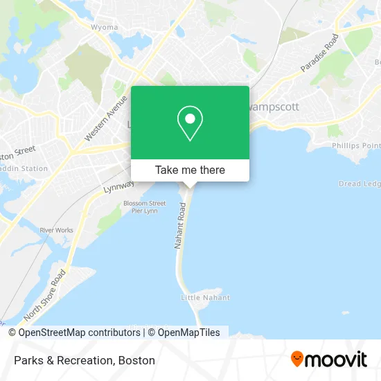
See Parks & Recreation, Nahant, on the map
Public Transit to Parks & Recreation in Nahant
Wondering how to get to Parks & Recreation in Nahant? Moovit helps you find the best way to get to Parks & Recreation with step-by-step directions from the nearest public transit station.
Moovit provides free maps and live directions to help you navigate through your city. View schedules, routes, timetables, and find out how long does it take to get to Parks & Recreation in real time.
Looking for the nearest stop or station to Parks & Recreation? Check out this list of stops closest to your destination: Beach Rd @ Surfside Rd; Broad St @ Silsbee St; Lynn Interim; Blossom Street Pier.
Bus: 426, 442, 439, 441, 441/442.Train: NEWBURYPORT/ROCKPORT.Ferry: LYNN FERRY.
Want to see if there’s another route that gets you there at an earlier time? Moovit helps you find alternative routes or times. Get directions from and directions to Parks & Recreation easily from the Moovit App or Website.
We make riding to Parks & Recreation easy, which is why over 1.7 million users, including users in Nahant, trust Moovit as the best app for public transit. You don’t need to download an individual bus app or train app, Moovit is your all-in-one transit app that helps you find the best bus time or train time available.
For information on prices of bus, subway and train, costs and ride fares to Parks & Recreation, please check the Moovit app.
Use the app to navigate to popular places including to the airport, hospital, stadium, grocery store, mall, coffee shop, school, college, and university.
Parks & Recreation Address: 1 Nahant Rd street in Nahant
- Nahant Beach,
- Nahant Beach Boulevard-Metropolitan Park System Of Greater Boston,
- Nahant Tennis Court,
- Nahant Long Beach,
- William G Talis Attorney,
- Stephen F. Murray Attorney,
- National Baseball Hall of Fame,
- Rosa Decastro Realty,
- J Santos Construction Inc,
- Seaport Family Dentistry,
- Law Office Of Russell C Sobelman - Personal Injury & Criminal Attorney,
- Roger Volk And Company,
- Mariachi Estrellas De Boston,
- W Baltimore Condo Association,
- Rdh Photography,
- Sanabia Photography,
- Lynn Shore Reservation,
- Cape Codder Boat Company,
- Libertyx Bitcoin Atm,
- Lucille Wine Shop & Tasting Room
Places Near Parks & Recreation (Nahant)
- House Of Blues, Boston,
- Prudential Center, Boston,
- Boston Convention & Exhibition Center, Boston,
- Wang Theater, Boston,
- Seaport District, Boston,
- Td Garden, Boston,
- Leader Bank Pavilion (Leader Bank Pavillion), Boston,
- Museum Of Science, Boston,
- North End, Boston,
- Castle Island, Boston,
- Boston Medical Center, Boston,
- Boston Children's Hospital, Boston,
- Boston Common, Boston,
- Quincy Market, Boston,
- Massachusetts General Hospital, Boston,
- Faneuil Hall, Boston,
- Wilbur Theatre, Boston,
- Cheers, Boston,
- Isabella Stewart Gardner Museum, Boston,
- Mgm Music Hall, Boston
How to get to popular places in Boston with public transit
Get around Nahant by public transit!
Traveling around Nahant has never been so easy. See step by step directions as you travel to any attraction, street or major public transit station. View bus and train schedules, arrival times, service alerts and detailed routes on a map, so you know exactly how to get to anywhere in Nahant.
When traveling to any destination around Nahant use Moovit's Live Directions with Get Off Notifications to know exactly where and how far to walk, how long to wait for your line, and how many stops are left. Moovit will alert you when it's time to get off — no need to constantly re-check whether yours is the next stop.
Wondering how to use public transit in Nahant or how to pay for public transit in Nahant? Moovit public transit app can help you navigate your way with public transit easily, and at minimum cost. It includes public transit fees, ticket prices, and costs. Looking for a map of Nahant public transit lines? Moovit public transit app shows all public transit maps in Nahant with all Bus, Train, Subway and Ferry routes and stops on an interactive map.
Boston has 4 transit type(s), including: Bus, Train, Subway and Ferry, operated by several transit agencies, including MBTA, Southeastern Regional Transit Authority, MetroWest Regional Transit Authority, Rhode Island Public Transit Authority, WRTA, Lowell Regional Transit Authority, Merrimack Valley Transit, Montachusett Regional Transit Authority, Cape Cod Regional Transit Authority, Brockton Area Transit Authority, Martha's Vineyard Transit Authority, the WAVE - Nantucket Regional Transit Authority, GATRA, Cape Ann Transportation Authority and Massport