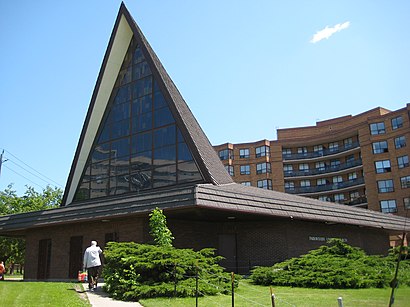
See Parkwoods, Toronto, on the map
Directions to Parkwoods (Toronto) with public transportation
The following transit lines have routes that pass near Parkwoods
 Bus:
Bus: - Subway:
How to get to Parkwoods by bus?
Click on the bus route to see step by step directions with maps, line arrival times and updated time schedules.
How to get to Parkwoods by subway?
Click on the subway route to see step by step directions with maps, line arrival times and updated time schedules.
Bus stations near Parkwoods in Toronto
- Underhill Dr At Beveridge Dr North Side,5 min walk,
- Underhill Dr At Beveridge Dr,6 min walk,
Bus lines to Parkwoods in Toronto
- 91C,York Mills Rd at Lochinvar Cres,
- 91D,Valley Woods Rd at York Mills Rd,
- 91,Woodbine Station,
What are the closest stations to Parkwoods?
The closest stations to Parkwoods are:
- Underhill Dr At Beveridge Dr North Side is 349 meters away, 5 min walk.
- Underhill Dr At Beveridge Dr is 394 meters away, 6 min walk.
Which bus lines stop near Parkwoods?
These bus lines stop near Parkwoods: 24, 54, 91.
Which subway line stops near Parkwoods?
4
What’s the nearest bus stop to Parkwoods in Toronto?
The nearest bus stop to Parkwoods in Toronto is Underhill Dr At Beveridge Dr North Side. It’s a 5 min walk away.
See Parkwoods, Toronto, on the map
Public Transit to Parkwoods in Toronto
Wondering how to get to Parkwoods in Toronto, Canada? Moovit helps you find the best way to get to Parkwoods with step-by-step directions from the nearest public transit station.
Moovit provides free maps and live directions to help you navigate through your city. View schedules, routes, timetables, and find out how long does it take to get to Parkwoods in real time.
Looking for the nearest stop or station to Parkwoods? Check out this list of stops closest to your destination: Underhill Dr At Beveridge Dr North Side; Underhill Dr At Beveridge Dr.
Bus:Subway:
Want to see if there’s another route that gets you there at an earlier time? Moovit helps you find alternative routes or times. Get directions from and directions to Parkwoods easily from the Moovit App or Website.
We make riding to Parkwoods easy, which is why over 1.5 million users, including users in Toronto, trust Moovit as the best app for public transit. You don’t need to download an individual bus app or train app, Moovit is your all-in-one transit app that helps you find the best bus time or train time available.
For information on prices of bus and subway, costs and ride fares to Parkwoods, please check the Moovit app.
Use the app to navigate to popular places including to the airport, hospital, stadium, grocery store, mall, coffee shop, school, college, and university.
Location: Toronto
Attractions near Parkwoods
City National Realty Svc Inc,10 Butterfield Drive,Beveridge Drive,20 Beveridge Drive,Cande Plumbing,34 Avonwick Gate,20 Averdon Crescent,Broadlands Skating Rink,Hatherton Crescent,10 Royal Doulton Drive,O'Connor Hills Tennis Club,Ranchdale Park,86 Fairhill Crescent,Broadlands Community Centre,19 Castlegrove Boulevard,Broadlands Community Recreation Centre,North York Broadlands Swimming,Ranchdale Public School,Ranchdale,Broadlands ParkHow to get to popular attractions in Toronto with public transit
GoodLife Fitness Centres, Toronto,Whitby, Ontario, Whitby,Hwy 401 & Hwy 400, Toronto,Phoenix Restaurant 金鳳餐廳, Markham,Meadowvale Town Centre, Mississauga,CF Fairview Park, Kitchener,Costco Wholesale, Burlington,Dixie Outlet Mall, Mississauga,Appleby GO Station, Burlington,Landmark Cinemas, Waterloo,IKEA, Burlington,St Joseph's Healthcare (Charlton Campus), Hamilton,Starbucks, Toronto,Starbucks, Toronto,University of Guelph, Guelph,GoodLife Fitness Centres, Toronto,Kinka Izakaya, Toronto,Oshawa GO Station, Oshawa,Terminal 1 - Toronto Pearson Int'L Airport, Mississauga,Erin Mills Town Centre, MississaugaGet around Toronto by public transit!
Traveling around Toronto has never been so easy. See step by step directions as you travel to any attraction, street or major public transit station. View bus and train schedules, arrival times, service alerts and detailed routes on a map, so you know exactly how to get to anywhere in Toronto.
When traveling to any destination around Toronto use Moovit's Live Directions with Get Off Notifications to know exactly where and how far to walk, how long to wait for your line, and how many stops are left. Moovit will alert you when it's time to get off — no need to constantly re-check whether yours is the next stop.
Wondering how to use public transit in Toronto or how to pay for public transit in Toronto? Moovit public transit app can help you navigate your way with public transit easily, and at minimum cost. It includes public transit fees, ticket prices, and costs. Looking for a map of Toronto public transit lines? Moovit public transit app shows all public transit maps in Toronto with all bus or subway routes and stops on an interactive map.
Toronto has 2 transit type(s), including: bus or subway, operated by several transit agencies, including TTC, TTC Streetcar, Toronto Subway, GO Transit Bus, GO Transit, Amtrak, York Region Transit, Grand River Transit, Guelph Transit, grt, Hamilton Street Railway, MiWay, Brampton Transit, Burlington Transit and Oakville Transit