Directions to Partners For Youth With Disabilities (Boston) with public transportation
The following transit lines have routes that pass near Partners For Youth With Disabilities
 Bus: 504, 92, 93, SL3, SL4.
- Train: FRAMINGHAM/WORCESTER, LOWELL, NEEDHAM, COMMUTER RAIL SHUTTLE, FAIRMOUNT LINE SHUTTLE.
- Subway: BLUE LINE, GREEN LINE D, ORANGE LINE, RED LINE, GREEN LINE B.
How to get to Partners For Youth With Disabilities by bus?
Click on the bus route to see step by step directions with maps, line arrival times and updated time schedules.
From Regent Theatre, Arlington
72 minFrom The Monument, Boston
49 minFrom Belmont, MA, Belmont
59 minFrom Milton Academy, Milton
97 minFrom La Quinta, Somerville
61 minFrom The Mall At Chestnut Hill, Newton
71 minFrom Revere Beach, Revere
72 minFrom LEGOLAND Discovery Center Boston, Somerville
57 minFrom Charles W. Eliot Bridge, Boston
67 minFrom FOUR POINTS BY SHERATON Boston Newton, Newton
25 min
How to get to Partners For Youth With Disabilities by train?
Click on the train route to see step by step directions with maps, line arrival times and updated time schedules.
How to get to Partners For Youth With Disabilities by subway?
Click on the subway route to see step by step directions with maps, line arrival times and updated time schedules.
Bus stops near Partners For Youth With Disabilities in Boston
- Chinatown Gate, 4 min walk,VIEW
- Washington St @ Essex St, 4 min walk,VIEW
- Federal St @ Franklin St, 4 min walk,VIEW
- Summer St @ Atlantic Ave, 5 min walk,VIEW
- Boston-South Station, 6 min walk,VIEW
- Chauncy St @ Summer St, 6 min walk,VIEW
- South Station Bus Terminal, 7 min walk,VIEW
- South Station Boston, 8 min walk,VIEW
Subway stations near Partners For Youth With Disabilities in Boston
Train station near Partners For Youth With Disabilities in Boston
- South Station, 8 min walk,VIEW
Bus lines to Partners For Youth With Disabilities in Boston
- 501, Downtown Via Cambridge St And Copley (Express),VIEW
- 504, Watertown Via Copley And Newton Corner (Express),VIEW
- 505, Waltham (Express),VIEW
- SL4, Nubian,VIEW
- 11, City Point,VIEW
- 15, Haymarket Via Fields Corner & Nubian,VIEW
- RED LINE SHUTTLE, Harvard - JFK/UMass via Congress Street,VIEW
- RED LINE SHUTTLE, Kendall/MIT - JFK/UMass,VIEW
- RED LINE SHUTTLE, Harvard - Broadway,VIEW
- RED LINE SHUTTLE, Kendall/MIT - Broadway via Downtown Crossing,VIEW
- RED LINE SHUTTLE, JFK/UMass - Kendall/MIT (Shuttle),VIEW
- 4, Design Center - North Station via South Station,VIEW
- 7, Otis & Summer - City Point,VIEW
- RED LINE SHUTTLE, Kendall/MIT - Broadway via Pearl Street,VIEW
- RED LINE SHUTTLE, JFK/UMass - Park Street,VIEW
- RED LINE SHUTTLE, Harvard - South Station,VIEW
- RED LINE SHUTTLE, Ashmont - Park Street via Post Office,VIEW
- RED LINE SHUTTLE, JFK/UMass - Park Street via Post Office,VIEW
- RED LINE SHUTTLE, Harvard - JFK/UMass via State Street,VIEW
- SL1, South Station - Logan Airport,VIEW
What are the closest stations to Partners For Youth With Disabilities?
The closest stations to Partners For Youth With Disabilities are:
- Chinatown Gate is 255 yards away, 4 min walk.
- Chinatown is 274 yards away, 4 min walk.
- Washington St @ Essex St is 285 yards away, 4 min walk.
- Federal St @ Franklin St is 319 yards away, 4 min walk.
- Summer St @ Atlantic Ave is 342 yards away, 5 min walk.
- Boston-South Station is 422 yards away, 6 min walk.
- Chauncy St @ Summer St is 435 yards away, 6 min walk.
- Downtown Crossing is 435 yards away, 6 min walk.
- Boylston is 479 yards away, 6 min walk.
- South Station Bus Terminal is 514 yards away, 7 min walk.
- South Station Boston is 615 yards away, 8 min walk.
- South Station is 627 yards away, 8 min walk.
Which bus lines stop near Partners For Youth With Disabilities?
These bus lines stop near Partners For Youth With Disabilities: 504, 92, 93, SL3, SL4.
Which train lines stop near Partners For Youth With Disabilities?
These train lines stop near Partners For Youth With Disabilities: FRAMINGHAM/WORCESTER, LOWELL, NEEDHAM.
Which subway lines stop near Partners For Youth With Disabilities?
These subway lines stop near Partners For Youth With Disabilities: BLUE LINE, GREEN LINE D, ORANGE LINE, RED LINE.
What’s the nearest subway station to Partners For Youth With Disabilities in Boston?
The nearest subway station to Partners For Youth With Disabilities in Boston is Chinatown. It’s a 4 min walk away.
What’s the nearest train station to Partners For Youth With Disabilities in Boston?
The nearest train station to Partners For Youth With Disabilities in Boston is South Station. It’s a 8 min walk away.
What’s the nearest bus station to Partners For Youth With Disabilities in Boston?
The nearest bus stations to Partners For Youth With Disabilities in Boston are Chinatown Gate, Washington St @ Essex St and Federal St @ Franklin St. The closest one is a 4 min walk away.
What time is the first subway to Partners For Youth With Disabilities in Boston?
The GREEN LINE D is the first subway that goes to Partners For Youth With Disabilities in Boston. It stops nearby at 5:09 AM.
What time is the last subway to Partners For Youth With Disabilities in Boston?
The GREEN LINE E is the last subway that goes to Partners For Youth With Disabilities in Boston. It stops nearby at 2:16 AM.
What time is the first train to Partners For Youth With Disabilities in Boston?
The PROVIDENCE/STOUGHTON is the first train that goes to Partners For Youth With Disabilities in Boston. It stops nearby at 4:20 AM.
What time is the last train to Partners For Youth With Disabilities in Boston?
The LAKE SHORE LIMITED is the last train that goes to Partners For Youth With Disabilities in Boston. It stops nearby at 8:32 PM.
What time is the first bus to Partners For Youth With Disabilities in Boston?
The SLW is the first bus that goes to Partners For Youth With Disabilities in Boston. It stops nearby at 4:19 AM.
What time is the last bus to Partners For Youth With Disabilities in Boston?
The FLIXBUS N2605 is the last bus that goes to Partners For Youth With Disabilities in Boston. It stops nearby at 9:25 AM.
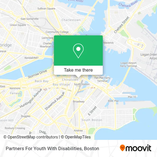
See Partners For Youth With Disabilities, Boston, on the map
Public Transit to Partners For Youth With Disabilities in Boston
Wondering how to get to Partners For Youth With Disabilities in Boston? Moovit helps you find the best way to get to Partners For Youth With Disabilities with step-by-step directions from the nearest public transit station.
Moovit provides free maps and live directions to help you navigate through your city. View schedules, routes, timetables, and find out how long does it take to get to Partners For Youth With Disabilities in real time.
Looking for the nearest stop or station to Partners For Youth With Disabilities? Check out this list of stops closest to your destination: Chinatown Gate; Chinatown; Washington St @ Essex St; Federal St @ Franklin St; Summer St @ Atlantic Ave; Boston-South Station; Chauncy St @ Summer St; Downtown Crossing; Boylston; South Station Bus Terminal; South Station Boston; South Station.
Bus: 504, 92, 93, SL3, SL4, 501, 505, 11, 15.Train: FRAMINGHAM/WORCESTER, LOWELL, NEEDHAM, COMMUTER RAIL SHUTTLE, FAIRMOUNT LINE SHUTTLE, FRANKLIN LINE SHUTTLE, KINGSTON LINE SHUTTLE, SL2.Subway: BLUE LINE, GREEN LINE D, ORANGE LINE, RED LINE, GREEN LINE B, GREEN LINE C, GREEN LINE E.
Want to see if there’s another route that gets you there at an earlier time? Moovit helps you find alternative routes or times. Get directions from and directions to Partners For Youth With Disabilities easily from the Moovit App or Website.
We make riding to Partners For Youth With Disabilities easy, which is why over 1.7 million users, including users in Boston, trust Moovit as the best app for public transit. You don’t need to download an individual bus app or train app, Moovit is your all-in-one transit app that helps you find the best bus time or train time available.
For information on prices of bus, subway and train, costs and ride fares to Partners For Youth With Disabilities, please check the Moovit app.
Use the app to navigate to popular places including to the airport, hospital, stadium, grocery store, mall, coffee shop, school, college, and university.
Partners For Youth With Disabilities Address: 89 South St street in Boston
- KPMG,
- Leather District Park,
- Keystone Associates,
- Offsuit,
- Marquis Leathers (Marquis de Sade),
- Leather District,
- Tataway,
- Plymouth Rock Building,
- Wework 711 Atlantic Avenue,
- One Financial Center,
- Daley and Associates,
- MBHP,
- South Sta Taxi Stand,
- Jim Hill Photography (Jim Kelly Photographer),
- LSI Boston,
- Greyhound-Boston (Greyhound Bus Lines),
- Greyhound-Boston,
- State Street Financial Center,
- Truist Bank (Suntrust Bank),
- Ronald P. Barriere
Places Near Partners For Youth With Disabilities (Boston)
- Boston Common, Boston,
- Mgm Music Hall, Boston,
- Boston Convention & Exhibition Center, Boston,
- Wang Theater, Boston,
- Cheers, Boston,
- Massachusetts General Hospital, Boston,
- Castle Island, Boston,
- Td Garden, Boston,
- Prudential Center, Boston,
- Quincy Market, Boston,
- North End, Boston,
- Isabella Stewart Gardner Museum, Boston,
- Faneuil Hall, Boston,
- Boston Children's Hospital, Boston,
- Leader Bank Pavilion (Leader Bank Pavillion), Boston,
- Museum Of Science, Boston,
- Seaport District, Boston,
- House Of Blues, Boston,
- Boston Medical Center, Boston,
- Wilbur Theatre, Boston
How to get to popular places in Boston with public transit
Get around Boston by public transit!
Traveling around Boston has never been so easy. See step by step directions as you travel to any attraction, street or major public transit station. View bus and train schedules, arrival times, service alerts and detailed routes on a map, so you know exactly how to get to anywhere in Boston.
When traveling to any destination around Boston use Moovit's Live Directions with Get Off Notifications to know exactly where and how far to walk, how long to wait for your line, and how many stops are left. Moovit will alert you when it's time to get off — no need to constantly re-check whether yours is the next stop.
Wondering how to use public transit in Boston or how to pay for public transit in Boston? Moovit public transit app can help you navigate your way with public transit easily, and at minimum cost. It includes public transit fees, ticket prices, and costs. Looking for a map of Boston public transit lines? Moovit public transit app shows all public transit maps in Boston with all Bus, Train, Subway and Ferry routes and stops on an interactive map.
Boston has 4 transit type(s), including: Bus, Train, Subway and Ferry, operated by several transit agencies, including MBTA, Southeastern Regional Transit Authority, MetroWest Regional Transit Authority, Rhode Island Public Transit Authority, WRTA, Lowell Regional Transit Authority, Merrimack Valley Transit, Montachusett Regional Transit Authority, Cape Cod Regional Transit Authority, Brockton Area Transit Authority, Martha's Vineyard Transit Authority, the WAVE - Nantucket Regional Transit Authority, GATRA, Cape Ann Transportation Authority and Massport