Directions to Partnership Of Historic Bostons with public transportation
The following transit lines have routes that pass near Partnership Of Historic Bostons
 Bus: 10, 39, 450, 501, 504.
- Train: FITCHBURG, FRAMINGHAM/WORCESTER, NEEDHAM, FOXBORO EVENT SERVICE, FRANKLIN/FOXBORO.
- Subway: GREEN LINE B, GREEN LINE C, GREEN LINE E, ORANGE LINE, GREEN LINE D.
How to get to Partnership Of Historic Bostons by bus?
Click on the bus route to see step by step directions with maps, line arrival times and updated time schedules.
How to get to Partnership Of Historic Bostons by train?
Click on the train route to see step by step directions with maps, line arrival times and updated time schedules.
How to get to Partnership Of Historic Bostons by subway?
Click on the subway route to see step by step directions with maps, line arrival times and updated time schedules.
Bus stops near Partnership Of Historic Bostons
- Boylston St @ Clarendon St, 2 min walk,VIEW
- Boston, MA - Copley Square (Corner Of Clarendon St. & St. James Ave. In Front Of Trinity Church), 2 min walk,VIEW
- Copley - Opp 575 Boylston St, 3 min walk,VIEW
- Copley - Saint James Ave @ Trinity Pl, 3 min walk,VIEW
- Copley - Boylston St @ Dartmouth St, 4 min walk,VIEW
- Saint James Ave @ Berkeley St, 4 min walk,VIEW
- Saint James Ave @ Dartmouth St, 4 min walk,VIEW
- Boylston St @ Dartmouth St, 4 min walk,VIEW
- Stuart St @ Dartmouth St, 6 min walk,VIEW
- Charles St @ Beacon St, 11 min walk,VIEW
Train station near Partnership Of Historic Bostons
- Back Bay - South End, 9 min walk,VIEW
Subway stations near Partnership Of Historic Bostons
Bus lines to Partnership Of Historic Bostons
- 9, Kenmore Via Boston Latin,VIEW
- 10, Arlington Via South Bay Center,VIEW
- 39, Haymarket Via Forest Hills,VIEW
- 55, West Fenway,VIEW
- 57, Haymarket Via Kenmore,VIEW
- GREEN LINE D SHUTTLE, Riverside (Shuttle),VIEW
- ORANGE LINE SHUTTLE, Back Bay Via Copley (Shuttle),VIEW
- ACTON/CONCORD COMMUTER, Acton,VIEW
- ORANGE LINE SHUTTLE, Forest Hills (Shuttle),VIEW
- GREEN LINE B SHUTTLE, Babcock Street (Shuttle),VIEW
- ORANGE LINE SHUTTLE, Copley (Shuttle),VIEW
- 501, Downtown Via Cambridge St And Copley (Express),VIEW
- 504, Downtown Via Copley (Express),VIEW
- GREEN LINE B SHUTTLE, Boston University East - Back Bay,VIEW
- GREEN LINE C SHUTTLE, Saint Mary's Street - Back Bay,VIEW
- GREEN LINE D SHUTTLE, Riverside - Copley (Express),VIEW
- GREEN LINE D SHUTTLE, Riverside - Copley via Woodland (Express),VIEW
- GREEN LINE D SHUTTLE, Woodland - Copley via Riverside (Express),VIEW
- GREEN LINE E SHUTTLE, Heath Street - Park Street,VIEW
- GREEN LINE SHUTTLE, Boston University East - Park Street,VIEW
What are the closest stations to Partnership Of Historic Bostons?
The closest stations to Partnership Of Historic Bostons are:
- Boylston St @ Clarendon St is 85 yards away, 2 min walk.
- Boston, MA - Copley Square (Corner Of Clarendon St. & St. James Ave. In Front Of Trinity Church) is 156 yards away, 2 min walk.
- Copley - Opp 575 Boylston St is 179 yards away, 3 min walk.
- Copley - Saint James Ave @ Trinity Pl is 223 yards away, 3 min walk.
- Copley - Boylston St @ Dartmouth St is 248 yards away, 4 min walk.
- Saint James Ave @ Berkeley St is 253 yards away, 4 min walk.
- Saint James Ave @ Dartmouth St is 274 yards away, 4 min walk.
- Boylston St @ Dartmouth St is 295 yards away, 4 min walk.
- Stuart St @ Dartmouth St is 439 yards away, 6 min walk.
- Back Bay - South End is 688 yards away, 9 min walk.
- Charles St @ Beacon St is 879 yards away, 11 min walk.
- Boylston is 959 yards away, 12 min walk.
- Charles/Mgh is 1544 yards away, 18 min walk.
Which bus lines stop near Partnership Of Historic Bostons?
These bus lines stop near Partnership Of Historic Bostons: 10, 39, 450, 501, 504.
Which train lines stop near Partnership Of Historic Bostons?
These train lines stop near Partnership Of Historic Bostons: FITCHBURG, FRAMINGHAM/WORCESTER, NEEDHAM.
Which subway lines stop near Partnership Of Historic Bostons?
These subway lines stop near Partnership Of Historic Bostons: GREEN LINE B, GREEN LINE C, GREEN LINE E, ORANGE LINE.
What’s the nearest subway station to Partnership Of Historic Bostons?
The nearest subway station to Partnership Of Historic Bostons is Boylston. It’s a 12 min walk away.
What’s the nearest train station to Partnership Of Historic Bostons?
The nearest train station to Partnership Of Historic Bostons is Back Bay - South End. It’s a 9 min walk away.
What’s the nearest bus station to Partnership Of Historic Bostons?
The nearest bus stations to Partnership Of Historic Bostons are Boylston St @ Clarendon St and Boston, MA - Copley Square (Corner Of Clarendon St. & St. James Ave. In Front Of Trinity Church). The closest one is a 2 min walk away.
What time is the first subway to Partnership Of Historic Bostons?
The GREEN LINE D is the first subway that goes to Partnership Of Historic Bostons. It stops nearby at 5:05 AM.
What time is the last subway to Partnership Of Historic Bostons?
The GREEN LINE E is the last subway that goes to Partnership Of Historic Bostons. It stops nearby at 2:16 AM.
What time is the first train to Partnership Of Historic Bostons?
The PROVIDENCE/STOUGHTON is the first train that goes to Partnership Of Historic Bostons. It stops nearby at 4:25 AM.
What time is the last train to Partnership Of Historic Bostons?
The LAKE SHORE LIMITED is the last train that goes to Partnership Of Historic Bostons. It stops nearby at 8:26 PM.
What time is the first bus to Partnership Of Historic Bostons?
The 57 is the first bus that goes to Partnership Of Historic Bostons. It stops nearby at 4:53 AM.
What time is the last bus to Partnership Of Historic Bostons?
The 10 is the last bus that goes to Partnership Of Historic Bostons. It stops nearby at 1:19 AM.
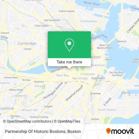
See Partnership Of Historic Bostons on the map
Public Transportation to Partnership Of Historic Bostons
Wondering how to get to Partnership Of Historic Bostons? Moovit helps you find the best way to get to Partnership Of Historic Bostons with step-by-step directions from the nearest public transit station.
Moovit provides free maps and live directions to help you navigate through your city. View schedules, routes, timetables, and find out how long does it take to get to Partnership Of Historic Bostons in real time.
Looking for the nearest stop or station to Partnership Of Historic Bostons? Check out this list of stops closest to your destination: Boylston St @ Clarendon St; Boston, MA - Copley Square (Corner Of Clarendon St. & St. James Ave. In Front Of Trinity Church); Copley - Opp 575 Boylston St; Copley - Saint James Ave @ Trinity Pl; Copley - Boylston St @ Dartmouth St; Saint James Ave @ Berkeley St; Saint James Ave @ Dartmouth St; Boylston St @ Dartmouth St; Stuart St @ Dartmouth St; Back Bay - South End; Charles St @ Beacon St; Boylston; Charles/Mgh.
Bus: 10, 39, 450, 501, 504, 9, 55, 57, ACTON/CONCORD COMMUTER, ORANGE LINE SHUTTLE.Train: FITCHBURG, FRAMINGHAM/WORCESTER, NEEDHAM, FOXBORO EVENT SERVICE, FRANKLIN/FOXBORO, ORANGE LINE.Subway: GREEN LINE B, GREEN LINE C, GREEN LINE E, ORANGE LINE, GREEN LINE D, RED LINE.
Want to see if there’s another route that gets you there at an earlier time? Moovit helps you find alternative routes or times. Get directions from and directions to Partnership Of Historic Bostons easily from the Moovit App or Website.
We make riding to Partnership Of Historic Bostons easy, which is why over 1.7 million users, including users in Boston, trust Moovit as the best app for public transit. You don’t need to download an individual bus app or train app, Moovit is your all-in-one transit app that helps you find the best bus time or train time available.
For information on prices of subway, bus and train, costs and ride fares to Partnership Of Historic Bostons, please check the Moovit app.
Use the app to navigate to popular places including to the airport, hospital, stadium, grocery store, mall, coffee shop, school, college, and university.
Partnership Of Historic Bostons Address: 66 Marlborough St street in Boston
- ISKCON,
- Gibson House Museum (The Gibson Society),
- Fisher College Student Center,
- Emerson College,
- Women's Lunch Place (The Womans Lunch Place),
- Marc Jacobs,
- Design Buzzer,
- Alton Lane,
- Polo Ralph Lauren,
- New England Historic Genealogical Society,
- Drybar,
- Thinking Cup,
- Georgetown Cupcake,
- 新英格兰历史悠久的基因学家协会,
- Fisher College Division Of Continuing Education,
- Fisher College,
- Express Edit (Shop Express),
- Express Edit,
- Victoria's Secret,
- Marcel Korn Dr
Places Near Partnership Of Historic Bostons
- Leader Bank Pavilion (Leader Bank Pavillion), Boston,
- Boston Medical Center, Boston,
- Wilbur Theatre, Boston,
- Prudential Center, Boston,
- House Of Blues, Boston,
- Boston Common, Boston,
- Quincy Market, Boston,
- Isabella Stewart Gardner Museum, Boston,
- Boston Children's Hospital, Boston,
- Seaport District, Boston,
- Cheers, Boston,
- Mgm Music Hall, Boston,
- Faneuil Hall, Boston,
- Wang Theater, Boston,
- Castle Island, Boston,
- Massachusetts General Hospital, Boston,
- North End, Boston,
- Boston Convention & Exhibition Center, Boston,
- Museum Of Science, Boston,
- Td Garden, Boston
How to get to popular places in Boston with public transit
Get around Boston by public transit!
Traveling around Boston has never been so easy. See step by step directions as you travel to any attraction, street or major public transit station. View bus and train schedules, arrival times, service alerts and detailed routes on a map, so you know exactly how to get to anywhere in Boston.
When traveling to any destination around Boston use Moovit's Live Directions with Get Off Notifications to know exactly where and how far to walk, how long to wait for your line, and how many stops are left. Moovit will alert you when it's time to get off — no need to constantly re-check whether yours is the next stop.
Wondering how to use public transit in Boston or how to pay for public transit in Boston? Moovit public transit app can help you navigate your way with public transit easily, and at minimum cost. It includes public transit fees, ticket prices, and costs. Looking for a map of Boston public transit lines? Moovit public transit app shows all public transit maps in Boston with all Bus, Train, Subway and Ferry routes and stops on an interactive map.
Boston has 4 transit type(s), including: Bus, Train, Subway and Ferry, operated by several transit agencies, including MBTA, Southeastern Regional Transit Authority, MetroWest Regional Transit Authority, Rhode Island Public Transit Authority, WRTA, Lowell Regional Transit Authority, Merrimack Valley Transit, Montachusett Regional Transit Authority, Cape Cod Regional Transit Authority, Brockton Area Transit Authority, Martha's Vineyard Transit Authority, the WAVE - Nantucket Regional Transit Authority, GATRA, Cape Ann Transportation Authority and Massport