Directions to Party Bus In Boston - by Partybusinbostonnow with public transportation
The following transit lines have routes that pass near Party Bus In Boston - by Partybusinbostonnow
 Bus: 16, 19, 23, 45, 14.
- Train: FAIRMOUNT, FRANKLIN/FOXBORO, PROVIDENCE/STOUGHTON.
- Subway: ORANGE LINE, RED LINE.
How to get to Party Bus In Boston - by Partybusinbostonnow by bus?
Click on the bus route to see step by step directions with maps, line arrival times and updated time schedules.
From Maverick Station
86 minFrom Wellington Station
106 minFrom Watertown, MA
88 minFrom The Burren
86 minFrom Embassy Suites Boston At Logan
79 minFrom 88 Broad Street
50 minFrom Old State House
45 minFrom Davis Sq
87 minFrom Battery Wharf Hotel
57 minFrom DoubleTree by Hilton Boston Logan Airport Chelsea
85 min
How to get to Party Bus In Boston - by Partybusinbostonnow by train?
Click on the train route to see step by step directions with maps, line arrival times and updated time schedules.
How to get to Party Bus In Boston - by Partybusinbostonnow by subway?
Click on the subway route to see step by step directions with maps, line arrival times and updated time schedules.
Bus stops near Party Bus In Boston - by Partybusinbostonnow
Subway station near Party Bus In Boston - by Partybusinbostonnow
- Fields Corner, 12 min walk,VIEW
Train station near Party Bus In Boston - by Partybusinbostonnow
- Four Corners/Geneva, 15 min walk,VIEW
Bus lines to Party Bus In Boston - by Partybusinbostonnow
What are the closest stations to Party Bus In Boston - by Partybusinbostonnow?
The closest stations to Party Bus In Boston - by Partybusinbostonnow are:
- Blue Hill Ave @ Brunswick St is 71 yards away, 1 min walk.
- Warren St @ Intervale St is 219 yards away, 3 min walk.
- Warren St @ Brunswick St is 272 yards away, 4 min walk.
- Columbia Rd @ Intervale St is 588 yards away, 8 min walk.
- Fields Corner is 966 yards away, 12 min walk.
- Four Corners/Geneva is 1284 yards away, 15 min walk.
Which bus lines stop near Party Bus In Boston - by Partybusinbostonnow?
These bus lines stop near Party Bus In Boston - by Partybusinbostonnow: 16, 19, 23, 45.
Which train line stops near Party Bus In Boston - by Partybusinbostonnow?
FAIRMOUNT (#1619 | Fairmount)
Which subway lines stop near Party Bus In Boston - by Partybusinbostonnow?
These subway lines stop near Party Bus In Boston - by Partybusinbostonnow: ORANGE LINE, RED LINE.
What’s the nearest subway station to Party Bus In Boston - by Partybusinbostonnow?
The nearest subway station to Party Bus In Boston - by Partybusinbostonnow is Fields Corner. It’s a 12 min walk away.
What’s the nearest train station to Party Bus In Boston - by Partybusinbostonnow?
The nearest train station to Party Bus In Boston - by Partybusinbostonnow is Four Corners/Geneva. It’s a 15 min walk away.
What’s the nearest bus station to Party Bus In Boston - by Partybusinbostonnow?
The nearest bus station to Party Bus In Boston - by Partybusinbostonnow is Blue Hill Ave @ Brunswick St. It’s a 1 min walk away.
What time is the first subway to Party Bus In Boston - by Partybusinbostonnow?
The RED LINE is the first subway that goes to Party Bus In Boston - by Partybusinbostonnow. It stops nearby at 5:18 AM.
What time is the last subway to Party Bus In Boston - by Partybusinbostonnow?
The RED LINE is the last subway that goes to Party Bus In Boston - by Partybusinbostonnow. It stops nearby at 2:01 AM.
What time is the first train to Party Bus In Boston - by Partybusinbostonnow?
The FAIRMOUNT is the first train that goes to Party Bus In Boston - by Partybusinbostonnow. It stops nearby at 4:47 AM.
What time is the last train to Party Bus In Boston - by Partybusinbostonnow?
The FAIRMOUNT is the last train that goes to Party Bus In Boston - by Partybusinbostonnow. It stops nearby at 12:00 AM.
What time is the first bus to Party Bus In Boston - by Partybusinbostonnow?
The 28 is the first bus that goes to Party Bus In Boston - by Partybusinbostonnow. It stops nearby at 3:17 AM.
What time is the last bus to Party Bus In Boston - by Partybusinbostonnow?
The 23 is the last bus that goes to Party Bus In Boston - by Partybusinbostonnow. It stops nearby at 2:33 AM.
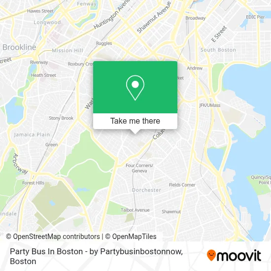
See Party Bus In Boston - by Partybusinbostonnow on the map
Public Transportation to Party Bus In Boston - by Partybusinbostonnow
Wondering how to get to Party Bus In Boston - by Partybusinbostonnow? Moovit helps you find the best way to get to Party Bus In Boston - by Partybusinbostonnow with step-by-step directions from the nearest public transit station.
Moovit provides free maps and live directions to help you navigate through your city. View schedules, routes, timetables, and find out how long does it take to get to Party Bus In Boston - by Partybusinbostonnow in real time.
Looking for the nearest stop or station to Party Bus In Boston - by Partybusinbostonnow? Check out this list of stops closest to your destination: Blue Hill Ave @ Brunswick St; Warren St @ Intervale St; Warren St @ Brunswick St; Columbia Rd @ Intervale St; Fields Corner; Four Corners/Geneva.
Bus: 16, 19, 23, 45, 14, 28, 10, 22.Train: FAIRMOUNT, FRANKLIN/FOXBORO, PROVIDENCE/STOUGHTON.Subway: ORANGE LINE, RED LINE.
Want to see if there’s another route that gets you there at an earlier time? Moovit helps you find alternative routes or times. Get directions from and directions to Party Bus In Boston - by Partybusinbostonnow easily from the Moovit App or Website.
We make riding to Party Bus In Boston - by Partybusinbostonnow easy, which is why over 1.7 million users, including users in Boston, trust Moovit as the best app for public transit. You don’t need to download an individual bus app or train app, Moovit is your all-in-one transit app that helps you find the best bus time or train time available.
For information on prices of bus, subway and train, costs and ride fares to Party Bus In Boston - by Partybusinbostonnow, please check the Moovit app.
Use the app to navigate to popular places including to the airport, hospital, stadium, grocery store, mall, coffee shop, school, college, and university.
Party Bus In Boston - by Partybusinbostonnow Address: 25 Normandy St street in Boston
- Dorchester,
- Gentiles Record,
- Gorgeous Lil Things,
- Grove Hall,
- Steven and Francines Locksmiths,
- Future Chefs,
- First Choice Market,
- Roxbury Prep Dorchester Campus,
- Redbox,
- Cac Mt. Joy Victory Center,
- Quincy Market,
- Blue Hill Ave & Georgia St,
- Abcd,
- Pine Street Inn,
- Boston Public Library Grove Hall Branch,
- Charles Street Ame Church (The Historic Charles Street African Methodist Episcopal Church),
- Ramzo African Market,
- Commercial Property Management Company in Massachusetts,
- Online Roofing Contractors Boston,
- Jeremiah E Burke High School
Places Near Party Bus In Boston - by Partybusinbostonnow
- Leader Bank Pavilion (Leader Bank Pavillion), Boston,
- Quincy Market, Boston,
- House Of Blues, Boston,
- Boston Medical Center, Boston,
- Cheers, Boston,
- Castle Island, Boston,
- Prudential Center, Boston,
- Boston Convention & Exhibition Center, Boston,
- North End, Boston,
- Isabella Stewart Gardner Museum, Boston,
- Massachusetts General Hospital, Boston,
- Wang Theater, Boston,
- Wilbur Theatre, Boston,
- Faneuil Hall, Boston,
- Seaport District, Boston,
- Mgm Music Hall, Boston,
- Td Garden, Boston,
- Boston Children's Hospital, Boston,
- Museum Of Science, Boston,
- Boston Common, Boston
How to get to popular places in Boston with public transit
Get around Boston by public transit!
Traveling around Boston has never been so easy. See step by step directions as you travel to any attraction, street or major public transit station. View bus and train schedules, arrival times, service alerts and detailed routes on a map, so you know exactly how to get to anywhere in Boston.
When traveling to any destination around Boston use Moovit's Live Directions with Get Off Notifications to know exactly where and how far to walk, how long to wait for your line, and how many stops are left. Moovit will alert you when it's time to get off — no need to constantly re-check whether yours is the next stop.
Wondering how to use public transit in Boston or how to pay for public transit in Boston? Moovit public transit app can help you navigate your way with public transit easily, and at minimum cost. It includes public transit fees, ticket prices, and costs. Looking for a map of Boston public transit lines? Moovit public transit app shows all public transit maps in Boston with all Bus, Train, Subway and Ferry routes and stops on an interactive map.
Boston has 4 transit type(s), including: Bus, Train, Subway and Ferry, operated by several transit agencies, including MBTA, Southeastern Regional Transit Authority, MetroWest Regional Transit Authority, Rhode Island Public Transit Authority, WRTA, Lowell Regional Transit Authority, Merrimack Valley Transit, Montachusett Regional Transit Authority, Cape Cod Regional Transit Authority, Brockton Area Transit Authority, Martha's Vineyard Transit Authority, the WAVE - Nantucket Regional Transit Authority, GATRA, Cape Ann Transportation Authority and Massport