Directions to Party City (Somerville) with public transportation
The following transit lines have routes that pass near Party City
 Bus: 85, 95, 89, 101, 89/93.
- Subway: ORANGE LINE, GREEN LINE B, GREEN LINE C, GREEN LINE E.
How to get to Party City by bus?
Click on the bus route to see step by step directions with maps, line arrival times and updated time schedules.
From Dorchester, Boston
101 minFrom Allston, Boston
66 minFrom Showa Boston Institute, Boston
110 minFrom The Lenox Hotel, Boston
76 minFrom Harvard T.H. Chan School of Public Health, Boston
58 minFrom JFK Library, Boston
106 minFrom Shubert Theatre, Boston
55 minFrom The Friendly Toast, Boston
78 minFrom UMass Boston Campus Center, Boston
107 minFrom Franklin Park Zoo, Boston
97 min
How to get to Party City by subway?
Click on the subway route to see step by step directions with maps, line arrival times and updated time schedules.
From Dorchester, Boston
54 minFrom Allston, Boston
67 minFrom The Lenox Hotel, Boston
34 minFrom Harvard T.H. Chan School of Public Health, Boston
50 minFrom JFK Library, Boston
60 minFrom Shubert Theatre, Boston
30 minFrom The Friendly Toast, Boston
31 minFrom UMass Boston Campus Center, Boston
60 minFrom Franklin Park Zoo, Boston
62 min
Bus stops near Party City in Somerville
Subway stations near Party City in Somerville
Bus lines to Party City in Somerville
What are the closest stations to Party City?
The closest stations to Party City are:
- Broadway @ Grant St is 132 yards away, 2 min walk.
- Broadway @ Montgomery Ave is 335 yards away, 4 min walk.
- Sullivan Square is 335 yards away, 5 min walk.
- Grand Union Blvd @ Foley St is 338 yards away, 5 min walk.
- Mystic Ave Opp Shore Dr is 511 yards away, 6 min walk.
- Gilman Square is 998 yards away, 12 min walk.
Which bus lines stop near Party City?
These bus lines stop near Party City: 85, 95.
Which subway line stops near Party City?
ORANGE LINE (Oak Grove)
What’s the nearest subway station to Party City in Somerville?
The nearest subway station to Party City in Somerville is Sullivan Square. It’s a 5 min walk away.
What’s the nearest bus station to Party City in Somerville?
The nearest bus station to Party City in Somerville is Broadway @ Grant St. It’s a 2 min walk away.
What time is the first subway to Party City in Somerville?
The GREEN LINE E is the first subway that goes to Party City in Somerville. It stops nearby at 4:49 AM.
What time is the last subway to Party City in Somerville?
The GREEN LINE E is the last subway that goes to Party City in Somerville. It stops nearby at 2:36 AM.
What time is the first bus to Party City in Somerville?
The 89/93 is the first bus that goes to Party City in Somerville. It stops nearby at 4:41 AM.
What time is the last bus to Party City in Somerville?
The 89 is the last bus that goes to Party City in Somerville. It stops nearby at 1:46 AM.
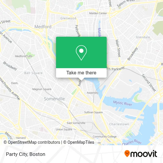
See Party City, Somerville, on the map
Public Transit to Party City in Somerville
Wondering how to get to Party City in Somerville? Moovit helps you find the best way to get to Party City with step-by-step directions from the nearest public transit station.
Moovit provides free maps and live directions to help you navigate through your city. View schedules, routes, timetables, and find out how long does it take to get to Party City in real time.
Looking for the nearest stop or station to Party City? Check out this list of stops closest to your destination: Broadway @ Grant St; Broadway @ Montgomery Ave; Sullivan Square; Grand Union Blvd @ Foley St; Mystic Ave Opp Shore Dr; Gilman Square.
Bus: 85, 95, 89, 101, 89/93, 90, ORANGE LINE SHUTTLE, ORANGE LINE SHUTTLE.Subway: ORANGE LINE, GREEN LINE B, GREEN LINE C, GREEN LINE E.
Want to see if there’s another route that gets you there at an earlier time? Moovit helps you find alternative routes or times. Get directions from and directions to Party City easily from the Moovit App or Website.
We make riding to Party City easy, which is why over 1.7 million users, including users in Somerville, trust Moovit as the best app for public transit. You don’t need to download an individual bus app or train app, Moovit is your all-in-one transit app that helps you find the best bus time or train time available.
For information on prices of subway and bus, costs and ride fares to Party City, please check the Moovit app.
Use the app to navigate to popular places including to the airport, hospital, stadium, grocery store, mall, coffee shop, school, college, and university.
Party City Address: 165 Middlesex Ave. street in Somerville
- Usps,
- Assembly Square Mall Shopping Center,
- Somerville District Court (Commonwealth of Massachusetts Middlesex County District Courts),
- Somerville District Court,
- La Quinta Inn & Suites Boston Somerville,
- La Quinta,
- Tj Maxx,
- Dm Stat,
- Legal Sea Foods ,
- Nike Factory Store,
- Ten Hills,
- DUNKIN',
- Somerville Carpet Cleaning,
- Crescent Locksmith & Key,
- Assembly Square Marketplace,
- Saks Fifth Avenue,
- Samsonite,
- Assembly Row Waterfront Trail,
- Artisan West Garage,
- Converse Outlet
Places Near Party City (Somerville)
- Mgm Music Hall, Boston,
- House Of Blues, Boston,
- Boston Medical Center, Boston,
- Castle Island, Boston,
- Leader Bank Pavilion (Leader Bank Pavillion), Boston,
- Museum Of Science, Boston,
- Boston Convention & Exhibition Center, Boston,
- Massachusetts General Hospital, Boston,
- Cheers, Boston,
- Wang Theater, Boston,
- Wilbur Theatre, Boston,
- Td Garden, Boston,
- Boston Common, Boston,
- Faneuil Hall, Boston,
- Isabella Stewart Gardner Museum, Boston,
- Quincy Market, Boston,
- Boston Children's Hospital, Boston,
- Prudential Center, Boston,
- Seaport District, Boston,
- North End, Boston
How to get to popular places in Boston with public transit
Get around Somerville by public transit!
Traveling around Somerville has never been so easy. See step by step directions as you travel to any attraction, street or major public transit station. View bus and train schedules, arrival times, service alerts and detailed routes on a map, so you know exactly how to get to anywhere in Somerville.
When traveling to any destination around Somerville use Moovit's Live Directions with Get Off Notifications to know exactly where and how far to walk, how long to wait for your line, and how many stops are left. Moovit will alert you when it's time to get off — no need to constantly re-check whether yours is the next stop.
Wondering how to use public transit in Somerville or how to pay for public transit in Somerville? Moovit public transit app can help you navigate your way with public transit easily, and at minimum cost. It includes public transit fees, ticket prices, and costs. Looking for a map of Somerville public transit lines? Moovit public transit app shows all public transit maps in Somerville with all Bus, Train, Subway and Ferry routes and stops on an interactive map.
Boston has 4 transit type(s), including: Bus, Train, Subway and Ferry, operated by several transit agencies, including MBTA, Southeastern Regional Transit Authority, MetroWest Regional Transit Authority, Rhode Island Public Transit Authority, WRTA, Lowell Regional Transit Authority, Merrimack Valley Transit, Montachusett Regional Transit Authority, Cape Cod Regional Transit Authority, Brockton Area Transit Authority, Martha's Vineyard Transit Authority, the WAVE - Nantucket Regional Transit Authority, GATRA, Cape Ann Transportation Authority and Massport