How to get to Party City by bus?
Click on the bus route to see step by step directions with maps, line arrival times and updated time schedules.
From Brighton Music Hall, Boston
80 minFrom Boston Landing Station, Boston
77 minFrom Harvard Square T Station - Red Line, Cambridge
86 minFrom Citizens Bank Opera House, Boston
80 minFrom Studio Allston, Boston
68 minFrom MBTA / Alewife #6, Cambridge
65 minFrom Brattle St / Harvard Sq, Cambridge
86 minFrom Regina Pizzeria, Boston
80 minFrom Apple Cinemas, Cambridge
73 min
How to get to Party City by train?
Click on the train route to see step by step directions with maps, line arrival times and updated time schedules.
Bus stop near Party City in Waltham
- Lexington St Opp Stearns Hill Rd, 2 min walk,VIEW
Train station near Party City in Waltham
- Waltham, 13 min walk,VIEW
Bus lines to Party City in Waltham
- 61, Waltham Center,VIEW
What are the closest stations to Party City?
The closest stations to Party City are:
- Lexington St Opp Stearns Hill Rd is 118 yards away, 2 min walk.
- Waltham is 1072 yards away, 13 min walk.
Which bus lines stop near Party City?
These bus lines stop near Party City: 61, 76.
Which train line stops near Party City?
FITCHBURG (#413 | Wachusett)
What’s the nearest train station to Party City in Waltham?
The nearest train station to Party City in Waltham is Waltham. It’s a 13 min walk away.
What’s the nearest bus station to Party City in Waltham?
The nearest bus station to Party City in Waltham is Lexington St Opp Stearns Hill Rd. It’s a 2 min walk away.
What time is the first train to Party City in Waltham?
The FITCHBURG is the first train that goes to Party City in Waltham. It stops nearby at 5:39 AM.
What time is the last train to Party City in Waltham?
The FITCHBURG is the last train that goes to Party City in Waltham. It stops nearby at 12:12 AM.
What time is the first bus to Party City in Waltham?
The 61 is the first bus that goes to Party City in Waltham. It stops nearby at 6:10 AM.
What time is the last bus to Party City in Waltham?
The 61 is the last bus that goes to Party City in Waltham. It stops nearby at 8:16 PM.
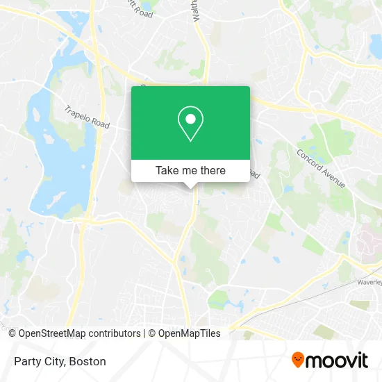
See Party City, Waltham, on the map
Public Transit to Party City in Waltham
Wondering how to get to Party City in Waltham? Moovit helps you find the best way to get to Party City with step-by-step directions from the nearest public transit station.
Moovit provides free maps and live directions to help you navigate through your city. View schedules, routes, timetables, and find out how long does it take to get to Party City in real time.
Looking for the nearest stop or station to Party City? Check out this list of stops closest to your destination: Lexington St Opp Stearns Hill Rd; Waltham.
Bus: 61, 76.Train: FITCHBURG.
Want to see if there’s another route that gets you there at an earlier time? Moovit helps you find alternative routes or times. Get directions from and directions to Party City easily from the Moovit App or Website.
We make riding to Party City easy, which is why over 1.7 million users, including users in Waltham, trust Moovit as the best app for public transit. You don’t need to download an individual bus app or train app, Moovit is your all-in-one transit app that helps you find the best bus time or train time available.
For information on prices of bus, train and subway, costs and ride fares to Party City, please check the Moovit app.
Use the app to navigate to popular places including to the airport, hospital, stadium, grocery store, mall, coffee shop, school, college, and university.
Party City Address: 800 Lexington St street in Waltham
- United Healthcare,
- Amazon Locker-Cucaracha,
- Morgans Appliance Service,
- T.J. Maxx,
- Salon 844 Waltham,
- Wal-Lex Shopping Center,
- Wal-lex Dry Cleaners,
- Chesterbrook Community Foundation,
- CR Services,
- Waltham YMCA,
- Rubber Soul Records,
- McSweeney Painting Co.,
- Tarnow Michael,
- Holmes Scott C Law Offices,
- John Lappini,
- Shady Pond Conservation Area,
- Bishops Forest Condos,
- Windsor Village at Waltham Apartments,
- Windsor,
- John F. Kennedy Middle School
Places Near Party City (Waltham)
- Castle Island, Boston,
- Leader Bank Pavilion (Leader Bank Pavillion), Boston,
- Wilbur Theatre, Boston,
- Prudential Center, Boston,
- Boston Medical Center, Boston,
- Cheers, Boston,
- Faneuil Hall, Boston,
- North End, Boston,
- Boston Common, Boston,
- Quincy Market, Boston,
- Seaport District, Boston,
- Boston Convention & Exhibition Center, Boston,
- Mgm Music Hall, Boston,
- Massachusetts General Hospital, Boston,
- Boston Children's Hospital, Boston,
- Museum Of Science, Boston,
- House Of Blues, Boston,
- Td Garden, Boston,
- Wang Theater, Boston,
- Isabella Stewart Gardner Museum, Boston
How to get to popular places in Boston with public transit
Get around Waltham by public transit!
Traveling around Waltham has never been so easy. See step by step directions as you travel to any attraction, street or major public transit station. View bus and train schedules, arrival times, service alerts and detailed routes on a map, so you know exactly how to get to anywhere in Waltham.
When traveling to any destination around Waltham use Moovit's Live Directions with Get Off Notifications to know exactly where and how far to walk, how long to wait for your line, and how many stops are left. Moovit will alert you when it's time to get off — no need to constantly re-check whether yours is the next stop.
Wondering how to use public transit in Waltham or how to pay for public transit in Waltham? Moovit public transit app can help you navigate your way with public transit easily, and at minimum cost. It includes public transit fees, ticket prices, and costs. Looking for a map of Waltham public transit lines? Moovit public transit app shows all public transit maps in Waltham with all Bus, Train, Subway and Ferry routes and stops on an interactive map.
Boston has 4 transit type(s), including: Bus, Train, Subway and Ferry, operated by several transit agencies, including MBTA, Southeastern Regional Transit Authority, MetroWest Regional Transit Authority, Rhode Island Public Transit Authority, WRTA, Lowell Regional Transit Authority, Merrimack Valley Transit, Montachusett Regional Transit Authority, Cape Cod Regional Transit Authority, Brockton Area Transit Authority, Martha's Vineyard Transit Authority, the WAVE - Nantucket Regional Transit Authority, GATRA, Cape Ann Transportation Authority and Massport