Directions to Pasadena Civic Auditorium with public transportation
The following transit lines have routes that pass near Pasadena Civic Auditorium
How to get to Pasadena Civic Auditorium by bus?
Click on the bus route to see step by step directions with maps, line arrival times and updated time schedules.
Bus stops near Pasadena Civic Auditorium
- Colorado / Garfield, 3 min walk,
Bus lines to Pasadena Civic Auditorium
- 180, Colorado - Lake,
- 267, El Monte Station,
- 662, Del Mar Station,
What are the closest stations to Pasadena Civic Auditorium?
The closest stations to Pasadena Civic Auditorium are:
- Colorado / Garfield is 224 yards away, 3 min walk.
Which bus lines stop near Pasadena Civic Auditorium?
These bus lines stop near Pasadena Civic Auditorium: 180/181, 187, 256.
Which light rail line stops near Pasadena Civic Auditorium?
GOLD LINE
What’s the nearest bus stop to Pasadena Civic Auditorium?
The nearest bus stop to Pasadena Civic Auditorium is Colorado / Garfield. It’s a 3 min walk away.
See Pasadena Civic Auditorium on the map
Public Transportation to Pasadena Civic Auditorium
Wondering how to get to Pasadena Civic Auditorium, United States? Moovit helps you find the best way to get to Pasadena Civic Auditorium with step-by-step directions from the nearest public transit station.
Moovit provides free maps and live directions to help you navigate through your city. View schedules, routes, timetables, and find out how long does it take to get to Pasadena Civic Auditorium in real time.
Looking for the nearest stop or station to Pasadena Civic Auditorium? Check out this list of stops closest to your destination: Colorado / Garfield.
Bus: 180/181, 187, 256, 180, 267, 662.Light Rail: GOLD LINE.
Want to see if there’s another route that gets you there at an earlier time? Moovit helps you find alternative routes or times. Get directions from and directions to Pasadena Civic Auditorium easily from the Moovit App or Website.
We make riding to Pasadena Civic Auditorium easy, which is why over 1.5 million users, including users in Pasadena, trust Moovit as the best app for public transit. You don’t need to download an individual bus app or train app, Moovit is your all-in-one transit app that helps you find the best bus time or train time available.
For information on prices of bus, light rail and subway, costs and ride fares to Pasadena Civic Auditorium, please check the Moovit app.
Use the app to navigate to popular places including to the airport, hospital, stadium, grocery store, mall, coffee shop, school, college, and university.
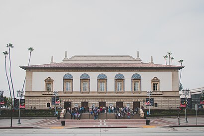
Pasadena Civic Auditorium Address: East Green Street street in Pasadena
The Pasadena Convention Center is a convention center in Pasadena, California, near Los Angeles, owned by the City of Pasadena. It consists of three buildings.Wiki
Attractions near Pasadena Civic Auditorium
Muse/Ique,International Make Up Artist Trade Show,International Health and Fitness Fair,Lovebirds Caf & Bakery,Scarela,Bricks L.A.,Kollaboration Star,Los Angeles Pottery Show,Pasadena Tour Company,Pasadena Ice Skating,Japan World Heroes,Dare the Show,La Children's Art Show,Visit Pasadena,Pasadena Convention Center Break Room,Monsterpalooza,Pcc Parking Structure 4,Pasadena Conv & Visitors Bureau,Pasadena Conference Center (Pasadena Convention Center),Pasadena Conference CenterHow to get to popular attractions in Pasadena with public transit
Rosecrans And Santa Gertrudes, La Mirada,Alamo Inn & Suites, Anaheim,Pacifica High School, Oxnard,Fair Oaks Ranch,Experian Parking Structure, Costa Mesa,The Trolley At The Grove, Fairfax, La,Amity Island, Universal City, La,Arroyo Valley High School, San Bernardino,Armand Hammer Museum Of Art, Westwood, La,Metroflex, Long Beach,Wilshire/Westwood Bus Stop, Westwood, La,Dyrdek Enterprises (Fantasy Factory), Boyle Heights, La,Kaiser Permanente Diamond Bar Medical Offices, Diamond Bar,Kaiser Permanente Anaheim - Kraemer Pharmacy, Anaheim,Toppers Pizza Place, Santa Clarita,Military Entrance Processing Station (MEPS), El Segundo,Smurf Village, West Hollywood,Saddleback College Quad, Mission Viejo,Florence And Crenshaw, Hyde Park, La,Mistress, Venice, LaGet around Los Angeles by public transit!
Traveling around Los Angeles has never been so easy. See step by step directions as you travel to any attraction, street or major public transit station. View bus and train schedules, arrival times, service alerts and detailed routes on a map, so you know exactly how to get to anywhere in Los Angeles.
When traveling to any destination around Los Angeles use Moovit's Live Directions with Get Off Notifications to know exactly where and how far to walk, how long to wait for your line, and how many stops are left. Moovit will alert you when it's time to get off — no need to constantly re-check whether yours is the next stop.
Wondering how to use public transit in Los Angeles or how to pay for public transit in Los Angeles? Moovit public transit app can help you navigate your way with public transit easily, and at minimum cost. It includes public transit fees, ticket prices, and costs. Looking for a map of Los Angeles public transit lines? Moovit public transit app shows all public transit maps in Los Angeles with all Bus, Train, Subway, Light Rail, Ferry and Funicular routes and stops on an interactive map.
Los Angeles has 6 transit type(s), including: Bus, Train, Subway, Light Rail, Ferry and Funicular, operated by several transit agencies, including Metro - Los Angeles, Metrolink Trains, METRO, Long Beach Transit, LADOT, OCTA, Foothill Transit, Big Blue Bus, Riverside Transit Agency, LAX FlyAway, Airporter Shuttle, Playa Vista Shuttle, Amtrak, OMNITRANS, Pasadena Transit