See Pasarét, Budapest, on the map
Directions to Pasarét (Budapest) with public transportation
The following transit lines have routes that pass near Pasarét
 Bus:
Bus: - Metro:
- Light Rail:
How to get to Pasarét by bus?
Click on the bus route to see step by step directions with maps, line arrival times and updated time schedules.
How to get to Pasarét by metro?
Click on the metro route to see step by step directions with maps, line arrival times and updated time schedules.
Bus stations near Pasarét in Budapest
- Budagyöngye,1 min walk,
- Szilágyi Erzsébet Fasor,4 min walk,
- Virág Árok,6 min walk,
- Virányos Út,12 min walk,
Light Rail stations near Pasarét in Budapest
- Budagyöngye,2 min walk,
Bus lines to Pasarét in Budapest
- 22,Széll Kálmán tér M / Budakeszi Tesco áruház,
- 22A,Széll Kálmán tér M / Budakeszi Dózsa György tér,
- 129,Széll Kálmán tér M / Szent Ferenc Kórház,
- 222,Széll Kálmán tér M / Budakeszi Honfoglalás sétány,
- 291,Nyugati pályaudvar M / Zugliget Libegő,
- 922,Széll Kálmán tér M / Budakeszi Dózsa György tér,
- 922B,Széll Kálmán tér M / Zsámbék autóbusz-forduló,
- 956,Hűvösvölgy / Pécel Kun József utca,
- 91,Rózsadomb ► Nyugati Pályaudvar M,
- 5,Rákospalota, Kossuth Utca,
- 155,Fácános Tér,
- 156,Dániel Út,
What are the closest stations to Pasarét?
The closest stations to Pasarét are:
- Budagyöngye is 40 meters away, 1 min walk.
- Szilágyi Erzsébet Fasor is 246 meters away, 4 min walk.
- Virág Árok is 433 meters away, 6 min walk.
- Virányos Út is 906 meters away, 12 min walk.
Which bus lines stop near Pasarét?
These bus lines stop near Pasarét: 129, 22, 22A, 5.
Which metro line stops near Pasarét?
M2
Which light rail line stops near Pasarét?
61
What’s the nearest light rail station to Pasarét in Budapest?
The nearest light rail station to Pasarét in Budapest is Budagyöngye. It’s a 2 min walk away.
What’s the nearest bus stop to Pasarét in Budapest?
The nearest bus stop to Pasarét in Budapest is Budagyöngye. It’s a 1 min walk away.
What time is the first light rail to Pasarét in Budapest?
The 59 is the first light rail that goes to Pasarét in Budapest. It stops nearby at 4:23 AM.
What time is the last light rail to Pasarét in Budapest?
The 59 is the last light rail that goes to Pasarét in Budapest. It stops nearby at 12:34 AM.
What time is the first bus to Pasarét in Budapest?
The 922 is the first bus that goes to Pasarét in Budapest. It stops nearby at 3:04 AM.
What time is the last bus to Pasarét in Budapest?
The 956 is the last bus that goes to Pasarét in Budapest. It stops nearby at 3:53 AM.
See Pasarét, Budapest, on the map
Public Transit to Pasarét in Budapest
Wondering how to get to Pasarét in Budapest, Hungary? Moovit helps you find the best way to get to Pasarét with step-by-step directions from the nearest public transit station.
Moovit provides free maps and live directions to help you navigate through your city. View schedules, routes, timetables, and find out how long does it take to get to Pasarét in real time.
Looking for the nearest stop or station to Pasarét? Check out this list of stops closest to your destination: Budagyöngye; Szilágyi Erzsébet Fasor; Virág Árok; Virányos Út.
Bus:Metro:Light Rail:
Want to see if there’s another route that gets you there at an earlier time? Moovit helps you find alternative routes or times. Get directions from and directions to Pasarét easily from the Moovit App or Website.
We make riding to Pasarét easy, which is why over 1.5 million users, including users in Budapest, trust Moovit as the best app for public transit. You don’t need to download an individual bus app or train app, Moovit is your all-in-one transit app that helps you find the best bus time or train time available.
For information on prices of bus, light rail and metro, costs and ride fares to Pasarét, please check the Moovit app.
Use the app to navigate to popular places including to the airport, hospital, stadium, grocery store, mall, coffee shop, school, college, and university.
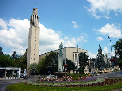
Pasarét Address: Budapest, Budapest street in Budapest
Attractions near Pasarét
Budagyöngye Parkoló,Harmony Alakformáló szalon,Zsolnaysho,Pharma Futar,Budapest Bank Atm,Semiramis Kávézó,Kodak Express fotó Cikk,Soltinvest Kft,Budagyongye 2000 Kft. V.A.,Cafe Zacc,Budagyongye 2004. Kft.,Denes Es Denes Bt.,Optika Plus,Divo Style (Pázsit),Szelva Gyorgyne Ev.Bud,Dm-Drogerie Markt Kft.,Teahome,Playersroom Budagyo:Ng,Budapest Bank Zrt. - Budagyöngye Fiók,Worldfashion & StyleHow to get to popular attractions in Budapest with public transit
Siemens Zrt. Csepel, Budapest,Fillér utca, Budapest,SPAR, Budapest,CBA Príma, Budapest,Jászai Mari Tér, Budapest,Budapest Airport Terminal 2a, Gyál,Örs Vezér Tere, Budapest,SPAR, Gödöllo,Aquaworld Budapest, Budapest,KFC, Budapest,ELMŰ Dél-budai Régióközpont, Budapest,Árpád híd, budai hídfő, Budapest,Rizmajer Kézműves Sörház, Budapest,99999 Informatika Kft., Budapest,ELTE IK, Budapest,Mandarin kert, Budapest,Tortuga Étterem, Budapest,Kelenvölgy (XI.ker.), Budapest,Csepel Plaza, Budapest,Kelenföld, városközpont, BudapestGet around Budapest by public transit!
Traveling around Budapest has never been so easy. See step by step directions as you travel to any attraction, street or major public transit station. View bus and train schedules, arrival times, service alerts and detailed routes on a map, so you know exactly how to get to anywhere in Budapest.
When traveling to any destination around Budapest use Moovit's Live Directions with Get Off Notifications to know exactly where and how far to walk, how long to wait for your line, and how many stops are left. Moovit will alert you when it's time to get off — no need to constantly re-check whether yours is the next stop.
Wondering how to use public transit in Budapest or how to pay for public transit in Budapest? Moovit public transit app can help you navigate your way with public transit easily, and at minimum cost. It includes public transit fees, ticket prices, and costs. Looking for a map of Budapest public transit lines? Moovit public transit app shows all public transit maps in Budapest with all bus, light rail or metro routes and stops on an interactive map.
Budapest has 3 transit type(s), including: bus, light rail or metro, operated by several transit agencies, including BKK, BKK, BKK, BKK and MÁV-HÉV