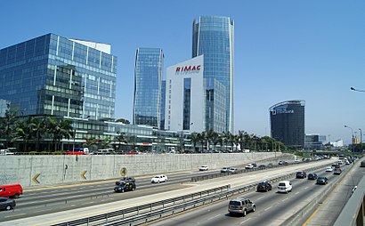
See Paseo De La República, Lima, on the map
Directions to Paseo De La República (Lima) with public transportation
The following transit lines have routes that pass near Paseo De La República
 Bus:
Bus: - Metro:
How to get to Paseo De La República by bus?
Click on the bus route to see step by step directions with maps, line arrival times and updated time schedules.
Bus stations near Paseo De La República in Lima
- Alejandro Tirado,3 min walk,
- Teodoro Cárdenas,4 min walk,
- Torres Paz, 1155,4 min walk,
- Torres Paz,5 min walk,
- Estación México,5 min walk,
- México,6 min walk,
- Terminal Perúbus México (Llegadas),8 min walk,
Metro stations near Paseo De La República in Lima
- Estacion La Cultura,35 min walk,
Bus lines to Paseo De La República in Lima
- 8403,San Gabriel (Villa María Del Triunfo) -28 De Julio (Lima),
- IM24,Oquendo,
- IM40,Ate - Callao,
- 3517,Bolívar (Pueblo Libre) - Campoy (San Juan de Lurigancho),
- 3203,Portón (San Juan De Lurigancho) - Plaza Norte (San Martin De Porres) - Portón (San Juan De Lurigancho),
- 3509,Javier Prado Oeste (Magdalena) - Pirámide Del Sol (San Juan De Lurigancho),
- 3806,Hospital Del Empleado (Lince) - Bayóvar (San Juan De Lurigancho),
- 4902,Puente Llanos (Ate) - Sarita Colonia (Callao),
- 405,Wiesse (San Juan De Lurigancho) - Canaval Y Moreyra (San Isidro),
- 3603,San Juan De Lurigancho - Lince,
- 3605,Parque Del Bombero (Lince) - Santa María (San Juan De Lurigancho),
- 3607,S.J.L. - Lince - S.J.L.,
- IO33B,Puente Piedra - Rimac,
- B,Estación Plaza De Flores (Barranco) - Estación Los Incas (Comas),
- C,Terminal Matellini (Chorrillos) - Estación Ramón Castilla (Centro De Lima),
- 3805,V.E.S - La Victoria,
- 8308,Wiesse (San Juan de Lurigancho) - Sumac Paccha (Lurín),
- 4901,Lurigancho - Lima,
- 1403,Carabayllo - Ate,
- 1804,Ancón - San Juan de Miraflores [C],
What are the closest stations to Paseo De La República?
The closest stations to Paseo De La República are:
- Teodoro Cárdenas is 231 meters away, 4 min walk.
- Alejandro Tirado is 233 meters away, 3 min walk.
- Torres Paz, 1155 is 260 meters away, 4 min walk.
- Torres Paz is 322 meters away, 5 min walk.
- Estación México is 335 meters away, 5 min walk.
- México is 373 meters away, 6 min walk.
- Terminal Perúbus México (Llegadas) is 588 meters away, 8 min walk.
- Estacion La Cultura is 2702 meters away, 35 min walk.
Which bus lines stop near Paseo De La República?
These bus lines stop near Paseo De La República: 3203, 4204, 4902, 8308, 8403, C, IM24.
What’s the nearest bus stop to Paseo De La República in Lima?
The nearest bus stops to Paseo De La República in Lima are Teodoro Cárdenas and Torres Paz, 1155. The closest one is a 4 min walk away.
What time is the first metro to Paseo De La República in Lima?
The LINEA 1 is the first metro that goes to Paseo De La República in Lima. It stops nearby at 5:19 AM.
What time is the last metro to Paseo De La República in Lima?
The LINEA 1 is the last metro that goes to Paseo De La República in Lima. It stops nearby at 10:05 PM.
What time is the first bus to Paseo De La República in Lima?
The 3203 is the first bus that goes to Paseo De La República in Lima. It stops nearby at 4:47 AM.
What time is the last bus to Paseo De La República in Lima?
The 8618 is the last bus that goes to Paseo De La República in Lima. It stops nearby at 12:22 AM.
How much is the bus fare to Paseo De La República?
The bus fare to Paseo De La República costs about S/.3.20.
See Paseo De La República, Lima, on the map
Public Transit to Paseo De La República in Lima
How to get to Paseo De La República in Lima, Peru?
It’s easy with Moovit. Type in your street address and Moovit’s route finder will locate the fastest way to get you there! Not sure where to get off on the street? Download the Moovit App to find live directions (including where to get off on Paseo De La República), see timetables and get the estimated arrival times for your favorite bus lines.
Looking for the nearest stop or station to Paseo De La República? Check out this list of closest stops available to your destination: Teodoro Cárdenas; Alejandro Tirado; Torres Paz; Torres Paz; Estación México; México; Terminal Perúbus México (Llegadas); Estacion La Cultura.
Bus:Metro:
Download the Moovit App to see the current schedule and routes available for Lima. No need to install a special bus app to check the bus time or a train app to get train time. Moovit is the only all-in-one transit app that helps you get where you need to go.
We make riding on public transit to Paseo De La República easy, which is why over 1.5 million users, including users in Lima trust Moovit as the best app for public transit.
Use the app to navigate to popular places including to the airport, hospital, stadium, grocery store, mall, coffee shop, school, college, and university.
Location: Lima
Streets near Paseo De La República, Lima
Calle Enrique Villar, Lima,Salida 11, La Victori,Avenida Nicolás Araníbar, Lima,Nicolás Araníbar, Lima,Londres, La Victori,Víaducto Iquitos, Lima,Jirón Comandante Torres Paz, Lima,Teodoro Cárdenas, Lima,Avenida Mexico, Lima,Paseo Parodi, Lima,Manuel Castañeda, Lima,Jirón Saenz Peña, La Victori,Rivas, La Victori,Viaducto Manco Capac, La Victori,Jirón Carlos Arrieta, Lima,Jirón Canta, Lima,Salida A Avenida México, Lima,Jirón Francia, Lima,Obsidianas, La Victori,Jirón Francia, La VictoriHow to get to popular attractions in Lima with public transit
San Juan De Lurigancho, San Juan D,ACENESPAR GC - Sede Playa Curayacu, San Bartol,Megaplaza Lima Norte, Independen,Museo De Arte De Lima, Lima,Campo De Marte, Jesus Mari,Paradero Panadería - Mirones Bajo, Lima,Biogen Agro, Los Olivos,Pueblo Libre, Lima,Chifa My Home, San Miguel,Parque La Pergola, Chorrillos,Parque John F. Kennedy, Miraflores,Capilla San Francisco de Asis, Ate,La Bolichera,Chosica, Lurigancho,Estación Naranjal, Independen,Lince, Lince,Tortas Gaby, San Miguel,MIQ Logistics, Miraflores,Tottus, Los Olivos,Eckerd Perú, ChorrillosGet around Lima by public transit!
Traveling around Lima has never been so easy. See step by step directions as you travel to any attraction, street or major public transit station. View bus and train schedules, arrival times, service alerts and detailed routes on a map, so you know exactly how to get to anywhere in Lima.
When traveling to any destination around Lima use Moovit's Live Directions with Get Off Notifications to know exactly where and how far to walk, how long to wait for your line, and how many stops are left. Moovit will alert you when it's time to get off — no need to constantly re-check whether yours is the next stop.
Wondering how to use public transit in Lima or how to pay for public transit in Lima? Moovit public transit app can help you navigate your way with public transit easily, and at minimum cost. It includes public transit fees, ticket prices, and costs. Looking for a map of Lima public transit lines? Moovit public transit app shows all public transit maps in Lima with all bus routes and stops on an interactive map.
Lima has 1 transit type(s), including: bus, operated by several transit agencies, including Metro de Lima, Corredor Rojo, Metropolitano, Metropolitano - Alimentadores, Corredor Morado, Corredor Azul, Rutas Tradicionales, Transportes y Servicios La Esperanza S.A., Grupo Diez S.A.C., Las Flores S.A., Virgen de la Asunción S.A., Consorcio HAM, Transportes y Service Canadá S.A., ETUL4SA and ETUCHISA