Directions to Paseo de Roxas (Makati City) with public transportation
The following transit lines have routes that pass near Paseo de Roxas
How to get to Paseo de Roxas by bus?
Click on the bus route to see step by step directions with maps, line arrival times and updated time schedules.
How to get to Paseo de Roxas by train?
Click on the train route to see step by step directions with maps, line arrival times and updated time schedules.
Bus stations near Paseo de Roxas in Makati City
- Paseo De Roxas / Pasay Road Intersection, Makati City, Manila,1 min walk,
- Esperanza Street, Makati City,4 min walk,
- Makati Ave / A. Arnaiz Ave, Makati City, Manila,4 min walk,
- A. Arnaiz Ave / Don Chino Roces Avenue Intersection, Makati City,8 min walk,
- Makati Ave / North Dr Intersection, Makati City, Manila,8 min walk,
- Ayala Center,9 min walk,
Train stations near Paseo de Roxas in Makati City
- Pasay Road Pnr,12 min walk,
- Ayala Mrt,15 min walk,
Bus lines to Paseo de Roxas in Makati City
- JEEP,Paseo De Roxas / Ayala Avenue Intersection, Makati City, Manila,
- JEEP,South Dr / A. Arnaiz Ave Intersection, Makati City, Manila,
- JEEP,Salcedo, Makati City,
- JEEP,Zapote / Kalayaan Ave, Makati City, Manila,
- JEEP,M. Almeda, Pateros, Manila,
- JEEP,J.P. Rizal Ave, Makati City, Manila,
- JEEP,Makati Ave / A. Arnaiz Ave, Makati City, Manila,
- JEEP,Sabio St / Chino Roces Ave Intersection, Makati City, Manila,
- JEEP,A. Arnaiz Ave / Don Chino Roces Avenue Intersection, Makati City,
- JEEP,Makati Ave / North Dr Intersection, Makati City, Manila,
- UV,Pasig,
- UV,Festival Mall/Alabang,
- P2P,Naia Terminal 3,
What are the closest stations to Paseo de Roxas?
The closest stations to Paseo de Roxas are:
- Paseo De Roxas / Pasay Road Intersection, Makati City, Manila is 11 meters away, 1 min walk.
- Esperanza Street, Makati City is 267 meters away, 4 min walk.
- Makati Ave / A. Arnaiz Ave, Makati City, Manila is 297 meters away, 4 min walk.
- A. Arnaiz Ave / Don Chino Roces Avenue Intersection, Makati City is 553 meters away, 8 min walk.
- Makati Ave / North Dr Intersection, Makati City, Manila is 586 meters away, 8 min walk.
- Ayala Center is 678 meters away, 9 min walk.
- Pasay Road Pnr is 874 meters away, 12 min walk.
- Ayala Mrt is 1116 meters away, 15 min walk.
Which bus lines stop near Paseo de Roxas?
These bus lines stop near Paseo de Roxas: BUS, JEEP, P2P.
Which train line stops near Paseo de Roxas?
PNR MC
What’s the nearest train station to Paseo de Roxas in Makati City?
The nearest train station to Paseo de Roxas in Makati City is Pasay Road Pnr. It’s a 12 min walk away.
What’s the nearest bus stop to Paseo de Roxas in Makati City?
The nearest bus stop to Paseo de Roxas in Makati City is Paseo De Roxas / Pasay Road Intersection, Makati City, Manila. It’s a 1 min walk away.
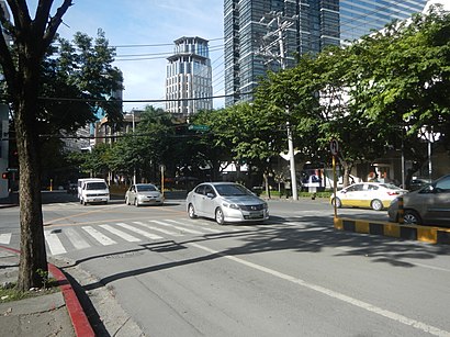
See Paseo de Roxas, Makati City, on the map
Public Transit to Paseo de Roxas in Makati City
Wondering how to get to Paseo de Roxas in Makati City, Philippines? Moovit helps you find the best way to get to Paseo de Roxas with step-by-step directions from the nearest public transit station.
Moovit provides free maps and live directions to help you navigate through your city. View schedules, routes, timetables, and find out how long does it take to get to Paseo de Roxas in real time.
Looking for the nearest stop or station to Paseo de Roxas? Check out this list of stops closest to your destination: Paseo De Roxas / Pasay Road Intersection; Esperanza Street; Makati Ave / A. Arnaiz Ave; A. Arnaiz Ave / Don Chino Roces Avenue Intersection; Makati Ave / North Dr Intersection; Ayala Center; Pasay Road Pnr; Ayala Mrt.
Bus:BUSJEEPP2PTrain:PNR MCMRT3
Want to see if there’s another route that gets you there at an earlier time? Moovit helps you find alternative routes or times. Get directions from and directions to Paseo de Roxas easily from the Moovit App or Website.
We make riding to Paseo de Roxas easy, which is why over 1.5 million users, including users in Makati City, trust Moovit as the best app for public transit. You don’t need to download an individual bus app or train app, Moovit is your all-in-one transit app that helps you find the best bus time or train time available.
For information on prices of bus and train, costs and ride fares to Paseo de Roxas, please check the Moovit app.
Use the app to navigate to popular places including to the airport, hospital, stadium, grocery store, mall, coffee shop, school, college, and university.
Paseo de Roxas Address: Paseo de Roxas, Makati, Metro Manila, Philippines street in Makati City
Attractions near Paseo de Roxas
Antonio Arnaiz Avenue,Arnaiz Ave / Edades St,Choi Garden Makati,Edades St,Arnaiz Ave / Paseo de Roxas,Bibingka Puto Bumbong,Paseo de Roxas & Antonio Arnaiz Avenue,Tsukiji Japanese Restaurant,Arnaiz Ave,Makati Dental Clinic by Dr. Donna Harder-Ferraren,Paseo de Roxas / Pasay Road Intersection, Makati City, Manila,Buskowitz,Reyes Navarro & Assoc,Hen Lin,Pacific Consultants Int'l,Philstaff Management Services Inc,Ubi Technology,Rosero's Dental Clinic,MilkyWay Café (Milky Way Cafe Restaurant),832 Arnaiz AvenueHow to get to popular attractions in Makati City with public transit
Carmona, Cavite, Carmona,LRT 1 (Jose Abad Santos Station), Manila,Montalban, Rizal, Rodriguez,Camella Homes Bacoor, Bacoor,J.CO Donuts & Coffee, Imus,Camella Gate Ayala Van Terminal, Bacoor,BonChon Chicken, Parañaque,Cathedral Parish of St. Andrew, Parañaque,C5 NB Toll Gate, Taguig,Commerce Avenue, Muntinlupa,Starmall, Bulacan,SM Cinema Southmall, Las Piñas,LRT 1 (Blumentritt Station), Manila,Malate, Parañaque,Smart LEC, PQ, Parañaque,North Fairview Park Subdivision, Quezon City,The Feast Bay Area,The Original Dampa, Parañaque,The Coffee Bean & Tea Leaf,Capitol Park Homes II, Kalookan CityGet around Makati City by public transit!
Traveling around Makati City has never been so easy. See step by step directions as you travel to any attraction, street or major public transit station. View bus and train schedules, arrival times, service alerts and detailed routes on a map, so you know exactly how to get to anywhere in Makati City.
When traveling to any destination around Makati City use Moovit's Live Directions with Get Off Notifications to know exactly where and how far to walk, how long to wait for your line, and how many stops are left. Moovit will alert you when it's time to get off — no need to constantly re-check whether yours is the next stop.
Wondering how to use public transit in Makati City or how to pay for public transit in Makati City? Moovit public transit app can help you navigate your way with public transit easily, and at minimum cost. It includes public transit fees, ticket prices, and costs. Looking for a map of Makati City public transit lines? Moovit public transit app shows all public transit maps in Makati City with all bus or train routes and stops on an interactive map.
Makati City has 2 transit type(s), including: bus or train, operated by several transit agencies, including MRTC, LRTA, PNR, LTFRB, BGC Bus, P2P and UV Express