Directions to Patchwork Community Craft (Boston) with public transportation
The following transit lines have routes that pass near Patchwork Community Craft
 Bus: COMMUTER RAIL SHUTTLE.
- Train: FRANKLIN/FOXBORO.
How to get to Patchwork Community Craft by bus?
Click on the bus route to see step by step directions with maps, line arrival times and updated time schedules.
How to get to Patchwork Community Craft by train?
Click on the train route to see step by step directions with maps, line arrival times and updated time schedules.
Bus stop near Patchwork Community Craft in Boston
- Norfolk Station - Bus Shuttle, 5 min walk,VIEW
Train station near Patchwork Community Craft in Boston
- Norfolk, 58 min walk,VIEW
Bus lines to Patchwork Community Craft in Boston
- COMMUTER RAIL SHUTTLE, Canton Junction (Shuttle),VIEW
What are the closest stations to Patchwork Community Craft?
The closest stations to Patchwork Community Craft are:
- Norfolk Station - Bus Shuttle is 334 yards away, 5 min walk.
- Norfolk is 4905 yards away, 58 min walk.
Which bus line stops near Patchwork Community Craft?
COMMUTER RAIL SHUTTLE (Forge Park/495 (Shuttle))
Which train line stops near Patchwork Community Craft?
FRANKLIN/FOXBORO (#721 | Forge Park/495)
What’s the nearest bus station to Patchwork Community Craft in Boston?
The nearest bus station to Patchwork Community Craft in Boston is Norfolk Station - Bus Shuttle. It’s a 5 min walk away.
What time is the first bus to Patchwork Community Craft in Boston?
The COMMUTER RAIL SHUTTLE is the first bus that goes to Patchwork Community Craft in Boston. It stops nearby at 4:19 AM.
What time is the last bus to Patchwork Community Craft in Boston?
The COMMUTER RAIL SHUTTLE is the last bus that goes to Patchwork Community Craft in Boston. It stops nearby at 1:00 AM.
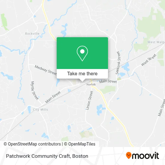
See Patchwork Community Craft, Boston, on the map
Public Transit to Patchwork Community Craft in Boston
Wondering how to get to Patchwork Community Craft in Boston? Moovit helps you find the best way to get to Patchwork Community Craft with step-by-step directions from the nearest public transit station.
Moovit provides free maps and live directions to help you navigate through your city. View schedules, routes, timetables, and find out how long does it take to get to Patchwork Community Craft in real time.
Looking for the nearest stop or station to Patchwork Community Craft? Check out this list of stops closest to your destination: Norfolk Station - Bus Shuttle; Norfolk.
Bus: COMMUTER RAIL SHUTTLE.Train: FRANKLIN/FOXBORO.
Want to see if there’s another route that gets you there at an earlier time? Moovit helps you find alternative routes or times. Get directions from and directions to Patchwork Community Craft easily from the Moovit App or Website.
We make riding to Patchwork Community Craft easy, which is why over 1.7 million users, including users in Boston, trust Moovit as the best app for public transit. You don’t need to download an individual bus app or train app, Moovit is your all-in-one transit app that helps you find the best bus time or train time available.
For information on prices of train and bus, costs and ride fares to Patchwork Community Craft, please check the Moovit app.
Use the app to navigate to popular places including to the airport, hospital, stadium, grocery store, mall, coffee shop, school, college, and university.
Patchwork Community Craft Address: 206 Main St Ste 7 street in Boston
- Landscape Oasis Llc,
- Friends Of the Norfolk Public Library,
- Lovells Sports Shop,
- Steller Salon & Apothecary,
- Norfolk, Massachusetts,
- Post Office-Norfolk,
- Walsh's Landscaping,
- Walsh's Greenhouse,
- Johnston Bruce E Real Estate,
- Place Carols Dr,
- C & K Custom Apparel,
- Foxboro Federal Savings,
- Walgreens Pharmacy,
- Blue Rhino Propane Exchange,
- Dr Mitchell Pasenkoff,
- Rainbow Seafood Company,
- Norfolk, MA Sepac,
- Dave Matthews Realtor - Nexthome Soundings Realty,
- Enrich Your Life Coaching,
- Norfolk MBTA Commuter Rail Train Station
Places Near Patchwork Community Craft (Boston)
- Isabella Stewart Gardner Museum, Boston,
- North End, Boston,
- Mgm Music Hall, Boston,
- Leader Bank Pavilion (Leader Bank Pavillion), Boston,
- Quincy Market, Boston,
- Massachusetts General Hospital, Boston,
- Boston Convention & Exhibition Center, Boston,
- Castle Island, Boston,
- Museum Of Science, Boston,
- Td Garden, Boston,
- Faneuil Hall, Boston,
- House Of Blues, Boston,
- Boston Children's Hospital, Boston,
- Wang Theater, Boston,
- Cheers, Boston,
- Wilbur Theatre, Boston,
- Boston Medical Center, Boston,
- Boston Common, Boston,
- Seaport District, Boston,
- Prudential Center, Boston
How to get to popular places in Boston with public transit
Get around Boston by public transit!
Traveling around Boston has never been so easy. See step by step directions as you travel to any attraction, street or major public transit station. View bus and train schedules, arrival times, service alerts and detailed routes on a map, so you know exactly how to get to anywhere in Boston.
When traveling to any destination around Boston use Moovit's Live Directions with Get Off Notifications to know exactly where and how far to walk, how long to wait for your line, and how many stops are left. Moovit will alert you when it's time to get off — no need to constantly re-check whether yours is the next stop.
Wondering how to use public transit in Boston or how to pay for public transit in Boston? Moovit public transit app can help you navigate your way with public transit easily, and at minimum cost. It includes public transit fees, ticket prices, and costs. Looking for a map of Boston public transit lines? Moovit public transit app shows all public transit maps in Boston with all Bus, Train, Subway and Ferry routes and stops on an interactive map.
Boston has 4 transit type(s), including: Bus, Train, Subway and Ferry, operated by several transit agencies, including MBTA, Southeastern Regional Transit Authority, MetroWest Regional Transit Authority, Rhode Island Public Transit Authority, WRTA, Lowell Regional Transit Authority, Merrimack Valley Transit, Montachusett Regional Transit Authority, Cape Cod Regional Transit Authority, Brockton Area Transit Authority, Martha's Vineyard Transit Authority, the WAVE - Nantucket Regional Transit Authority, GATRA, Cape Ann Transportation Authority and Massport