Directions to Path For Adaptive Opportunities (Boston) with public transportation
The following transit lines have routes that pass near Path For Adaptive Opportunities
 Bus: 01, 09, 11, NCS, 10.
- Train: FRAMINGHAM/WORCESTER, LAKE SHORE LIMITED.
How to get to Path For Adaptive Opportunities by bus?
Click on the bus route to see step by step directions with maps, line arrival times and updated time schedules.
From Newton-Wellesley Hospital, Newton
77 minFrom Bose Corp, Framingham
77 minFrom I-95 / Route 128 & Route 16 Interchange (Exit 21), Newton
74 minFrom Boston Marriott Newton, Newton
100 minFrom Hopkinton, MA, Hopkinton
61 minFrom Wellesley, MA, Wellesley
71 minFrom Staples Corporate HQ, Framingham
58 minFrom Newton Wellesley Hospital Green Building, Newton
77 minFrom Babson College, Wellesley
69 min
How to get to Path For Adaptive Opportunities by train?
Click on the train route to see step by step directions with maps, line arrival times and updated time schedules.
Bus stops near Path For Adaptive Opportunities in Boston
Train stations near Path For Adaptive Opportunities in Boston
Bus lines to Path For Adaptive Opportunities in Boston
What are the closest stations to Path For Adaptive Opportunities?
The closest stations to Path For Adaptive Opportunities are:
- West Natick Mbta Station is 317 yards away, 4 min walk.
- West Natick Mbta on Rt 135 is 1271 yards away, 15 min walk.
- Natick Center is 3272 yards away, 39 min walk.
- Framingham Amtrak is 4731 yards away, 56 min walk.
Which bus lines stop near Path For Adaptive Opportunities?
These bus lines stop near Path For Adaptive Opportunities: 01, 09, 11.
Which train line stops near Path For Adaptive Opportunities?
FRAMINGHAM/WORCESTER (#521 | Worcester)
What’s the nearest bus station to Path For Adaptive Opportunities in Boston?
The nearest bus station to Path For Adaptive Opportunities in Boston is West Natick Mbta Station. It’s a 4 min walk away.
What time is the first train to Path For Adaptive Opportunities in Boston?
The FRAMINGHAM/WORCESTER is the first train that goes to Path For Adaptive Opportunities in Boston. It stops nearby at 4:54 AM.
What time is the last train to Path For Adaptive Opportunities in Boston?
The LAKE SHORE LIMITED is the last train that goes to Path For Adaptive Opportunities in Boston. It stops nearby at 8:00 PM.
What time is the first bus to Path For Adaptive Opportunities in Boston?
The 10 is the first bus that goes to Path For Adaptive Opportunities in Boston. It stops nearby at 6:33 AM.
What time is the last bus to Path For Adaptive Opportunities in Boston?
The 11 is the last bus that goes to Path For Adaptive Opportunities in Boston. It stops nearby at 8:28 PM.
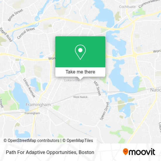
See Path For Adaptive Opportunities, Boston, on the map
Public Transit to Path For Adaptive Opportunities in Boston
Wondering how to get to Path For Adaptive Opportunities in Boston? Moovit helps you find the best way to get to Path For Adaptive Opportunities with step-by-step directions from the nearest public transit station.
Moovit provides free maps and live directions to help you navigate through your city. View schedules, routes, timetables, and find out how long does it take to get to Path For Adaptive Opportunities in real time.
Looking for the nearest stop or station to Path For Adaptive Opportunities? Check out this list of stops closest to your destination: West Natick Mbta Station; West Natick Mbta on Rt 135; Natick Center; Framingham Amtrak.
Bus: 01, 09, 11, NCS, 10.Train: FRAMINGHAM/WORCESTER, LAKE SHORE LIMITED.
Want to see if there’s another route that gets you there at an earlier time? Moovit helps you find alternative routes or times. Get directions from and directions to Path For Adaptive Opportunities easily from the Moovit App or Website.
We make riding to Path For Adaptive Opportunities easy, which is why over 1.7 million users, including users in Boston, trust Moovit as the best app for public transit. You don’t need to download an individual bus app or train app, Moovit is your all-in-one transit app that helps you find the best bus time or train time available.
For information on prices of bus and train, costs and ride fares to Path For Adaptive Opportunities, please check the Moovit app.
Use the app to navigate to popular places including to the airport, hospital, stadium, grocery store, mall, coffee shop, school, college, and university.
Path For Adaptive Opportunities Address: 179 Boden Ln street in Boston
- Natick Recreation and Parks,
- A M Dalrymple Mono,
- Boudreau Landscaping,
- Medicare Insurance Advisors Natick,
- Gurjar Gujarati Assoc of,
- Lillys Painting,
- A Place To Turn Food Pantry,
- MBTA West Natick Station,
- MBTA Commuter Rail #508,
- Blue Hill Promotional Products,
- Town of Natick Elementary School,
- Brown,
- Family Worship Center,
- Pelvic Health,
- Minuteman Press Natick,
- Clean All over Laundromat,
- Danielle Eagan, LMT,Occ,
- Snap-on,
- W Central St,
- Brooklyn New York
Places Near Path For Adaptive Opportunities (Boston)
- Isabella Stewart Gardner Museum, Boston,
- Boston Medical Center, Boston,
- North End, Boston,
- Boston Children's Hospital, Boston,
- Cheers, Boston,
- Massachusetts General Hospital, Boston,
- Museum Of Science, Boston,
- Td Garden, Boston,
- Leader Bank Pavilion (Leader Bank Pavillion), Boston,
- House Of Blues, Boston,
- Quincy Market, Boston,
- Mgm Music Hall, Boston,
- Boston Common, Boston,
- Castle Island, Boston,
- Prudential Center, Boston,
- Boston Convention & Exhibition Center, Boston,
- Faneuil Hall, Boston,
- Wang Theater, Boston,
- Wilbur Theatre, Boston,
- Seaport District, Boston
How to get to popular places in Boston with public transit
Get around Boston by public transit!
Traveling around Boston has never been so easy. See step by step directions as you travel to any attraction, street or major public transit station. View bus and train schedules, arrival times, service alerts and detailed routes on a map, so you know exactly how to get to anywhere in Boston.
When traveling to any destination around Boston use Moovit's Live Directions with Get Off Notifications to know exactly where and how far to walk, how long to wait for your line, and how many stops are left. Moovit will alert you when it's time to get off — no need to constantly re-check whether yours is the next stop.
Wondering how to use public transit in Boston or how to pay for public transit in Boston? Moovit public transit app can help you navigate your way with public transit easily, and at minimum cost. It includes public transit fees, ticket prices, and costs. Looking for a map of Boston public transit lines? Moovit public transit app shows all public transit maps in Boston with all Bus, Train, Subway and Ferry routes and stops on an interactive map.
Boston has 4 transit type(s), including: Bus, Train, Subway and Ferry, operated by several transit agencies, including MBTA, Southeastern Regional Transit Authority, MetroWest Regional Transit Authority, Rhode Island Public Transit Authority, WRTA, Lowell Regional Transit Authority, Merrimack Valley Transit, Montachusett Regional Transit Authority, Cape Cod Regional Transit Authority, Brockton Area Transit Authority, Martha's Vineyard Transit Authority, the WAVE - Nantucket Regional Transit Authority, GATRA, Cape Ann Transportation Authority and Massport