How to get to Path Medical - Billing & Collection by bus?
Click on the bus route to see step by step directions with maps, line arrival times and updated time schedules.
From Broward Health Medical Center, Fort Lauderdale
50 minFrom Trapeze Swing Club, Fort Lauderdale
72 minFrom Broward College-Central, Davie
38 minFrom Brandsmart USA - Clearance Center, Fl, Davie
54 minFrom State Road 7 & West Sunrise Boulevard, Plantation
47 minFrom Nova Southeastern University, Davie
57 minFrom Griffin Road And 441, Hollywood
51 minFrom Red Carpet Inn Fort Lauderdale Airport / Cruise Port, Hollywood
95 minFrom Amerant Bank Arena, Plantation
37 minFrom JP Taravella High School, Coral Springs-Margate
62 min
Bus stops near Path Medical - Billing & Collection in Plantation
Bus lines to Path Medical - Billing & Collection in Plantation
What are the closest stations to Path Medical - Billing & Collection?
The closest stations to Path Medical - Billing & Collection are:
- University Drive/North Marcano Boulevard is 156 yards away, 3 min walk.
- Sunrise Boulevard/University Drive is 769 yards away, 10 min walk.
Which bus lines stop near Path Medical - Billing & Collection?
These bus lines stop near Path Medical - Billing & Collection: 02, 36, 81.
What’s the nearest bus station to Path Medical - Billing & Collection in Plantation?
The nearest bus station to Path Medical - Billing & Collection in Plantation is University Drive/North Marcano Boulevard. It’s a 3 min walk away.
What time is the first bus to Path Medical - Billing & Collection in Plantation?
The 36 is the first bus that goes to Path Medical - Billing & Collection in Plantation. It stops nearby at 4:56 AM.
What time is the last bus to Path Medical - Billing & Collection in Plantation?
The 02 is the last bus that goes to Path Medical - Billing & Collection in Plantation. It stops nearby at 1:13 AM.
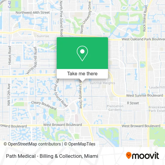
See Path Medical - Billing & Collection, Plantation, on the map
Public Transit to Path Medical - Billing & Collection in Plantation
Wondering how to get to Path Medical - Billing & Collection in Plantation? Moovit helps you find the best way to get to Path Medical - Billing & Collection with step-by-step directions from the nearest public transit station.
Moovit provides free maps and live directions to help you navigate through your city. View schedules, routes, timetables, and find out how long does it take to get to Path Medical - Billing & Collection in real time.
Looking for the nearest stop or station to Path Medical - Billing & Collection? Check out this list of stops closest to your destination: University Drive/North Marcano Boulevard; Sunrise Boulevard/University Drive.
Bus: 02, 36, 81, 56.
Want to see if there’s another route that gets you there at an earlier time? Moovit helps you find alternative routes or times. Get directions from and directions to Path Medical - Billing & Collection easily from the Moovit App or Website.
We make riding to Path Medical - Billing & Collection easy, which is why over 1.5 million users, including users in Plantation, trust Moovit as the best app for public transit. You don’t need to download an individual bus app or train app, Moovit is your all-in-one transit app that helps you find the best bus time or train time available.
For information on prices of bus, costs and ride fares to Path Medical - Billing & Collection, please check the Moovit app.
Use the app to navigate to popular places including to the airport, hospital, stadium, grocery store, mall, coffee shop, school, college, and university.
Path Medical - Billing & Collection Address: 1380 N University Dr Fort Lauderdale, FL 33322 street in Plantation
- Daly & Barber, P.A.,
- Medical Center of the Palm Beach E S,
- Feingold & Posner,
- USPS Collection Box - Blue Box,
- Dr Talavera,
- Charland Construction,
- Nationsbenefits,
- University D/N Marcano B ,
- Lock Center Solutions,
- Fort Lauderdale 25 Locksmith,
- Holiday Inn Express Hotel Suites Ft Lauderdale Plantation an IHG Hotel,
- Xfinity Store by Comcast,
- Torburn Partners,
- Adore Plastic Surgery,
- Hijabs Queen,
- Jacaranda Travel,
- Naturally Balanced Holistic Healthcare,
- Akumin,
- Arium Siena Cove,
- Sunrise B/Motorola Ent
Places Near Path Medical - Billing & Collection (Plantation)
- Port of Miami Cruise Terminal, Miami,
- Sawgrass Mall, Miami,
- Marlins Park, Miami,
- Miami Design District, Miami,
- Miami Freedom Park, Miami,
- Keiser University Flagship Campus, West Palm Beach,
- Zoo Miami, Miami,
- Dolphin Mall Bus, Miami,
- Wynwood, Miami,
- Dolphin Mall, Miami,
- Sawgrass mall ( FL ), Miami Beach,
- Brickell City Centre, Miami,
- Bayside Marketplace, Miami,
- Miami VA Hospital, Miami,
- Aventura Mall, Miami,
- Richard E. Gerstein Justice Building, Miami,
- Miami-Dade County Courthouse, Miami,
- Hard Rock Stadium, Miami Gardens,
- Little Havana, Miami,
- Aventura Mall, Miami Beach
How to get to popular places in Miami with public transit
Get around Plantation by public transit!
Traveling around Plantation has never been so easy. See step by step directions as you travel to any attraction, street or major public transit station. View bus and train schedules, arrival times, service alerts and detailed routes on a map, so you know exactly how to get to anywhere in Plantation.
When traveling to any destination around Plantation use Moovit's Live Directions with Get Off Notifications to know exactly where and how far to walk, how long to wait for your line, and how many stops are left. Moovit will alert you when it's time to get off — no need to constantly re-check whether yours is the next stop.
Wondering how to use public transit in Plantation or how to pay for public transit in Plantation? Moovit public transit app can help you navigate your way with public transit easily, and at minimum cost. It includes public transit fees, ticket prices, and costs. Looking for a map of Plantation public transit lines? Moovit public transit app shows all public transit maps in Plantation with all Bus, Train, Light Rail and Ferry routes and stops on an interactive map.
Miami has 4 transit type(s), including: Bus, Train, Light Rail and Ferry, operated by several transit agencies, including Broward County Transit, Miami-Dade Transit, Metrorail, Palm Tran, Tri-Rail, Brightline, MARTY, City of Homestead Trolley, Key West Transit, Treasure Coast Connector, GoLine IRT, Amtrak, Greyhound-us, FlixBus-us and Aventura Express Shuttle Bus