Directions to Pathfinding Immigration (Watertown Town) with public transportation
The following transit lines have routes that pass near Pathfinding Immigration
 Bus: 70, 558.
- Train: FITCHBURG, FRAMINGHAM/WORCESTER.
How to get to Pathfinding Immigration by bus?
Click on the bus route to see step by step directions with maps, line arrival times and updated time schedules.
From Faulkner Hospital, Boston
75 minFrom Boston Scientific Shuttle: Prudential Center Stop, Boston
54 minFrom Prudential Center, Boston
47 minFrom Lechmere Station, Cambridge
58 minFrom Takeda Pharmaceuticals, Cambridge
36 minFrom Cambridgeside Galleria Shuttle Stop, Cambridge
59 minFrom Chevalier Theater, Medford
71 minFrom The Cheesecake Factory, Boston
54 minFrom Beth Israel Deaconess Medical Center, Boston
62 minFrom New England Conservatory of Music, Boston
55 min
How to get to Pathfinding Immigration by train?
Click on the train route to see step by step directions with maps, line arrival times and updated time schedules.
From Faulkner Hospital, Boston
167 minFrom Boston Scientific Shuttle: Prudential Center Stop, Boston
68 minFrom Prudential Center, Boston
66 minFrom Lechmere Station, Cambridge
71 minFrom Cambridgeside Galleria Shuttle Stop, Cambridge
72 minFrom The Cheesecake Factory, Boston
68 minFrom Beth Israel Deaconess Medical Center, Boston
68 minFrom New England Conservatory of Music, Boston
146 min
Train stations near Pathfinding Immigration in Watertown Town
Bus stops near Pathfinding Immigration in Watertown Town
What are the closest stations to Pathfinding Immigration?
The closest stations to Pathfinding Immigration are:
- Newtonville is 148 yards away, 2 min walk.
- Main St @ Waverley Ave is 290 yards away, 4 min walk.
- California St @ Bridge St is 699 yards away, 9 min walk.
- Waltham is 1420 yards away, 18 min walk.
Which bus line stops near Pathfinding Immigration?
70 (Market Place Dr)
Which train lines stop near Pathfinding Immigration?
These train lines stop near Pathfinding Immigration: FITCHBURG, FRAMINGHAM/WORCESTER.
What’s the nearest train station to Pathfinding Immigration in Watertown Town?
The nearest train station to Pathfinding Immigration in Watertown Town is Newtonville. It’s a 2 min walk away.
What’s the nearest bus station to Pathfinding Immigration in Watertown Town?
The nearest bus station to Pathfinding Immigration in Watertown Town is Main St @ Waverley Ave. It’s a 4 min walk away.
What time is the first train to Pathfinding Immigration in Watertown Town?
The FRAMINGHAM/WORCESTER is the first train that goes to Pathfinding Immigration in Watertown Town. It stops nearby at 5:22 AM.
What time is the last train to Pathfinding Immigration in Watertown Town?
The FRAMINGHAM/WORCESTER is the last train that goes to Pathfinding Immigration in Watertown Town. It stops nearby at 12:20 AM.
What time is the first bus to Pathfinding Immigration in Watertown Town?
The 70 is the first bus that goes to Pathfinding Immigration in Watertown Town. It stops nearby at 4:41 AM.
What time is the last bus to Pathfinding Immigration in Watertown Town?
The 70 is the last bus that goes to Pathfinding Immigration in Watertown Town. It stops nearby at 12:47 AM.
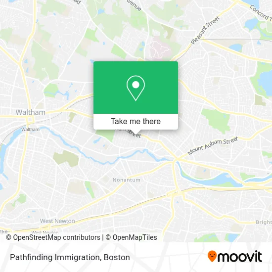
See Pathfinding Immigration, Watertown Town, on the map
Public Transit to Pathfinding Immigration in Watertown Town
Wondering how to get to Pathfinding Immigration in Watertown Town? Moovit helps you find the best way to get to Pathfinding Immigration with step-by-step directions from the nearest public transit station.
Moovit provides free maps and live directions to help you navigate through your city. View schedules, routes, timetables, and find out how long does it take to get to Pathfinding Immigration in real time.
Looking for the nearest stop or station to Pathfinding Immigration? Check out this list of stops closest to your destination: Newtonville; Main St @ Waverley Ave; California St @ Bridge St; Waltham.
Bus: 70, 558.Train: FITCHBURG, FRAMINGHAM/WORCESTER.
Want to see if there’s another route that gets you there at an earlier time? Moovit helps you find alternative routes or times. Get directions from and directions to Pathfinding Immigration easily from the Moovit App or Website.
We make riding to Pathfinding Immigration easy, which is why over 1.7 million users, including users in Watertown Town, trust Moovit as the best app for public transit. You don’t need to download an individual bus app or train app, Moovit is your all-in-one transit app that helps you find the best bus time or train time available.
For information on prices of bus and train, costs and ride fares to Pathfinding Immigration, please check the Moovit app.
Use the app to navigate to popular places including to the airport, hospital, stadium, grocery store, mall, coffee shop, school, college, and university.
Pathfinding Immigration Address: 16 Pilgrim Rd street in Watertown Town
- Central Rock,
- Narinian,
- USPS Collection Box - Blue Box,
- Cyprotex US,
- Foxwoods,
- Lifebloom Candles,
- Deborah K. Rosene Ph.D.,
- Nzuko - Watertown,
- Launch Watertown,
- D and V Realty,
- Sylvia Frerk - Unitedhealthcare Licensed Sales Agent,
- Joe S Barber Shop,
- Bemis Park,
- Tim Roche,
- Clark Reid Co Incorporated Watertown,
- E Joyce Munger Apartments,
- Charchaflian PI,
- Locksmith,
- Watertown Public Schools,
- Watertown Middle School
Places Near Pathfinding Immigration (Watertown Town)
- Td Garden, Boston,
- Leader Bank Pavilion (Leader Bank Pavillion), Boston,
- Boston Common, Boston,
- Cheers, Boston,
- Prudential Center, Boston,
- Mgm Music Hall, Boston,
- Museum Of Science, Boston,
- Wilbur Theatre, Boston,
- Castle Island, Boston,
- Massachusetts General Hospital, Boston,
- House Of Blues, Boston,
- Isabella Stewart Gardner Museum, Boston,
- Boston Children's Hospital, Boston,
- Boston Convention & Exhibition Center, Boston,
- Faneuil Hall, Boston,
- Wang Theater, Boston,
- Seaport District, Boston,
- North End, Boston,
- Boston Medical Center, Boston,
- Quincy Market, Boston
How to get to popular places in Boston with public transit
Get around Watertown Town by public transit!
Traveling around Watertown Town has never been so easy. See step by step directions as you travel to any attraction, street or major public transit station. View bus and train schedules, arrival times, service alerts and detailed routes on a map, so you know exactly how to get to anywhere in Watertown Town.
When traveling to any destination around Watertown Town use Moovit's Live Directions with Get Off Notifications to know exactly where and how far to walk, how long to wait for your line, and how many stops are left. Moovit will alert you when it's time to get off — no need to constantly re-check whether yours is the next stop.
Wondering how to use public transit in Watertown Town or how to pay for public transit in Watertown Town? Moovit public transit app can help you navigate your way with public transit easily, and at minimum cost. It includes public transit fees, ticket prices, and costs. Looking for a map of Watertown Town public transit lines? Moovit public transit app shows all public transit maps in Watertown Town with all Bus, Train, Subway and Ferry routes and stops on an interactive map.
Boston has 4 transit type(s), including: Bus, Train, Subway and Ferry, operated by several transit agencies, including MBTA, Southeastern Regional Transit Authority, MetroWest Regional Transit Authority, Rhode Island Public Transit Authority, WRTA, Lowell Regional Transit Authority, Merrimack Valley Transit, Montachusett Regional Transit Authority, Cape Cod Regional Transit Authority, Brockton Area Transit Authority, Martha's Vineyard Transit Authority, the WAVE - Nantucket Regional Transit Authority, GATRA, Cape Ann Transportation Authority and Massport