Directions to Pathway Development (Melrose) with public transportation
The following transit lines have routes that pass near Pathway Development
 Bus: 132, 137, 131, HAVERHILL LINE SHUTTLE, HAVERHILL LINE SHUTTLE.
- Train: HAVERHILL, ORANGE LINE.
- Subway: ORANGE LINE.
How to get to Pathway Development by bus?
Click on the bus route to see step by step directions with maps, line arrival times and updated time schedules.
From DoubleTree by Hilton Boston Logan Airport Chelsea, Chelsea
73 minFrom Chelsea, MA, Chelsea
72 minFrom Medford Square, Medford
60 minFrom Rino's Place, Boston
86 minFrom Danehy Park, Cambridge
105 minFrom Charlestown Navy Yard, Boston
79 minFrom USS Constitution, Boston
79 minFrom MBTA / Alewife #6, Cambridge
123 minFrom Charlestown, Boston
88 minFrom Warren Tavern, Boston
92 min
How to get to Pathway Development by train?
Click on the train route to see step by step directions with maps, line arrival times and updated time schedules.
How to get to Pathway Development by subway?
Click on the subway route to see step by step directions with maps, line arrival times and updated time schedules.
Bus stops near Pathway Development in Melrose
Train station near Pathway Development in Melrose
- Oak Grove, 30 min walk,VIEW
Bus lines to Pathway Development in Melrose
- 131, Malden Via Oak Grove,VIEW
- HAVERHILL LINE SHUTTLE, Ballardvale - Malden Center,VIEW
- HAVERHILL LINE SHUTTLE, Reading - Oak Grove,VIEW
- HAVERHILL LINE SHUTTLE, Haverhill - Malden Center,VIEW
- HAVERHILL LINE SHUTTLE, Haverhill - North Station,VIEW
- HAVERHILL LINE SHUTTLE, Ballardvale - North Station,VIEW
- HAVERHILL, Haverhill,VIEW
- 137, Malden,VIEW
What are the closest stations to Pathway Development?
The closest stations to Pathway Development are:
- Franklin St Opp Greenwood St is 252 yards away, 4 min walk.
- Melrose Highlands is 267 yards away, 4 min walk.
- Main St Opp Linden Rd is 404 yards away, 5 min walk.
- Oak Grove is 2496 yards away, 30 min walk.
Which bus lines stop near Pathway Development?
These bus lines stop near Pathway Development: 132, 137.
Which train line stops near Pathway Development?
HAVERHILL (#229 | Haverhill)
Which subway line stops near Pathway Development?
ORANGE LINE (Oak Grove)
What’s the nearest train station to Pathway Development in Melrose?
The nearest train station to Pathway Development in Melrose is Oak Grove. It’s a 30 min walk away.
What’s the nearest bus station to Pathway Development in Melrose?
The nearest bus stations to Pathway Development in Melrose are Franklin St Opp Greenwood St and Melrose Highlands. The closest one is a 4 min walk away.
What time is the first subway to Pathway Development in Melrose?
The ORANGE LINE is the first subway that goes to Pathway Development in Melrose. It stops nearby at 5:15 AM.
What time is the last subway to Pathway Development in Melrose?
The ORANGE LINE is the last subway that goes to Pathway Development in Melrose. It stops nearby at 1:59 AM.
What time is the first train to Pathway Development in Melrose?
The HAVERHILL is the first train that goes to Pathway Development in Melrose. It stops nearby at 5:29 AM.
What time is the last train to Pathway Development in Melrose?
The HAVERHILL is the last train that goes to Pathway Development in Melrose. It stops nearby at 12:00 AM.
What time is the first bus to Pathway Development in Melrose?
The 137 is the first bus that goes to Pathway Development in Melrose. It stops nearby at 5:03 AM.
What time is the last bus to Pathway Development in Melrose?
The 137 is the last bus that goes to Pathway Development in Melrose. It stops nearby at 10:53 PM.
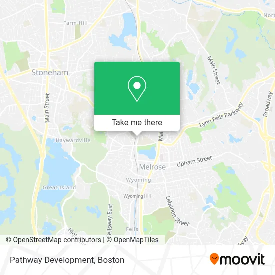
See Pathway Development, Melrose, on the map
Public Transit to Pathway Development in Melrose
Wondering how to get to Pathway Development in Melrose? Moovit helps you find the best way to get to Pathway Development with step-by-step directions from the nearest public transit station.
Moovit provides free maps and live directions to help you navigate through your city. View schedules, routes, timetables, and find out how long does it take to get to Pathway Development in real time.
Looking for the nearest stop or station to Pathway Development? Check out this list of stops closest to your destination: Franklin St Opp Greenwood St; Melrose Highlands; Main St Opp Linden Rd; Oak Grove.
Bus: 132, 137, 131, HAVERHILL LINE SHUTTLE, HAVERHILL LINE SHUTTLE, HAVERHILL LINE SHUTTLE, HAVERHILL LINE SHUTTLE, HAVERHILL LINE SHUTTLE.Train: HAVERHILL, ORANGE LINE.Subway: ORANGE LINE.
Want to see if there’s another route that gets you there at an earlier time? Moovit helps you find alternative routes or times. Get directions from and directions to Pathway Development easily from the Moovit App or Website.
We make riding to Pathway Development easy, which is why over 1.7 million users, including users in Melrose, trust Moovit as the best app for public transit. You don’t need to download an individual bus app or train app, Moovit is your all-in-one transit app that helps you find the best bus time or train time available.
For information on prices of bus, subway and train, costs and ride fares to Pathway Development, please check the Moovit app.
Use the app to navigate to popular places including to the airport, hospital, stadium, grocery store, mall, coffee shop, school, college, and university.
Pathway Development Address: 178A Tremont St street in Melrose
- Locksmith Available,
- Dna Automotive Repair,
- Namaste Mind Body & Soul Spa,
- Pantheon Training Complex,
- LS the Ride Cafe,
- Enterprise Rent-A-Car,
- Morelli Field,
- Melrose Veterans Memorial Middle School,
- Melrose Dog Society,
- 24 Hour A Melrose Locksmith,
- Symond John Dent,
- Melrose High School (Melrose Public Schools - Central Administration),
- Hope for Our Sisters,
- City of Melrose,
- New Hope Community Church,
- Melrose Vets,
- Health Insurance Brokers Melrose,
- Midol Locksmith,
- Lewis Monk Field,
- Krux Athletics
Places Near Pathway Development (Melrose)
- North End, Boston,
- Prudential Center, Boston,
- Boston Convention & Exhibition Center, Boston,
- Boston Medical Center, Boston,
- Boston Children's Hospital, Boston,
- Massachusetts General Hospital, Boston,
- House Of Blues, Boston,
- Isabella Stewart Gardner Museum, Boston,
- Castle Island, Boston,
- Faneuil Hall, Boston,
- Quincy Market, Boston,
- Wilbur Theatre, Boston,
- Museum Of Science, Boston,
- Boston Common, Boston,
- Leader Bank Pavilion (Leader Bank Pavillion), Boston,
- Mgm Music Hall, Boston,
- Seaport District, Boston,
- Td Garden, Boston,
- Cheers, Boston,
- Wang Theater, Boston
How to get to popular places in Boston with public transit
Get around Melrose by public transit!
Traveling around Melrose has never been so easy. See step by step directions as you travel to any attraction, street or major public transit station. View bus and train schedules, arrival times, service alerts and detailed routes on a map, so you know exactly how to get to anywhere in Melrose.
When traveling to any destination around Melrose use Moovit's Live Directions with Get Off Notifications to know exactly where and how far to walk, how long to wait for your line, and how many stops are left. Moovit will alert you when it's time to get off — no need to constantly re-check whether yours is the next stop.
Wondering how to use public transit in Melrose or how to pay for public transit in Melrose? Moovit public transit app can help you navigate your way with public transit easily, and at minimum cost. It includes public transit fees, ticket prices, and costs. Looking for a map of Melrose public transit lines? Moovit public transit app shows all public transit maps in Melrose with all Bus, Train, Subway and Ferry routes and stops on an interactive map.
Boston has 4 transit type(s), including: Bus, Train, Subway and Ferry, operated by several transit agencies, including MBTA, Southeastern Regional Transit Authority, MetroWest Regional Transit Authority, Rhode Island Public Transit Authority, WRTA, Lowell Regional Transit Authority, Merrimack Valley Transit, Montachusett Regional Transit Authority, Cape Cod Regional Transit Authority, Brockton Area Transit Authority, Martha's Vineyard Transit Authority, the WAVE - Nantucket Regional Transit Authority, GATRA, Cape Ann Transportation Authority and Massport