Directions to Pathway Law (Arlington) with public transportation
The following transit lines have routes that pass near Pathway Law
 Bus: 350, 67, 77, 80, 95.
- Train: FITCHBURG, LOWELL.
- Subway: GREEN LINE E, RED LINE, GREEN LINE B, GREEN LINE C.
How to get to Pathway Law by bus?
Click on the bus route to see step by step directions with maps, line arrival times and updated time schedules.
From Northeastern University, Boston
67 minFrom Maggiano's (Maggiano's Little Italy), Boston
64 minFrom Fenway Park (Fenway Park, Home of the Boston Red Sox), Boston
67 minFrom Brigham & Women's Hospital, Boston
71 minFrom Isabella Stewart Gardner Museum, Boston
72 minFrom Fairfield Inn Suites by Marriott Boston Cambridge, Cambridge
47 minFrom P.F. Chang's, Boston
63 minFrom Modern Pastry Shop, Boston
73 minFrom Somerville, MA, Somerville
38 minFrom The Freedom Trail, Boston
72 min
How to get to Pathway Law by train?
Click on the train route to see step by step directions with maps, line arrival times and updated time schedules.
How to get to Pathway Law by subway?
Click on the subway route to see step by step directions with maps, line arrival times and updated time schedules.
From Northeastern University, Boston
75 minFrom Maggiano's (Maggiano's Little Italy), Boston
68 minFrom Fenway Park (Fenway Park, Home of the Boston Red Sox), Boston
86 minFrom Brigham & Women's Hospital, Boston
87 minFrom Isabella Stewart Gardner Museum, Boston
85 minFrom Fairfield Inn Suites by Marriott Boston Cambridge, Cambridge
78 minFrom P.F. Chang's, Boston
66 minFrom Modern Pastry Shop, Boston
70 minFrom Somerville, MA, Somerville
68 minFrom The Freedom Trail, Boston
61 min
Bus stops near Pathway Law in Arlington
Subway stations near Pathway Law in Arlington
Bus lines to Pathway Law in Arlington
What are the closest stations to Pathway Law?
The closest stations to Pathway Law are:
- Pleasant St @ Pelham Terr is 144 yards away, 3 min walk.
- Massachusetts Ave @ Mystic St is 295 yards away, 4 min walk.
- Belmont is 366 yards away, 5 min walk.
- Massachusetts Ave @ Medford St is 481 yards away, 6 min walk.
- Medford St @ Massachusetts Ave is 546 yards away, 7 min walk.
- Broadway @ Massachusetts Ave is 605 yards away, 8 min walk.
- Alewife is 3710 yards away, 44 min walk.
- Medford/Tufts Station is 4319 yards away, 51 min walk.
- West Medford is 4777 yards away, 56 min walk.
Which bus lines stop near Pathway Law?
These bus lines stop near Pathway Law: 350, 67, 77, 80, 95.
Which train lines stop near Pathway Law?
These train lines stop near Pathway Law: FITCHBURG, LOWELL.
Which subway lines stop near Pathway Law?
These subway lines stop near Pathway Law: GREEN LINE E, RED LINE.
What’s the nearest train station to Pathway Law in Arlington?
The nearest train station to Pathway Law in Arlington is Belmont. It’s a 5 min walk away.
What’s the nearest bus station to Pathway Law in Arlington?
The nearest bus station to Pathway Law in Arlington is Pleasant St @ Pelham Terr. It’s a 3 min walk away.
What time is the first subway to Pathway Law in Arlington?
The GREEN LINE E is the first subway that goes to Pathway Law in Arlington. It stops nearby at 4:57 AM.
What time is the last subway to Pathway Law in Arlington?
The GREEN LINE E is the last subway that goes to Pathway Law in Arlington. It stops nearby at 2:41 AM.
What time is the first train to Pathway Law in Arlington?
The LOWELL is the first train that goes to Pathway Law in Arlington. It stops nearby at 5:31 AM.
What time is the last train to Pathway Law in Arlington?
The LOWELL is the last train that goes to Pathway Law in Arlington. It stops nearby at 12:20 AM.
What time is the first bus to Pathway Law in Arlington?
The 77 is the first bus that goes to Pathway Law in Arlington. It stops nearby at 4:53 AM.
What time is the last bus to Pathway Law in Arlington?
The 80 is the last bus that goes to Pathway Law in Arlington. It stops nearby at 1:33 AM.
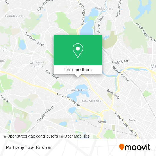
See Pathway Law, Arlington, on the map
Public Transit to Pathway Law in Arlington
Wondering how to get to Pathway Law in Arlington? Moovit helps you find the best way to get to Pathway Law with step-by-step directions from the nearest public transit station.
Moovit provides free maps and live directions to help you navigate through your city. View schedules, routes, timetables, and find out how long does it take to get to Pathway Law in real time.
Looking for the nearest stop or station to Pathway Law? Check out this list of stops closest to your destination: Pleasant St @ Pelham Terr; Massachusetts Ave @ Mystic St; Belmont; Massachusetts Ave @ Medford St; Medford St @ Massachusetts Ave; Broadway @ Massachusetts Ave; Alewife; Medford/Tufts Station; West Medford.
Bus: 350, 67, 77, 80, 95.Train: FITCHBURG, LOWELL.Subway: GREEN LINE E, RED LINE, GREEN LINE B, GREEN LINE C.
Want to see if there’s another route that gets you there at an earlier time? Moovit helps you find alternative routes or times. Get directions from and directions to Pathway Law easily from the Moovit App or Website.
We make riding to Pathway Law easy, which is why over 1.7 million users, including users in Arlington, trust Moovit as the best app for public transit. You don’t need to download an individual bus app or train app, Moovit is your all-in-one transit app that helps you find the best bus time or train time available.
For information on prices of bus, subway and train, costs and ride fares to Pathway Law, please check the Moovit app.
Use the app to navigate to popular places including to the airport, hospital, stadium, grocery store, mall, coffee shop, school, college, and university.
Pathway Law Address: 67 Pleasant St Arlington, MA 02476 street in Arlington
- 1 Arlington Taxi,
- Spy Pond Park,
- McClure Katy Doctor,
- Jaimie Winkler, Dietitian,
- Board of Health,
- Robbins Memorial Garden,
- Vintage Tea & Cake,
- Arlington Masonic Temple,
- Donahue Jonathan LMHC,
- Designer Carpet Cleaning,
- Suming Sullivan Licsw,
- VCA,
- Local Scratch Kitchen,
- Benny Willis, PHD,
- Pristine Carpet Cleaning,
- Bank of America,
- Tatte Bakery & Cafe,
- Home Carpet Cleaning,
- Center Psychotherapy,
- Law Offices of Susan D Stamps
Places Near Pathway Law (Arlington)
- Prudential Center, Boston,
- Mgm Music Hall, Boston,
- North End, Boston,
- Castle Island, Boston,
- Wang Theater, Boston,
- Boston Medical Center, Boston,
- Leader Bank Pavilion (Leader Bank Pavillion), Boston,
- House Of Blues, Boston,
- Cheers, Boston,
- Faneuil Hall, Boston,
- Museum Of Science, Boston,
- Quincy Market, Boston,
- Boston Children's Hospital, Boston,
- Massachusetts General Hospital, Boston,
- Td Garden, Boston,
- Boston Convention & Exhibition Center, Boston,
- Seaport District, Boston,
- Wilbur Theatre, Boston,
- Boston Common, Boston,
- Isabella Stewart Gardner Museum, Boston
How to get to popular places in Boston with public transit
Get around Arlington by public transit!
Traveling around Arlington has never been so easy. See step by step directions as you travel to any attraction, street or major public transit station. View bus and train schedules, arrival times, service alerts and detailed routes on a map, so you know exactly how to get to anywhere in Arlington.
When traveling to any destination around Arlington use Moovit's Live Directions with Get Off Notifications to know exactly where and how far to walk, how long to wait for your line, and how many stops are left. Moovit will alert you when it's time to get off — no need to constantly re-check whether yours is the next stop.
Wondering how to use public transit in Arlington or how to pay for public transit in Arlington? Moovit public transit app can help you navigate your way with public transit easily, and at minimum cost. It includes public transit fees, ticket prices, and costs. Looking for a map of Arlington public transit lines? Moovit public transit app shows all public transit maps in Arlington with all Bus, Train, Subway and Ferry routes and stops on an interactive map.
Boston has 4 transit type(s), including: Bus, Train, Subway and Ferry, operated by several transit agencies, including MBTA, Southeastern Regional Transit Authority, MetroWest Regional Transit Authority, Rhode Island Public Transit Authority, WRTA, Lowell Regional Transit Authority, Merrimack Valley Transit, Montachusett Regional Transit Authority, Cape Cod Regional Transit Authority, Brockton Area Transit Authority, Martha's Vineyard Transit Authority, the WAVE - Nantucket Regional Transit Authority, GATRA, Cape Ann Transportation Authority and Massport