Train station near Patton Homestead in Boston
- Hamilton/Wenham, 38 min walk,VIEW
- Hamilton Historical Society,
- Johnson Land,
- Ipswich River Wildlife Sanctuary,
- Gazebo,
- Horse Island,
- Pingree Rink,
- Pingree School Apparel Store - South Hamilton, MA Spiritshop.Com,
- Asbury Grove,
- Bunker Meadows,
- Sunrise Property Care Inc.,
- 186 Winthrop St,
- J & S Carpet Cleaners,
- ایسکس کاؤنٹی،میساچیوسٹس,
- شهرستان اسکس، ماساچوست,
- Foote Brothers (Foote Bros Canoe Rentals),
- Animal Care,
- Moirasfitness,
- Wenham Town,
- Atm Walgreens,
- Houndstooth Consignors
Places Near Patton Homestead (Boston)
- Faneuil Hall, Boston,
- Quincy Market, Boston,
- House Of Blues, Boston,
- Td Garden, Boston,
- Leader Bank Pavilion (Leader Bank Pavillion), Boston,
- North End, Boston,
- Wang Theater, Boston,
- Boston Children's Hospital, Boston,
- Boston Common, Boston,
- Cheers, Boston,
- Mgm Music Hall, Boston,
- Museum Of Science, Boston,
- Seaport District, Boston,
- Prudential Center, Boston,
- Massachusetts General Hospital, Boston,
- Boston Convention & Exhibition Center, Boston,
- Wilbur Theatre, Boston,
- Boston Medical Center, Boston,
- Isabella Stewart Gardner Museum, Boston,
- Castle Island, Boston
How to get to popular places in Boston with public transit
What are the closest stations to Patton Homestead?
The closest stations to Patton Homestead are:
- Hamilton/Wenham is 3223 yards away, 38 min walk.
What time is the first train to Patton Homestead in Boston?
The NEWBURYPORT/ROCKPORT is the first train that goes to Patton Homestead in Boston. It stops nearby at 5:07 AM.
What time is the last train to Patton Homestead in Boston?
The NEWBURYPORT/ROCKPORT is the last train that goes to Patton Homestead in Boston. It stops nearby at 12:40 AM.
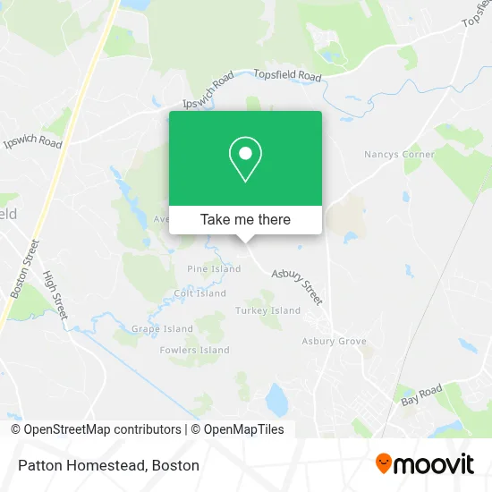
See Patton Homestead, Boston, on the map
Public Transit to Patton Homestead in Boston
Wondering how to get to Patton Homestead in Boston? Moovit helps you find the best way to get to Patton Homestead with step-by-step directions from the nearest public transit station.
Moovit provides free maps and live directions to help you navigate through your city. View schedules, routes, timetables, and find out how long does it take to get to Patton Homestead in real time.
Looking for the nearest stop or station to Patton Homestead? Check out this list of stops closest to your destination: Hamilton/Wenham.
Want to see if there’s another route that gets you there at an earlier time? Moovit helps you find alternative routes or times. Get directions from and directions to Patton Homestead easily from the Moovit App or Website.
We make riding to Patton Homestead easy, which is why over 1.7 million users, including users in Boston, trust Moovit as the best app for public transit. You don’t need to download an individual bus app or train app, Moovit is your all-in-one transit app that helps you find the best bus time or train time available.
Use the app to navigate to popular places including to the airport, hospital, stadium, grocery store, mall, coffee shop, school, college, and university.
Patton Homestead Address: 650 Asbury St street in Boston
Get around Boston by public transit!
Traveling around Boston has never been so easy. See step by step directions as you travel to any attraction, street or major public transit station. View bus and train schedules, arrival times, service alerts and detailed routes on a map, so you know exactly how to get to anywhere in Boston.
When traveling to any destination around Boston use Moovit's Live Directions with Get Off Notifications to know exactly where and how far to walk, how long to wait for your line, and how many stops are left. Moovit will alert you when it's time to get off — no need to constantly re-check whether yours is the next stop.
Wondering how to use public transit in Boston or how to pay for public transit in Boston? Moovit public transit app can help you navigate your way with public transit easily, and at minimum cost. It includes public transit fees, ticket prices, and costs. Looking for a map of Boston public transit lines? Moovit public transit app shows all public transit maps in Boston with all Bus, Train, Subway and Ferry routes and stops on an interactive map.
Boston has 4 transit type(s), including: Bus, Train, Subway and Ferry, operated by several transit agencies, including MBTA, Southeastern Regional Transit Authority, MetroWest Regional Transit Authority, Rhode Island Public Transit Authority, WRTA, Lowell Regional Transit Authority, Merrimack Valley Transit, Montachusett Regional Transit Authority, Cape Cod Regional Transit Authority, Brockton Area Transit Authority, Martha's Vineyard Transit Authority, the WAVE - Nantucket Regional Transit Authority, GATRA, Cape Ann Transportation Authority and Massport