Directions to Patty's Auto (Revere) with public transportation
The following transit lines have routes that pass near Patty's Auto
 Bus: 116, 450, 455.
- Train: NEWBURYPORT/ROCKPORT.
- Subway: BLUE LINE.
How to get to Patty's Auto by bus?
Click on the bus route to see step by step directions with maps, line arrival times and updated time schedules.
From Boston Common Visitor Center, Boston
42 minFrom The Langham Boston, Boston
42 minFrom Charles/MGH T Stop, Boston
46 minFrom One Financial Center, Boston
47 minFrom Hynes Convention Center MBTA Station, Boston
34 minFrom Hood Park, Boston
80 minFrom Bow Market, Somerville
86 minFrom 100 Cambridge Street Garage, Boston
36 minFrom Seaport District, Boston
52 minFrom Black Falcon Cruise Terminal, Boston
79 min
How to get to Patty's Auto by train?
Click on the train route to see step by step directions with maps, line arrival times and updated time schedules.
How to get to Patty's Auto by subway?
Click on the subway route to see step by step directions with maps, line arrival times and updated time schedules.
From Boston Common Visitor Center, Boston
63 minFrom The Langham Boston, Boston
63 minFrom Charles/MGH T Stop, Boston
70 minFrom One Financial Center, Boston
67 minFrom Hynes Convention Center MBTA Station, Boston
58 minFrom Hood Park, Boston
76 minFrom Bow Market, Somerville
87 minFrom 100 Cambridge Street Garage, Boston
62 minFrom Seaport District, Boston
90 min
Subway station near Patty's Auto in Revere
- Beachmont, 13 min walk,VIEW
Train station near Patty's Auto in Revere
- River Works, 46 min walk,VIEW
What are the closest stations to Patty's Auto?
The closest stations to Patty's Auto are:
- Beachmont is 1059 yards away, 13 min walk.
- River Works is 3890 yards away, 46 min walk.
Which bus lines stop near Patty's Auto?
These bus lines stop near Patty's Auto: 116, 450, 455.
Which train line stops near Patty's Auto?
NEWBURYPORT/ROCKPORT (#45 | Rockport)
Which subway line stops near Patty's Auto?
BLUE LINE (Wonderland)
What’s the nearest subway station to Patty's Auto in Revere?
The nearest subway station to Patty's Auto in Revere is Beachmont. It’s a 13 min walk away.
What time is the first subway to Patty's Auto in Revere?
The BLUE LINE is the first subway that goes to Patty's Auto in Revere. It stops nearby at 5:12 AM.
What time is the last subway to Patty's Auto in Revere?
The BLUE LINE is the last subway that goes to Patty's Auto in Revere. It stops nearby at 2:10 AM.
What time is the first train to Patty's Auto in Revere?
The NEWBURYPORT/ROCKPORT is the first train that goes to Patty's Auto in Revere. It stops nearby at 5:33 AM.
What time is the last train to Patty's Auto in Revere?
The NEWBURYPORT/ROCKPORT is the last train that goes to Patty's Auto in Revere. It stops nearby at 12:13 AM.
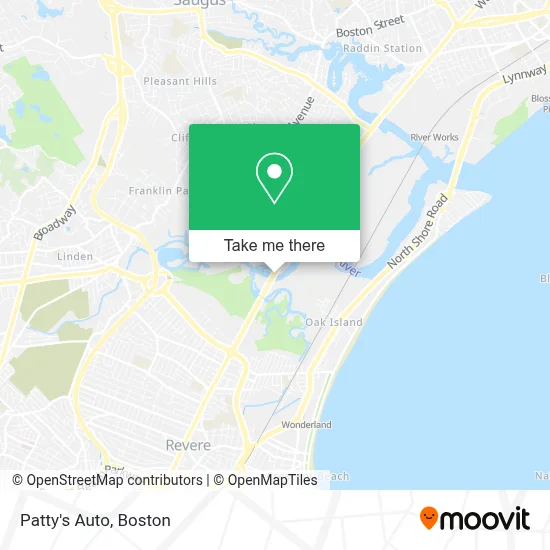
See Patty's Auto, Revere, on the map
Public Transit to Patty's Auto in Revere
Wondering how to get to Patty's Auto in Revere? Moovit helps you find the best way to get to Patty's Auto with step-by-step directions from the nearest public transit station.
Moovit provides free maps and live directions to help you navigate through your city. View schedules, routes, timetables, and find out how long does it take to get to Patty's Auto in real time.
Looking for the nearest stop or station to Patty's Auto? Check out this list of stops closest to your destination: Beachmont; River Works.
Bus: 116, 450, 455.Train: NEWBURYPORT/ROCKPORT.Subway: BLUE LINE.
Want to see if there’s another route that gets you there at an earlier time? Moovit helps you find alternative routes or times. Get directions from and directions to Patty's Auto easily from the Moovit App or Website.
We make riding to Patty's Auto easy, which is why over 1.7 million users, including users in Revere, trust Moovit as the best app for public transit. You don’t need to download an individual bus app or train app, Moovit is your all-in-one transit app that helps you find the best bus time or train time available.
For information on prices of bus, subway and train, costs and ride fares to Patty's Auto, please check the Moovit app.
Use the app to navigate to popular places including to the airport, hospital, stadium, grocery store, mall, coffee shop, school, college, and university.
Patty's Auto Address: 2 Salem Tpke street in Revere
- Desjardines Express,
- Haas Health and Wellness Center,
- Osa General Contractor,
- Dunkin',
- Daniel Webster Commercial Leasing,
- Diversified Funding Inc,
- Nardely Remodeling,
- Boston Car Service,
- Nanas Service,
- Corefix Repairing Store,
- Vivant Home Security & Automation,
- AT&T,
- Blink Charging,
- BJ's Wholesale Club,
- Oak Island,
- BJ's Restaurant & Brewhouse,
- Planning with A SC,
- Sea Plane Basin,
- Maxim Crane Works, LP,
- Rumney Flats
Places Near Patty's Auto (Revere)
- Boston Children's Hospital, Boston,
- House Of Blues, Boston,
- Faneuil Hall, Boston,
- North End, Boston,
- Isabella Stewart Gardner Museum, Boston,
- Boston Common, Boston,
- Massachusetts General Hospital, Boston,
- Quincy Market, Boston,
- Boston Convention & Exhibition Center, Boston,
- Boston Medical Center, Boston,
- Wilbur Theatre, Boston,
- Seaport District, Boston,
- Prudential Center, Boston,
- Castle Island, Boston,
- Wang Theater, Boston,
- Td Garden, Boston,
- Leader Bank Pavilion (Leader Bank Pavillion), Boston,
- Cheers, Boston,
- Mgm Music Hall, Boston,
- Museum Of Science, Boston
How to get to popular places in Boston with public transit
Get around Revere by public transit!
Traveling around Revere has never been so easy. See step by step directions as you travel to any attraction, street or major public transit station. View bus and train schedules, arrival times, service alerts and detailed routes on a map, so you know exactly how to get to anywhere in Revere.
When traveling to any destination around Revere use Moovit's Live Directions with Get Off Notifications to know exactly where and how far to walk, how long to wait for your line, and how many stops are left. Moovit will alert you when it's time to get off — no need to constantly re-check whether yours is the next stop.
Wondering how to use public transit in Revere or how to pay for public transit in Revere? Moovit public transit app can help you navigate your way with public transit easily, and at minimum cost. It includes public transit fees, ticket prices, and costs. Looking for a map of Revere public transit lines? Moovit public transit app shows all public transit maps in Revere with all Bus, Train, Subway and Ferry routes and stops on an interactive map.
Boston has 4 transit type(s), including: Bus, Train, Subway and Ferry, operated by several transit agencies, including MBTA, Southeastern Regional Transit Authority, MetroWest Regional Transit Authority, Rhode Island Public Transit Authority, WRTA, Lowell Regional Transit Authority, Merrimack Valley Transit, Montachusett Regional Transit Authority, Cape Cod Regional Transit Authority, Brockton Area Transit Authority, Martha's Vineyard Transit Authority, the WAVE - Nantucket Regional Transit Authority, GATRA, Cape Ann Transportation Authority and Massport