Directions to Paty Modas (Colombo) with public transportation
The following transit lines have routes that pass near Paty Modas
How to get to Paty Modas by bus?
Click on the bus route to see step by step directions with maps, line arrival times and updated time schedules.
From Rua Itupava, Centro
36 minFrom Parque das Águas de Pinhais, Pinhais
55 minFrom Rua Atilio Borio, Alto Da Rua XV
34 minFrom Jockey Club do Paraná, Tarumã
47 minFrom Hospital São Lucas, Juvevê
29 minFrom Hospital Marcelino Champagnat, Jardim Botânico
43 minFrom Hospital Oswaldo Cruz, Centro
36 minFrom Rua XV de Novembro, Colombo
54 minFrom Praça Nossa Senhora de Salette, Centro Cívico
44 minFrom Jockey Plaza Shopping Center, Tarumã
42 min
Bus stops near Paty Modas in Colombo
Bus lines to Paty Modas in Colombo
- U01 SEDE / MARACANÃ, Posto Coyote → Terminal Maracanã,VIEW
- I90 CACHOEIRA / MARACANÃ, Terminal Cachoeira → Terminal Maracanã,VIEW
- B29 ROÇA GRANDE / APDEC (VIA MARACANÃ), Terminal Maracanã → Terminal Roça Grande,VIEW
- B17 SANTA HELENA, Santa Helena → Terminal Maracanã,VIEW
- B30 ANA TERRA, Terminal Maracanã → Ana Terra,VIEW
- B15 ANA TERRA (VIA ADRIANE), Ana Terra → Terminal Maracanã,VIEW
- B16 ADRIANE, Adriane → Terminal Maracanã,VIEW
- B56 ANA TERRA (VIA ADRIANE) / JARDIM EUCALIPTOS, Jardim Eucaliptos → Terminal Maracanã,VIEW
- B02 MARACANÃ / CABRAL, Terminal Maracanã → Terminal Cabral,VIEW
- B03 GUARAITUBA / ALTO DA XV (VIA MARACANÃ), Terminal Guaraituba ↺ Jardim Social / Alto da Rua XV (Circular),VIEW
- B06 GUARAITUBA / RUI BARBOSA (VIA MARACANÃ / SEMIDIRETO), Praça Rui Barbosa → Terminal Guaraituba,VIEW
- B07 GUARAITUBA / CABRAL (VIA MARACANÃ), Terminal Guaraituba → Terminal Cabral,VIEW
- B11 MARACANÃ / SANTA CÂNDIDA, Terminal Santa Cândida → Terminal Maracanã,VIEW
- B13 JARDIM DAS GRAÇAS, Jardim Das Graças → Terminal Maracanã,VIEW
- B14 PLANALTO, Planalto → Terminal Maracanã,VIEW
- B20 GUARAITUBA / CABRAL (VIA MARACANÃ), Terminal Maracanã → Terminal Guaraituba,VIEW
- I20 MARACANÃ / AFONSO PENA, Terminal Maracanã → Terminal Afonso Pena,VIEW
- B25 MARACANÃ / BAIRRO ALTO, Terminal Bairro Alto → Terminal Maracanã,VIEW
- B26 JARDIM EUCALIPTOS, Sentido Horário,VIEW
- B41 MARACANÃ / CAPÃO DA IMBUIA, Terminal Maracanã → Terminal Capão da Imbuia,VIEW
What are the closest stations to Paty Modas?
The closest stations to Paty Modas are:
- Rua São Pedro, 1148 is 101 meters away, 2 min walk.
- Rua Roberto Lambach Falavinha, 25 is 123 meters away, 2 min walk.
- Rua Roberto Lambach Falavinha, 31 is 128 meters away, 2 min walk.
- Rua Joaquim Rocha, 429 is 280 meters away, 4 min walk.
- Terminal Metropolitano Maracanã is 287 meters away, 4 min walk.
- Rodovia Br 476 (Estrada Da Ribeira) - Alto Maracanã is 385 meters away, 6 min walk.
Which bus lines stop near Paty Modas?
These bus lines stop near Paty Modas: 607 COLOMBO / CIC, B06 GUARAITUBA / RUI BARBOSA (VIA MARACANÃ / SEMIDIRETO), B41 MARACANÃ / CAPÃO DA IMBUIA, I20 MARACANÃ / AFONSO PENA, I90 CACHOEIRA / MARACANÃ.
What’s the nearest bus station to Paty Modas in Colombo?
The nearest bus stations to Paty Modas in Colombo are Rua São Pedro, 1148, Rua Roberto Lambach Falavinha, 25 and Rua Roberto Lambach Falavinha, 31. The closest one is a 2 min walk away.
What time is the first bus to Paty Modas in Colombo?
The B69 MAD. CURITIBA / SÃO DIMAS is the first bus that goes to Paty Modas in Colombo. It stops nearby at 4:10 AM.
What time is the last bus to Paty Modas in Colombo?
The B69 MAD. CURITIBA / SÃO DIMAS is the last bus that goes to Paty Modas in Colombo. It stops nearby at 1:51 AM.
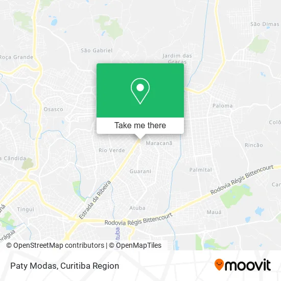
See Paty Modas, Colombo, on the map
Public Transit to Paty Modas in Colombo
Wondering how to get to Paty Modas in Colombo? Moovit helps you find the best way to get to Paty Modas with step-by-step directions from the nearest public transit station.
Moovit provides free maps and live directions to help you navigate through your city. View schedules, routes, timetables, and find out how long does it take to get to Paty Modas in real time.
Looking for the nearest stop or station to Paty Modas? Check out this list of stops closest to your destination: Rua São Pedro; Rua Roberto Lambach Falavinha; Rua Roberto Lambach Falavinha; Rua Joaquim Rocha; Terminal Metropolitano Maracanã; Rodovia Br 476 (Estrada Da Ribeira) - Alto Maracanã.
Bus: 607 COLOMBO / CIC, B06 GUARAITUBA / RUI BARBOSA (VIA MARACANÃ / SEMIDIRETO), B41 MARACANÃ / CAPÃO DA IMBUIA, I20 MARACANÃ / AFONSO PENA, I90 CACHOEIRA / MARACANÃ, U01 SEDE / MARACANÃ, B29 ROÇA GRANDE / APDEC (VIA MARACANÃ), B17 SANTA HELENA, B30 ANA TERRA, B15 ANA TERRA (VIA ADRIANE), B16 ADRIANE, B56 ANA TERRA (VIA ADRIANE) / JARDIM EUCALIPTOS, B02 MARACANÃ / CABRAL, B03 GUARAITUBA / ALTO DA XV (VIA MARACANÃ), B07 GUARAITUBA / CABRAL (VIA MARACANÃ), B11 MARACANÃ / SANTA CÂNDIDA, Y99 TUNAS DO PARANÁ / GUADALUPE, 0950-500 CURITIBA / ADRIANÓPOLIS (VIA TUNAS DO PARANÁ).
Want to see if there’s another route that gets you there at an earlier time? Moovit helps you find alternative routes or times. Get directions from and directions to Paty Modas easily from the Moovit App or Website.
We make riding to Paty Modas easy, which is why over 1.5 million users, including users in Colombo, trust Moovit as the best app for public transit. You don’t need to download an individual bus app or train app, Moovit is your all-in-one transit app that helps you find the best bus time or train time available.
For information on prices of bus, costs and ride fares to Paty Modas, please check the Moovit app.
Use the app to navigate to popular places including to the airport, hospital, stadium, grocery store, mall, coffee shop, school, college, and university.
Paty Modas Address: Rua Joaquim Rocha, 24 Maracanã Colombo-PR 83408-450 street in Colombo
- Med Prev,
- Martinsilva - Acessorios,
- Glamur Z,
- Vidracaria Apollo,
- Kb Moda Intima,
- Oticas Bella Visao,
- Lanchonete e Refeições Alvorada,
- Alosan,
- Studiofoto,
- Big Lanches,
- Fisio Zeni - Clínica de Reabilitação,
- Rh Diagnosticos,
- Ponto das Fraldas,
- Espetinhos Brasil,
- Plena Forma Suplementos Alimentares,
- Thiago Gomes Montador de Moveis,
- Lanchonete e Restaurante Alvorada,
- Bem Estar Maracana,
- Casa de Bolos,
- Danafarma Colombo
Places Near Paty Modas (Colombo)
- Shopping Palladium, Portão,
- Hospital Universitário Evangélico de Curitiba, Bigorrilho,
- Hospital Erasto Gaertner, Jardim Das Américas,
- Pontifícia Universidade Católica do Paraná (PUCPR), Prado Velho,
- Hospital do Rocio, Campo,
- Jockey Plaza Shopping Center, Tarumã,
- Parque Barigui, Mercês,
- Hospital Angelina Caron, Campina Grande Do Sul,
- Hospital Nossa Senhora Das Graças, Mercês,
- Hospital Madalena Sofia, Bairro Alto,
- Arena Da Baixada - Curitiba,
- Campo Largo, Campo,
- Rua General Mário Tourinho, Campina Do Siqueira,
- Park Shopping Barigüi, Mossunguê,
- Shopping Estação, Rebouças,
- Rua Martim Afonso 558, Mercês,
- Hhhhh, Fazendinha,
- Hospital de Clínicas (HC - UFPR), Centro,
- Hospital Da Cruz Vermelha, Batel,
- Jardim Botânico de Curitiba PR, Centro
How to get to popular places in Curitiba Region with public transit
Get around Colombo by public transit!
Traveling around Colombo has never been so easy. See step by step directions as you travel to any attraction, street or major public transit station. View bus and train schedules, arrival times, service alerts and detailed routes on a map, so you know exactly how to get to anywhere in Colombo.
When traveling to any destination around Colombo use Moovit's Live Directions with Get Off Notifications to know exactly where and how far to walk, how long to wait for your line, and how many stops are left. Moovit will alert you when it's time to get off — no need to constantly re-check whether yours is the next stop.
Wondering how to use public transit in Colombo or how to pay for public transit in Colombo? Moovit public transit app can help you navigate your way with public transit easily, and at minimum cost. It includes public transit fees, ticket prices, and costs. Looking for a map of Colombo public transit lines? Moovit public transit app shows all public transit maps in Colombo with all Bus and Cable Car routes and stops on an interactive map.
Curitiba Region has 2 transit type(s), including: Bus and Cable Car, operated by several transit agencies, including Sistema Integrado de Mobilidade (URBS), Sistema Integrado de Mobilidade (AMEP), URBS (Cartões bancários e Dinheiro), URBS (Cartões bancários / Cartão URBS), AMEP (Cartões bancários / Cartão MetroCard), AMEP (Cartões bancários / Cartão MetroCard / Dinheiro), Viação Colombo (Dinheiro), TRIAR (Cartão TRIAR / Dinheiro), Empresa Curitiba Cerro Azul (Dinheiro), Expresso Nossa Senhora da Penha (Dinheiro), Empresa Campo Alto Tijucas (Dinheiro), Auto Viação São José (Cartão VEM / Dinheiro), BRT S/A (Cartão VEM / Dinheiro), TransPiedade (Cartão Cidadão / Dinheiro) and Oceânica Sul (Cartão Transporte / Dinheiro)
Public transit lines with stations closest to Paty Modas in Colombo
Bus lines with stations closest to Paty Modas in Colombo
Terminal Metropolitano Maracanã
- B02 MARACANÃ / CABRALMARACANÃ / CABRAL
 B03 GUARAITUBA / ALTO DA XV (VIA MARACANÃ)GUARAITUBA / ALTO DA XV (via MARACANÃ)
- B06 GUARAITUBA / RUI BARBOSA (VIA MARACANÃ / SEMIDIRETO)GUARAITUBA / RUI BARBOSA (via MARACANÃ / SEMIDIRETO)
- B07 GUARAITUBA / CABRAL (VIA MARACANÃ)GUARAITUBA / CABRAL (via MARACANÃ)
- B11 MARACANÃ / SANTA CÂNDIDAMARACANÃ / SANTA CÂNDIDA