Directions to Paul Labonte Insurance Inc (Boston) with public transportation
The following transit lines have routes that pass near Paul Labonte Insurance Inc
 Bus: 211.
- Train: FALL RIVER/NEW BEDFORD.
- Ferry: SEASTREAK, SEASTREAK, CUTTYHUNK FERRY.
How to get to Paul Labonte Insurance Inc by bus?
Click on the bus route to see step by step directions with maps, line arrival times and updated time schedules.
From Amazon Fulfillment Bos7, Fall River
131 minFrom Lizzy Borden House, Fall River
89 minFrom Charlton Memorial Hospital, Fall River
119 minFrom Bristol Community College, Fall River
101 minFrom Bedford Industrial Park, New Bedford
115 minFrom Walmart Fall River Supercenter, Fall River
114 minFrom B.M.C. Durfee High School, Fall River
100 minFrom RMV New Bedford, New Bedford
113 minFrom Mass Maritime Academy, Buzzards Bay
123 minFrom Falmouth MA USA, Falmouth
118 min
Bus stop near Paul Labonte Insurance Inc in Boston
- Phoenix Rail Trail, 8 min walk,VIEW
Ferry stations near Paul Labonte Insurance Inc in Boston
Train station near Paul Labonte Insurance Inc in Boston
- New Bedford, 60 min walk,VIEW
Bus lines to Paul Labonte Insurance Inc in Boston
- 211, Fairhaven,VIEW
What are the closest stations to Paul Labonte Insurance Inc?
The closest stations to Paul Labonte Insurance Inc are:
- Phoenix Rail Trail is 611 yards away, 8 min walk.
- New Bedford, MA is 4684 yards away, 55 min walk.
- Cuttyhunk Ferry Pier, New Bedford, MA is 4878 yards away, 58 min walk.
- New Bedford is 5118 yards away, 60 min walk.
Which bus line stops near Paul Labonte Insurance Inc?
211 (Fairhaven)
What’s the nearest bus station to Paul Labonte Insurance Inc in Boston?
The nearest bus station to Paul Labonte Insurance Inc in Boston is Phoenix Rail Trail. It’s a 8 min walk away.
What time is the first train to Paul Labonte Insurance Inc in Boston?
The FALL RIVER/NEW BEDFORD is the first train that goes to Paul Labonte Insurance Inc in Boston. It stops nearby at 4:16 AM.
What time is the last train to Paul Labonte Insurance Inc in Boston?
The FALL RIVER/NEW BEDFORD is the last train that goes to Paul Labonte Insurance Inc in Boston. It stops nearby at 1:38 AM.
What time is the first bus to Paul Labonte Insurance Inc in Boston?
The 211 is the first bus that goes to Paul Labonte Insurance Inc in Boston. It stops nearby at 6:22 AM.
What time is the last bus to Paul Labonte Insurance Inc in Boston?
The 211 is the last bus that goes to Paul Labonte Insurance Inc in Boston. It stops nearby at 6:19 PM.
What time is the first ferry to Paul Labonte Insurance Inc in Boston?
The SEASTREAK is the first ferry that goes to Paul Labonte Insurance Inc in Boston. It stops nearby at 8:20 AM.
What time is the last ferry to Paul Labonte Insurance Inc in Boston?
The SEASTREAK is the last ferry that goes to Paul Labonte Insurance Inc in Boston. It stops nearby at 8:40 PM.
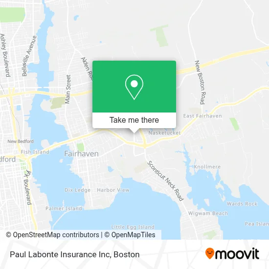
See Paul Labonte Insurance Inc, Boston, on the map
Public Transit to Paul Labonte Insurance Inc in Boston
Wondering how to get to Paul Labonte Insurance Inc in Boston? Moovit helps you find the best way to get to Paul Labonte Insurance Inc with step-by-step directions from the nearest public transit station.
Moovit provides free maps and live directions to help you navigate through your city. View schedules, routes, timetables, and find out how long does it take to get to Paul Labonte Insurance Inc in real time.
Looking for the nearest stop or station to Paul Labonte Insurance Inc? Check out this list of stops closest to your destination: Phoenix Rail Trail; New Bedford; Cuttyhunk Ferry Pier; New Bedford.
Bus: 211.Train: FALL RIVER/NEW BEDFORD.Ferry: SEASTREAK, SEASTREAK, CUTTYHUNK FERRY.
Want to see if there’s another route that gets you there at an earlier time? Moovit helps you find alternative routes or times. Get directions from and directions to Paul Labonte Insurance Inc easily from the Moovit App or Website.
We make riding to Paul Labonte Insurance Inc easy, which is why over 1.7 million users, including users in Boston, trust Moovit as the best app for public transit. You don’t need to download an individual bus app or train app, Moovit is your all-in-one transit app that helps you find the best bus time or train time available.
For information on prices of bus, costs and ride fares to Paul Labonte Insurance Inc, please check the Moovit app.
Use the app to navigate to popular places including to the airport, hospital, stadium, grocery store, mall, coffee shop, school, college, and university.
Paul Labonte Insurance Inc Address: 41 Alden Rd street in Boston
- The North Face,
- Eblens - 26,
- TACO BELL,
- Partners Insurance Group,
- Gmec-Emt,
- Steve Riccardi,
- Anjos Realty Services,
- Jmr & Company LLC,
- Fairhaven Commons,
- AAA,
- US Bank,
- Credit Union 1,
- Marshalls,
- Minute Key,
- WESTERN UNION,
- Merrimack Valley Credit Union,
- Midas,
- Fairhaven Ma 204,
- Pack Action Canines,
- East Coast Wireless
Places Near Paul Labonte Insurance Inc (Boston)
- Cheers, Boston,
- Museum Of Science, Boston,
- House Of Blues, Boston,
- Seaport District, Boston,
- Boston Children's Hospital, Boston,
- Wang Theater, Boston,
- Massachusetts General Hospital, Boston,
- Leader Bank Pavilion (Leader Bank Pavillion), Boston,
- Boston Convention & Exhibition Center, Boston,
- Td Garden, Boston,
- Prudential Center, Boston,
- Boston Common, Boston,
- Mgm Music Hall, Boston,
- Wilbur Theatre, Boston,
- Quincy Market, Boston,
- Isabella Stewart Gardner Museum, Boston,
- Castle Island, Boston,
- Boston Medical Center, Boston,
- North End, Boston,
- Faneuil Hall, Boston
How to get to popular places in Boston with public transit
Get around Boston by public transit!
Traveling around Boston has never been so easy. See step by step directions as you travel to any attraction, street or major public transit station. View bus and train schedules, arrival times, service alerts and detailed routes on a map, so you know exactly how to get to anywhere in Boston.
When traveling to any destination around Boston use Moovit's Live Directions with Get Off Notifications to know exactly where and how far to walk, how long to wait for your line, and how many stops are left. Moovit will alert you when it's time to get off — no need to constantly re-check whether yours is the next stop.
Wondering how to use public transit in Boston or how to pay for public transit in Boston? Moovit public transit app can help you navigate your way with public transit easily, and at minimum cost. It includes public transit fees, ticket prices, and costs. Looking for a map of Boston public transit lines? Moovit public transit app shows all public transit maps in Boston with all Bus, Train, Subway and Ferry routes and stops on an interactive map.
Boston has 4 transit type(s), including: Bus, Train, Subway and Ferry, operated by several transit agencies, including MBTA, Southeastern Regional Transit Authority, MetroWest Regional Transit Authority, Rhode Island Public Transit Authority, WRTA, Lowell Regional Transit Authority, Merrimack Valley Transit, Montachusett Regional Transit Authority, Cape Cod Regional Transit Authority, Brockton Area Transit Authority, Martha's Vineyard Transit Authority, the WAVE - Nantucket Regional Transit Authority, GATRA, Cape Ann Transportation Authority and Massport