Directions to Paul R. Duncan, Md (Boston) with public transportation
The following transit lines have routes that pass near Paul R. Duncan, Md
 Bus: 43, 501, 504, SL4, SL5.
- Train: FRAMINGHAM/WORCESTER, LOWELL, NEWBURYPORT/ROCKPORT.
- Subway: GREEN LINE B, GREEN LINE D, ORANGE LINE, RED LINE, GREEN LINE C.
How to get to Paul R. Duncan, Md by bus?
Click on the bus route to see step by step directions with maps, line arrival times and updated time schedules.
From Massachusetts Water Resource Authority (MWRA), Chelsea
47 minFrom Regent Theatre, Arlington
81 minFrom Milton Academy, Milton
87 minFrom Heartbreak Hill, Newton
40 minFrom Boston College (BC), Boston
58 minFrom Everett, MA, Everett
73 minFrom Hampton Inn Boston Logan Airport, Revere
43 minFrom FOUR POINTS BY SHERATON Boston Newton, Newton
23 minFrom Mount Auburn, Cambridge
50 minFrom Newton, MA, Newton
40 min
How to get to Paul R. Duncan, Md by train?
Click on the train route to see step by step directions with maps, line arrival times and updated time schedules.
How to get to Paul R. Duncan, Md by subway?
Click on the subway route to see step by step directions with maps, line arrival times and updated time schedules.
Bus stops near Paul R. Duncan, Md in Boston
- Charles St S @ Park Plaza, 3 min walk,VIEW
- Washington St @ Essex St, 4 min walk,VIEW
- Kneeland St @ Washington St, 4 min walk,VIEW
- Stuart St @ Charles St S, 4 min walk,VIEW
- Arlington St @ Isabella St, 4 min walk,VIEW
- Chinatown Gate, 5 min walk,VIEW
- Washington St @ Tufts Med Ctr, 5 min walk,VIEW
- Tremont St @ Boylston Station, 7 min walk,VIEW
Subway stations near Paul R. Duncan, Md in Boston
Bus lines to Paul R. Duncan, Md in Boston
- 43, Park St & Tremont St,VIEW
- SL5, Downtown,VIEW
- 501, Downtown Via Cambridge St And Copley (Express),VIEW
- 504, Downtown Via Copley (Express),VIEW
- 39, Forest Hills,VIEW
- 57, Watertown Via Kenmore,VIEW
- 9, City Point,VIEW
- 505, Waltham (Express),VIEW
- SL4, South Station,VIEW
- 11, Chauncy & Summer,VIEW
- 15, Mattapan Via Nubian & Fields Corner,VIEW
- GREEN LINE E SHUTTLE, Heath Street (Shuttle),VIEW
- GREEN LINE SHUTTLE, Blandford Street (Shuttle),VIEW
What are the closest stations to Paul R. Duncan, Md?
The closest stations to Paul R. Duncan, Md are:
- Charles St S @ Park Plaza is 205 yards away, 3 min walk.
- Downtown Crossing is 245 yards away, 3 min walk.
- Washington St @ Essex St is 249 yards away, 4 min walk.
- Kneeland St @ Washington St is 260 yards away, 4 min walk.
- Stuart St @ Charles St S is 305 yards away, 4 min walk.
- Arlington is 325 yards away, 4 min walk.
- Arlington St @ Isabella St is 335 yards away, 4 min walk.
- Chinatown Gate is 359 yards away, 5 min walk.
- Washington St @ Tufts Med Ctr is 385 yards away, 5 min walk.
- Tremont St @ Boylston Station is 506 yards away, 7 min walk.
Which bus lines stop near Paul R. Duncan, Md?
These bus lines stop near Paul R. Duncan, Md: 43, 501, 504, SL4.
Which train lines stop near Paul R. Duncan, Md?
These train lines stop near Paul R. Duncan, Md: FRAMINGHAM/WORCESTER, LOWELL, NEWBURYPORT/ROCKPORT.
Which subway lines stop near Paul R. Duncan, Md?
These subway lines stop near Paul R. Duncan, Md: GREEN LINE B, GREEN LINE D, ORANGE LINE.
What’s the nearest subway station to Paul R. Duncan, Md in Boston?
The nearest subway station to Paul R. Duncan, Md in Boston is Downtown Crossing. It’s a 3 min walk away.
What’s the nearest bus station to Paul R. Duncan, Md in Boston?
The nearest bus station to Paul R. Duncan, Md in Boston is Charles St S @ Park Plaza. It’s a 3 min walk away.
What time is the first subway to Paul R. Duncan, Md in Boston?
The GREEN LINE D is the first subway that goes to Paul R. Duncan, Md in Boston. It stops nearby at 5:07 AM.
What time is the last subway to Paul R. Duncan, Md in Boston?
The GREEN LINE E is the last subway that goes to Paul R. Duncan, Md in Boston. It stops nearby at 2:16 AM.
What time is the first bus to Paul R. Duncan, Md in Boston?
The 43 is the first bus that goes to Paul R. Duncan, Md in Boston. It stops nearby at 5:06 AM.
What time is the last bus to Paul R. Duncan, Md in Boston?
The 9 is the last bus that goes to Paul R. Duncan, Md in Boston. It stops nearby at 1:15 AM.
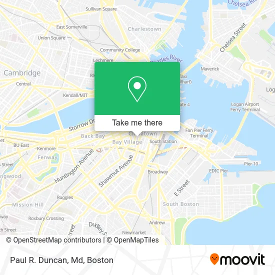
See Paul R. Duncan, Md, Boston, on the map
Public Transit to Paul R. Duncan, Md in Boston
Wondering how to get to Paul R. Duncan, Md in Boston? Moovit helps you find the best way to get to Paul R. Duncan, Md with step-by-step directions from the nearest public transit station.
Moovit provides free maps and live directions to help you navigate through your city. View schedules, routes, timetables, and find out how long does it take to get to Paul R. Duncan, Md in real time.
Looking for the nearest stop or station to Paul R. Duncan, Md? Check out this list of stops closest to your destination: Charles St S @ Park Plaza; Downtown Crossing; Washington St @ Essex St; Kneeland St @ Washington St; Stuart St @ Charles St S; Arlington; Arlington St @ Isabella St; Chinatown Gate; Washington St @ Tufts Med Ctr; Tremont St @ Boylston Station.
Bus: 43, 501, 504, SL4, SL5, 39, 57.Train: FRAMINGHAM/WORCESTER, LOWELL, NEWBURYPORT/ROCKPORT.Subway: GREEN LINE B, GREEN LINE D, ORANGE LINE, RED LINE, GREEN LINE C, GREEN LINE E.
Want to see if there’s another route that gets you there at an earlier time? Moovit helps you find alternative routes or times. Get directions from and directions to Paul R. Duncan, Md easily from the Moovit App or Website.
We make riding to Paul R. Duncan, Md easy, which is why over 1.7 million users, including users in Boston, trust Moovit as the best app for public transit. You don’t need to download an individual bus app or train app, Moovit is your all-in-one transit app that helps you find the best bus time or train time available.
For information on prices of bus, subway and train, costs and ride fares to Paul R. Duncan, Md, please check the Moovit app.
Use the app to navigate to popular places including to the airport, hospital, stadium, grocery store, mall, coffee shop, school, college, and university.
Paul R. Duncan, Md Address: 260 Tremont Street, Biewend Building, 5th Floor street in Boston
- Wang Theater,
- Citi Performing Arts Center Wang Theatre,
- Hollis Street Theatre,
- Boch Center,
- Courtyard Marriott Lobby,
- Wilbur Theatre,
- Myron Siu, MD,
- Deborah Green-Laroche, MD,
- Wang Theatre (Wang Theater),
- Tufts Children's Hospital Physical Medicine and Rehabilitation,
- Moxy Hotel,
- Tufts Medical Center - Biewend building,
- Boston Theatre District,
- Elizabeth Park, MD,
- Theatre District,
- American Red Cross (Amer Red Crs Blood Donation Ctr),
- Floating Hospital For Children,
- Genkiya Sushi,
- The W Hotel Boston,
- Moxy Boston Downtown
Places Near Paul R. Duncan, Md (Boston)
- Cheers, Boston,
- Mgm Music Hall, Boston,
- Boston Children's Hospital, Boston,
- Museum Of Science, Boston,
- North End, Boston,
- Quincy Market, Boston,
- Faneuil Hall, Boston,
- Boston Medical Center, Boston,
- Wilbur Theatre, Boston,
- Boston Common, Boston,
- Prudential Center, Boston,
- House Of Blues, Boston,
- Castle Island, Boston,
- Isabella Stewart Gardner Museum, Boston,
- Td Garden, Boston,
- Leader Bank Pavilion (Leader Bank Pavillion), Boston,
- Seaport District, Boston,
- Boston Convention & Exhibition Center, Boston,
- Wang Theater, Boston,
- Massachusetts General Hospital, Boston
How to get to popular places in Boston with public transit
Get around Boston by public transit!
Traveling around Boston has never been so easy. See step by step directions as you travel to any attraction, street or major public transit station. View bus and train schedules, arrival times, service alerts and detailed routes on a map, so you know exactly how to get to anywhere in Boston.
When traveling to any destination around Boston use Moovit's Live Directions with Get Off Notifications to know exactly where and how far to walk, how long to wait for your line, and how many stops are left. Moovit will alert you when it's time to get off — no need to constantly re-check whether yours is the next stop.
Wondering how to use public transit in Boston or how to pay for public transit in Boston? Moovit public transit app can help you navigate your way with public transit easily, and at minimum cost. It includes public transit fees, ticket prices, and costs. Looking for a map of Boston public transit lines? Moovit public transit app shows all public transit maps in Boston with all Bus, Train, Subway and Ferry routes and stops on an interactive map.
Boston has 4 transit type(s), including: Bus, Train, Subway and Ferry, operated by several transit agencies, including MBTA, Southeastern Regional Transit Authority, MetroWest Regional Transit Authority, Rhode Island Public Transit Authority, WRTA, Lowell Regional Transit Authority, Merrimack Valley Transit, Montachusett Regional Transit Authority, Cape Cod Regional Transit Authority, Brockton Area Transit Authority, Martha's Vineyard Transit Authority, the WAVE - Nantucket Regional Transit Authority, GATRA, Cape Ann Transportation Authority and Massport