Directions to Paul T O'Reilly And Associates (Belmont) with public transportation
The following transit lines have routes that pass near Paul T O'Reilly And Associates
 Bus: 71, 73.
- Train: FITCHBURG, FRAMINGHAM/WORCESTER.
- Subway: RED LINE, GREEN LINE B.
How to get to Paul T O'Reilly And Associates by bus?
Click on the bus route to see step by step directions with maps, line arrival times and updated time schedules.
From Santarpio's Pizza, Boston
91 minFrom Homewood Suites by Hilton Boston Logan Airport Chelsea, Chelsea
76 minFrom Paul Revere House, Boston
81 minFrom Sunrise Shuttle Pick Up, Boston
97 minFrom South Boston, Boston
75 minFrom Capo Restaurant & Supper Club, Boston
71 minFrom Old State House, Boston
59 minFrom Arnold Arboretum, Boston
100 minFrom La Quinta Inn & Suites Boston Somerville, Somerville
60 minFrom Winter Hill, Somerville
76 min
How to get to Paul T O'Reilly And Associates by train?
Click on the train route to see step by step directions with maps, line arrival times and updated time schedules.
How to get to Paul T O'Reilly And Associates by subway?
Click on the subway route to see step by step directions with maps, line arrival times and updated time schedules.
From Santarpio's Pizza, Boston
80 minFrom Paul Revere House, Boston
69 minFrom Sunrise Shuttle Pick Up, Boston
78 minFrom South Boston, Boston
74 minFrom Capo Restaurant & Supper Club, Boston
74 minFrom Old State House, Boston
63 minFrom Arnold Arboretum, Boston
88 minFrom La Quinta Inn & Suites Boston Somerville, Somerville
79 minFrom Winter Hill, Somerville
93 min
Bus stops near Paul T O'Reilly And Associates in Belmont
Subway stations near Paul T O'Reilly And Associates in Belmont
Train station near Paul T O'Reilly And Associates in Belmont
- Waverley, 43 min walk,VIEW
What are the closest stations to Paul T O'Reilly And Associates?
The closest stations to Paul T O'Reilly And Associates are:
- Belmont St @ St. Mary's St is 21 yards away, 1 min walk.
- Mt Auburn St @ Cottage St is 236 yards away, 3 min walk.
- Warren Street is 1477 yards away, 18 min walk.
- Alewife is 3583 yards away, 42 min walk.
- Waverley is 3655 yards away, 43 min walk.
Which bus lines stop near Paul T O'Reilly And Associates?
These bus lines stop near Paul T O'Reilly And Associates: 71, 73.
Which train lines stop near Paul T O'Reilly And Associates?
These train lines stop near Paul T O'Reilly And Associates: FITCHBURG, FRAMINGHAM/WORCESTER.
Which subway line stops near Paul T O'Reilly And Associates?
RED LINE (Alewife)
What’s the nearest subway station to Paul T O'Reilly And Associates in Belmont?
The nearest subway station to Paul T O'Reilly And Associates in Belmont is Warren Street. It’s a 18 min walk away.
What’s the nearest bus station to Paul T O'Reilly And Associates in Belmont?
The nearest bus station to Paul T O'Reilly And Associates in Belmont is Belmont St @ St. Mary's St. It’s a 1 min walk away.
What time is the first subway to Paul T O'Reilly And Associates in Belmont?
The GREEN LINE B is the first subway that goes to Paul T O'Reilly And Associates in Belmont. It stops nearby at 5:12 AM.
What time is the last subway to Paul T O'Reilly And Associates in Belmont?
The GREEN LINE B is the last subway that goes to Paul T O'Reilly And Associates in Belmont. It stops nearby at 2:28 AM.
What time is the first train to Paul T O'Reilly And Associates in Belmont?
The FITCHBURG is the first train that goes to Paul T O'Reilly And Associates in Belmont. It stops nearby at 5:39 AM.
What time is the last train to Paul T O'Reilly And Associates in Belmont?
The FITCHBURG is the last train that goes to Paul T O'Reilly And Associates in Belmont. It stops nearby at 12:11 AM.
What time is the first bus to Paul T O'Reilly And Associates in Belmont?
The 73 is the first bus that goes to Paul T O'Reilly And Associates in Belmont. It stops nearby at 4:53 AM.
What time is the last bus to Paul T O'Reilly And Associates in Belmont?
The 71 is the last bus that goes to Paul T O'Reilly And Associates in Belmont. It stops nearby at 1:19 AM.
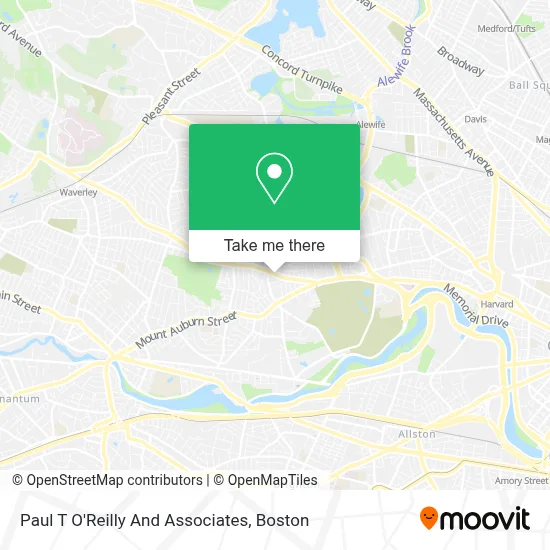
See Paul T O'Reilly And Associates, Belmont, on the map
Public Transit to Paul T O'Reilly And Associates in Belmont
Wondering how to get to Paul T O'Reilly And Associates in Belmont? Moovit helps you find the best way to get to Paul T O'Reilly And Associates with step-by-step directions from the nearest public transit station.
Moovit provides free maps and live directions to help you navigate through your city. View schedules, routes, timetables, and find out how long does it take to get to Paul T O'Reilly And Associates in real time.
Looking for the nearest stop or station to Paul T O'Reilly And Associates? Check out this list of stops closest to your destination: Belmont St @ St. Mary's St; Mt Auburn St @ Cottage St; Warren Street; Alewife; Waverley.
Bus: 71, 73.Train: FITCHBURG, FRAMINGHAM/WORCESTER.Subway: RED LINE, GREEN LINE B.
Want to see if there’s another route that gets you there at an earlier time? Moovit helps you find alternative routes or times. Get directions from and directions to Paul T O'Reilly And Associates easily from the Moovit App or Website.
We make riding to Paul T O'Reilly And Associates easy, which is why over 1.7 million users, including users in Belmont, trust Moovit as the best app for public transit. You don’t need to download an individual bus app or train app, Moovit is your all-in-one transit app that helps you find the best bus time or train time available.
For information on prices of bus, subway and train, costs and ride fares to Paul T O'Reilly And Associates, please check the Moovit app.
Use the app to navigate to popular places including to the airport, hospital, stadium, grocery store, mall, coffee shop, school, college, and university.
Paul T O'Reilly And Associates Address: 158 Belmont St street in Belmont
- Kaizen Karate & Martial Arts,
- Info Center,
- Belmont Lock and Key Inc,
- Ravello Italian Kitchen,
- Belmont Variety,
- MBTA Bus Route 73,
- Corcoran Park Center,
- Belmont, MA,
- MyEyeDr.,
- Joyce Bloom Maryland Counseling,
- Haggery Library & Technology Center,
- Religious Sacred Heart,
- Trattoria Catering Order,
- MBTA Route 71 Bus Stop | Mt. Auburn St. & Bigelow Ave.,
- The New England of Optometry,
- Kendall Green Luce Team,
- Red Lentil,
- Lucas Schalge Locks Change,
- Kitaeff Showroom,
- Watertown-Cambridge Greenway
Places Near Paul T O'Reilly And Associates (Belmont)
- Massachusetts General Hospital, Boston,
- North End, Boston,
- House Of Blues, Boston,
- Quincy Market, Boston,
- Wilbur Theatre, Boston,
- Mgm Music Hall, Boston,
- Td Garden, Boston,
- Wang Theater, Boston,
- Isabella Stewart Gardner Museum, Boston,
- Prudential Center, Boston,
- Castle Island, Boston,
- Museum Of Science, Boston,
- Boston Convention & Exhibition Center, Boston,
- Cheers, Boston,
- Faneuil Hall, Boston,
- Seaport District, Boston,
- Boston Medical Center, Boston,
- Boston Common, Boston,
- Leader Bank Pavilion (Leader Bank Pavillion), Boston,
- Boston Children's Hospital, Boston
How to get to popular places in Boston with public transit
Get around Belmont by public transit!
Traveling around Belmont has never been so easy. See step by step directions as you travel to any attraction, street or major public transit station. View bus and train schedules, arrival times, service alerts and detailed routes on a map, so you know exactly how to get to anywhere in Belmont.
When traveling to any destination around Belmont use Moovit's Live Directions with Get Off Notifications to know exactly where and how far to walk, how long to wait for your line, and how many stops are left. Moovit will alert you when it's time to get off — no need to constantly re-check whether yours is the next stop.
Wondering how to use public transit in Belmont or how to pay for public transit in Belmont? Moovit public transit app can help you navigate your way with public transit easily, and at minimum cost. It includes public transit fees, ticket prices, and costs. Looking for a map of Belmont public transit lines? Moovit public transit app shows all public transit maps in Belmont with all Bus, Train, Subway and Ferry routes and stops on an interactive map.
Boston has 4 transit type(s), including: Bus, Train, Subway and Ferry, operated by several transit agencies, including MBTA, Southeastern Regional Transit Authority, MetroWest Regional Transit Authority, Rhode Island Public Transit Authority, WRTA, Lowell Regional Transit Authority, Merrimack Valley Transit, Montachusett Regional Transit Authority, Cape Cod Regional Transit Authority, Brockton Area Transit Authority, Martha's Vineyard Transit Authority, the WAVE - Nantucket Regional Transit Authority, GATRA, Cape Ann Transportation Authority and Massport