Directions to Paylessforoil.Com (Boston) with public transportation
The following transit lines have routes that pass near Paylessforoil.Com
 Bus: P21E, R29, G19.
- Train: VALLEY FLYER, VERMONTER.
How to get to Paylessforoil.Com by bus?
Click on the bus route to see step by step directions with maps, line arrival times and updated time schedules.
From Foxwoods, Worcester
164 minFrom Dcu Center, Worcester
145 minFrom Saint Vincent Hospital at Worcester Medical Center, Worcester
145 minFrom Gardner, MA, Gardner
277 minFrom Worcester, MA, Worcester
143 minFrom Palladium, Worcester
148 minFrom Polar Park, Worcester
145 minFrom South High Community School, Worcester
231 minFrom Registry Of Motor Vehicles (Rmv) Branch Office, Worcester
147 min
How to get to Paylessforoil.Com by train?
Click on the train route to see step by step directions with maps, line arrival times and updated time schedules.
Bus stops near Paylessforoil.Com in Boston
Train station near Paylessforoil.Com in Boston
- Holyoke Amtrak, 57 min walk,VIEW
Bus lines to Paylessforoil.Com in Boston
What are the closest stations to Paylessforoil.Com?
The closest stations to Paylessforoil.Com are:
- Main / Pleasant is 769 yards away, 10 min walk.
- Bridge / Main is 963 yards away, 12 min walk.
- Holyoke Amtrak is 4802 yards away, 57 min walk.
Which bus lines stop near Paylessforoil.Com?
These bus lines stop near Paylessforoil.Com: P21E, R29.
Which train lines stop near Paylessforoil.Com?
These train lines stop near Paylessforoil.Com: VALLEY FLYER, VERMONTER.
What’s the nearest bus station to Paylessforoil.Com in Boston?
The nearest bus station to Paylessforoil.Com in Boston is Main / Pleasant. It’s a 10 min walk away.
What time is the first train to Paylessforoil.Com in Boston?
The VALLEY FLYER is the first train that goes to Paylessforoil.Com in Boston. It stops nearby at 6:45 AM.
What time is the last train to Paylessforoil.Com in Boston?
The VALLEY FLYER is the last train that goes to Paylessforoil.Com in Boston. It stops nearby at 9:51 PM.
What time is the first bus to Paylessforoil.Com in Boston?
The G19 is the first bus that goes to Paylessforoil.Com in Boston. It stops nearby at 6:25 AM.
What time is the last bus to Paylessforoil.Com in Boston?
The G19 is the last bus that goes to Paylessforoil.Com in Boston. It stops nearby at 7:59 PM.
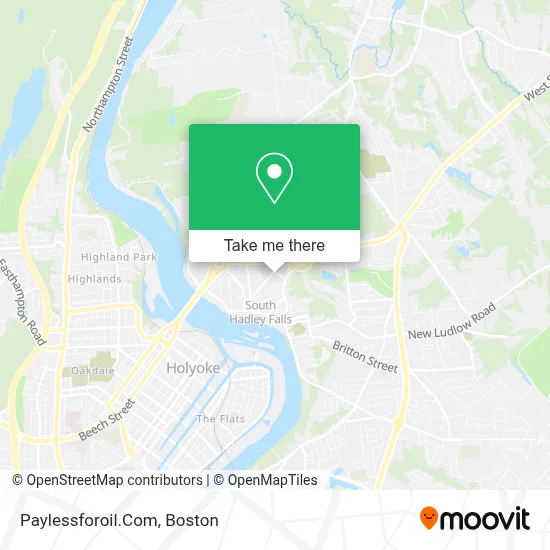
See Paylessforoil.Com, Boston, on the map
Public Transit to Paylessforoil.Com in Boston
Wondering how to get to Paylessforoil.Com in Boston? Moovit helps you find the best way to get to Paylessforoil.Com with step-by-step directions from the nearest public transit station.
Moovit provides free maps and live directions to help you navigate through your city. View schedules, routes, timetables, and find out how long does it take to get to Paylessforoil.Com in real time.
Looking for the nearest stop or station to Paylessforoil.Com? Check out this list of stops closest to your destination: Main / Pleasant; Bridge / Main; Holyoke Amtrak.
Bus: P21E, R29, G19.Train: VALLEY FLYER, VERMONTER.
Want to see if there’s another route that gets you there at an earlier time? Moovit helps you find alternative routes or times. Get directions from and directions to Paylessforoil.Com easily from the Moovit App or Website.
We make riding to Paylessforoil.Com easy, which is why over 1.7 million users, including users in Boston, trust Moovit as the best app for public transit. You don’t need to download an individual bus app or train app, Moovit is your all-in-one transit app that helps you find the best bus time or train time available.
For information on prices of bus and train, costs and ride fares to Paylessforoil.Com, please check the Moovit app.
Use the app to navigate to popular places including to the airport, hospital, stadium, grocery store, mall, coffee shop, school, college, and university.
Paylessforoil.Com Address: 27 Gaylord St street in Boston
- Mohawk Fine Paper,
- South Hadley Ahpc,
- E Ink,
- Interstate Batteries,
- Woronoco Savings Bank,
- McCain & Sons Plumbing & Heating,
- Bernashe Electric-So Hadley,
- Oreck,
- Carpets Today,
- Jubinville Insurance Group,
- Music To Your Eyes Painting,
- Intoxalock Ignition Interlock,
- S & R Auto & Detailing,
- Underdown Fine Carpentry,
- Time for A Carwash,
- A D T Security Services,
- The Law Office of James E. Baker, PC,
- Integrity Plumbing & Heating,
- Riverside Cafe,
- Town of South Hadley, Ma
Places Near Paylessforoil.Com (Boston)
- Seaport District, Boston,
- Cheers, Boston,
- Td Garden, Boston,
- Isabella Stewart Gardner Museum, Boston,
- Prudential Center, Boston,
- Mgm Music Hall, Boston,
- House Of Blues, Boston,
- Faneuil Hall, Boston,
- Castle Island, Boston,
- Massachusetts General Hospital, Boston,
- North End, Boston,
- Museum Of Science, Boston,
- Boston Medical Center, Boston,
- Boston Children's Hospital, Boston,
- Wilbur Theatre, Boston,
- Wang Theater, Boston,
- Leader Bank Pavilion (Leader Bank Pavillion), Boston,
- Quincy Market, Boston,
- Boston Convention & Exhibition Center, Boston,
- Boston Common, Boston
How to get to popular places in Boston with public transit
Get around Boston by public transit!
Traveling around Boston has never been so easy. See step by step directions as you travel to any attraction, street or major public transit station. View bus and train schedules, arrival times, service alerts and detailed routes on a map, so you know exactly how to get to anywhere in Boston.
When traveling to any destination around Boston use Moovit's Live Directions with Get Off Notifications to know exactly where and how far to walk, how long to wait for your line, and how many stops are left. Moovit will alert you when it's time to get off — no need to constantly re-check whether yours is the next stop.
Wondering how to use public transit in Boston or how to pay for public transit in Boston? Moovit public transit app can help you navigate your way with public transit easily, and at minimum cost. It includes public transit fees, ticket prices, and costs. Looking for a map of Boston public transit lines? Moovit public transit app shows all public transit maps in Boston with all Bus, Train, Subway and Ferry routes and stops on an interactive map.
Boston has 4 transit type(s), including: Bus, Train, Subway and Ferry, operated by several transit agencies, including MBTA, Southeastern Regional Transit Authority, MetroWest Regional Transit Authority, Rhode Island Public Transit Authority, WRTA, Lowell Regional Transit Authority, Merrimack Valley Transit, Montachusett Regional Transit Authority, Cape Cod Regional Transit Authority, Brockton Area Transit Authority, Martha's Vineyard Transit Authority, the WAVE - Nantucket Regional Transit Authority, GATRA, Cape Ann Transportation Authority and Massport