Directions to Pcfine (Needham) with public transportation
The following transit lines have routes that pass near Pcfine
 Bus: 52, 59, NEEDHAM LINE SHUTTLE, NEEDHAM LINE SHUTTLE.
- Train: NEEDHAM.
How to get to Pcfine by bus?
Click on the bus route to see step by step directions with maps, line arrival times and updated time schedules.
From New Balance, Boston
106 minFrom Roadrunner, Boston
108 minFrom VA Medical Center, Boston (Jamaica Plain), Boston
96 minFrom Watertown, MA, Watertown Town
81 minFrom Alumni Stadium, Boston
113 minFrom Mission Hill, Boston
98 minFrom Faulkner Hospital, Boston
81 minFrom MBTA Jackson Square Station, Boston
106 min
How to get to Pcfine by train?
Click on the train route to see step by step directions with maps, line arrival times and updated time schedules.
Bus stop near Pcfine in Needham
- Hersey, 13 min walk,VIEW
Train station near Pcfine in Needham
- Needham Center, 32 min walk,VIEW
Bus lines to Pcfine in Needham
What are the closest stations to Pcfine?
The closest stations to Pcfine are:
- Hersey is 1082 yards away, 13 min walk.
- Needham Center is 2654 yards away, 32 min walk.
Which bus lines stop near Pcfine?
These bus lines stop near Pcfine: 52, 59.
Which train line stops near Pcfine?
NEEDHAM (#625 | Needham Heights)
What’s the nearest bus station to Pcfine in Needham?
The nearest bus station to Pcfine in Needham is Hersey. It’s a 13 min walk away.
What time is the first train to Pcfine in Needham?
The NEEDHAM is the first train that goes to Pcfine in Needham. It stops nearby at 7:05 AM.
What time is the last train to Pcfine in Needham?
The NEEDHAM is the last train that goes to Pcfine in Needham. It stops nearby at 6:38 PM.
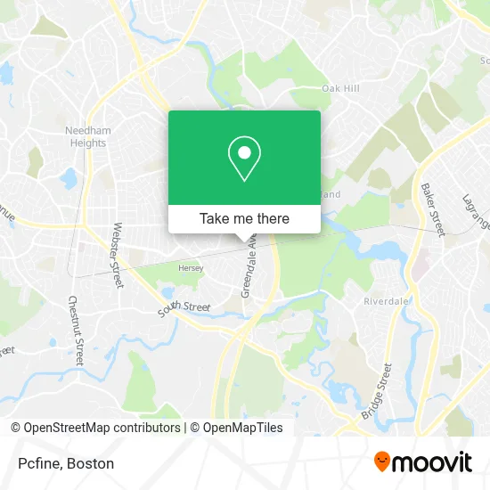
See Pcfine, Needham, on the map
Public Transit to Pcfine in Needham
Wondering how to get to Pcfine in Needham? Moovit helps you find the best way to get to Pcfine with step-by-step directions from the nearest public transit station.
Moovit provides free maps and live directions to help you navigate through your city. View schedules, routes, timetables, and find out how long does it take to get to Pcfine in real time.
Looking for the nearest stop or station to Pcfine? Check out this list of stops closest to your destination: Hersey; Needham Center.
Bus: 52, 59, NEEDHAM LINE SHUTTLE, NEEDHAM LINE SHUTTLE.Train: NEEDHAM.
Want to see if there’s another route that gets you there at an earlier time? Moovit helps you find alternative routes or times. Get directions from and directions to Pcfine easily from the Moovit App or Website.
We make riding to Pcfine easy, which is why over 1.7 million users, including users in Needham, trust Moovit as the best app for public transit. You don’t need to download an individual bus app or train app, Moovit is your all-in-one transit app that helps you find the best bus time or train time available.
For information on prices of bus, train and subway, costs and ride fares to Pcfine, please check the Moovit app.
Use the app to navigate to popular places including to the airport, hospital, stadium, grocery store, mall, coffee shop, school, college, and university.
Pcfine Address: 22 Grosvenor Rd street in Needham
- Saint Sebastian's School,
- Theodore Crowell, CPA,
- The Rashi School,
- Newbridge on the Charles Public Access,
- Newbridge on the Charles (New Bridge on the Charles Independent Living),
- New Bridge On The Charles,
- Richards' Mark Photography Studio,
- Marketing Drive Boston,
- Paxerahealth,
- Newton Center Carpet Cleaning,
- Meaningful Gift,
- Genpower Holdings,
- Big Belly Solar,
- ATM,
- Willowbend,
- Abaco Sporting Club,
- View Community Senior Living,
- Connecticut School of Broadcasting,
- Newton Massachusetts,
- Pa529
Places Near Pcfine (Needham)
- Castle Island, Boston,
- Faneuil Hall, Boston,
- Leader Bank Pavilion (Leader Bank Pavillion), Boston,
- Boston Children's Hospital, Boston,
- Boston Medical Center, Boston,
- House Of Blues, Boston,
- Museum Of Science, Boston,
- Seaport District, Boston,
- Wilbur Theatre, Boston,
- Boston Convention & Exhibition Center, Boston,
- North End, Boston,
- Prudential Center, Boston,
- Mgm Music Hall, Boston,
- Cheers, Boston,
- Massachusetts General Hospital, Boston,
- Quincy Market, Boston,
- Wang Theater, Boston,
- Td Garden, Boston,
- Boston Common, Boston,
- Isabella Stewart Gardner Museum, Boston
How to get to popular places in Boston with public transit
Get around Needham by public transit!
Traveling around Needham has never been so easy. See step by step directions as you travel to any attraction, street or major public transit station. View bus and train schedules, arrival times, service alerts and detailed routes on a map, so you know exactly how to get to anywhere in Needham.
When traveling to any destination around Needham use Moovit's Live Directions with Get Off Notifications to know exactly where and how far to walk, how long to wait for your line, and how many stops are left. Moovit will alert you when it's time to get off — no need to constantly re-check whether yours is the next stop.
Wondering how to use public transit in Needham or how to pay for public transit in Needham? Moovit public transit app can help you navigate your way with public transit easily, and at minimum cost. It includes public transit fees, ticket prices, and costs. Looking for a map of Needham public transit lines? Moovit public transit app shows all public transit maps in Needham with all Bus, Train, Subway and Ferry routes and stops on an interactive map.
Boston has 4 transit type(s), including: Bus, Train, Subway and Ferry, operated by several transit agencies, including MBTA, Southeastern Regional Transit Authority, MetroWest Regional Transit Authority, Rhode Island Public Transit Authority, WRTA, Lowell Regional Transit Authority, Merrimack Valley Transit, Montachusett Regional Transit Authority, Cape Cod Regional Transit Authority, Brockton Area Transit Authority, Martha's Vineyard Transit Authority, the WAVE - Nantucket Regional Transit Authority, GATRA, Cape Ann Transportation Authority and Massport