Directions to Pdia (Waltham) with public transportation
The following transit lines have routes that pass near Pdia
 Bus: 553, 554, 558, 505.
- Train: FRAMINGHAM/WORCESTER, FITCHBURG.
- Subway: GREEN LINE D.
How to get to Pdia by bus?
Click on the bus route to see step by step directions with maps, line arrival times and updated time schedules.
From Vertex Pharmaceuticals, Inc., Boston
59 minFrom Alumni Stadium, Newton
61 minFrom Brookline High School (Brookline Town High School), Brookline
58 minFrom Christian A Herter Park, Boston
59 minFrom VFW Parkway, Boston
60 minFrom Boston University Track and Tennis Center, Boston
51 minFrom Brookline, MA, Brookline
63 minFrom Citizens Bank Opera House, Boston
45 minFrom Studio Allston, Boston
54 minFrom Hampton Inn & Suites-Hampton Watertown Boston (Hampton Inn & Suites Watertown Boston), Watertown Town
50 min
How to get to Pdia by train?
Click on the train route to see step by step directions with maps, line arrival times and updated time schedules.
How to get to Pdia by subway?
Click on the subway route to see step by step directions with maps, line arrival times and updated time schedules.
Bus stops near Pdia in Waltham
Subway station near Pdia in Waltham
- Riverside, 29 min walk,VIEW
Bus lines to Pdia in Waltham
What are the closest stations to Pdia?
The closest stations to Pdia are:
- Rumford Ave @ Lexington St is 128 yards away, 2 min walk.
- Lexington St @ Whitlowe Rd is 307 yards away, 4 min walk.
- West Newton is 781 yards away, 10 min walk.
- Riverside is 2452 yards away, 29 min walk.
- Waltham is 4773 yards away, 56 min walk.
Which bus lines stop near Pdia?
These bus lines stop near Pdia: 553, 554, 558.
Which train line stops near Pdia?
FRAMINGHAM/WORCESTER (#521 | Worcester)
Which subway line stops near Pdia?
GREEN LINE D (Riverside)
What’s the nearest subway station to Pdia in Waltham?
The nearest subway station to Pdia in Waltham is Riverside. It’s a 29 min walk away.
What’s the nearest train station to Pdia in Waltham?
The nearest train station to Pdia in Waltham is West Newton. It’s a 10 min walk away.
What’s the nearest bus station to Pdia in Waltham?
The nearest bus station to Pdia in Waltham is Rumford Ave @ Lexington St. It’s a 2 min walk away.
What time is the first subway to Pdia in Waltham?
The GREEN LINE D is the first subway that goes to Pdia in Waltham. It stops nearby at 4:45 AM.
What time is the last subway to Pdia in Waltham?
The GREEN LINE D is the last subway that goes to Pdia in Waltham. It stops nearby at 2:48 AM.
What time is the first train to Pdia in Waltham?
The FRAMINGHAM/WORCESTER is the first train that goes to Pdia in Waltham. It stops nearby at 5:19 AM.
What time is the last train to Pdia in Waltham?
The FRAMINGHAM/WORCESTER is the last train that goes to Pdia in Waltham. It stops nearby at 12:22 AM.
What time is the first bus to Pdia in Waltham?
The 505 is the first bus that goes to Pdia in Waltham. It stops nearby at 5:58 AM.
What time is the last bus to Pdia in Waltham?
The 553 is the last bus that goes to Pdia in Waltham. It stops nearby at 8:56 PM.
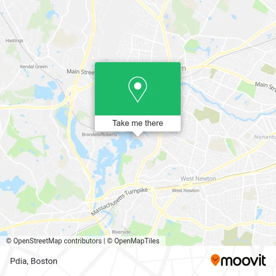
See Pdia, Waltham, on the map
Public Transit to Pdia in Waltham
Wondering how to get to Pdia in Waltham? Moovit helps you find the best way to get to Pdia with step-by-step directions from the nearest public transit station.
Moovit provides free maps and live directions to help you navigate through your city. View schedules, routes, timetables, and find out how long does it take to get to Pdia in real time.
Looking for the nearest stop or station to Pdia? Check out this list of stops closest to your destination: Rumford Ave @ Lexington St; Lexington St @ Whitlowe Rd; West Newton; Riverside; Waltham.
Bus: 553, 554, 558, 505.Train: FRAMINGHAM/WORCESTER, FITCHBURG.Subway: GREEN LINE D.
Want to see if there’s another route that gets you there at an earlier time? Moovit helps you find alternative routes or times. Get directions from and directions to Pdia easily from the Moovit App or Website.
We make riding to Pdia easy, which is why over 1.7 million users, including users in Waltham, trust Moovit as the best app for public transit. You don’t need to download an individual bus app or train app, Moovit is your all-in-one transit app that helps you find the best bus time or train time available.
For information on prices of bus, subway and train, costs and ride fares to Pdia, please check the Moovit app.
Use the app to navigate to popular places including to the airport, hospital, stadium, grocery store, mall, coffee shop, school, college, and university.
Pdia Address: Island in Boston, MA street in Waltham
- LS Charles River - We,
- Edward Jones - Financial Advisor: Timothy Braceland,
- Mt. Feake Cemetery,
- Keyword Advisors,
- Eci Software Innovations,
- West Suburban YMCA,
- UPS Drop Box,
- New England Insurance Group,
- Viridian Therapeutics,
- Fractyl Laboratories,
- Ogin,
- Devoted Health,
- The Cove Park, Auburndale, Ma,
- William F. Stanley Elementary School,
- Neotys,
- Kelly's Property Services,
- Burr Elementary School,
- O'Brien Wealth Partners Llc,
- Michelle Densmore Fitness,
- Brandeis University
Places Near Pdia (Waltham)
- House Of Blues, Boston,
- Prudential Center, Boston,
- Wang Theater, Boston,
- Boston Convention & Exhibition Center, Boston,
- Wilbur Theatre, Boston,
- Boston Children's Hospital, Boston,
- North End, Boston,
- Boston Medical Center, Boston,
- Boston Common, Boston,
- Museum Of Science, Boston,
- Td Garden, Boston,
- Mgm Music Hall, Boston,
- Massachusetts General Hospital, Boston,
- Faneuil Hall, Boston,
- Seaport District, Boston,
- Quincy Market, Boston,
- Isabella Stewart Gardner Museum, Boston,
- Cheers, Boston,
- Leader Bank Pavilion (Leader Bank Pavillion), Boston,
- Castle Island, Boston
How to get to popular places in Boston with public transit
Get around Waltham by public transit!
Traveling around Waltham has never been so easy. See step by step directions as you travel to any attraction, street or major public transit station. View bus and train schedules, arrival times, service alerts and detailed routes on a map, so you know exactly how to get to anywhere in Waltham.
When traveling to any destination around Waltham use Moovit's Live Directions with Get Off Notifications to know exactly where and how far to walk, how long to wait for your line, and how many stops are left. Moovit will alert you when it's time to get off — no need to constantly re-check whether yours is the next stop.
Wondering how to use public transit in Waltham or how to pay for public transit in Waltham? Moovit public transit app can help you navigate your way with public transit easily, and at minimum cost. It includes public transit fees, ticket prices, and costs. Looking for a map of Waltham public transit lines? Moovit public transit app shows all public transit maps in Waltham with all Bus, Train, Subway and Ferry routes and stops on an interactive map.
Boston has 4 transit type(s), including: Bus, Train, Subway and Ferry, operated by several transit agencies, including MBTA, Southeastern Regional Transit Authority, MetroWest Regional Transit Authority, Rhode Island Public Transit Authority, WRTA, Lowell Regional Transit Authority, Merrimack Valley Transit, Montachusett Regional Transit Authority, Cape Cod Regional Transit Authority, Brockton Area Transit Authority, Martha's Vineyard Transit Authority, the WAVE - Nantucket Regional Transit Authority, GATRA, Cape Ann Transportation Authority and Massport