Directions to Peabody Area Chamber Of Commerce with public transportation
The following transit lines have routes that pass near Peabody Area Chamber Of Commerce
 Bus: 436.
How to get to Peabody Area Chamber Of Commerce by bus?
Click on the bus route to see step by step directions with maps, line arrival times and updated time schedules.
Bus stop near Peabody Area Chamber Of Commerce
- Centennial Dr Opp Rt128 Ramp, 7 min walk,VIEW
Bus lines to Peabody Area Chamber Of Commerce
- 436, Liberty Tree Via North Shore Mall & Lynnfield St,VIEW
What are the closest stations to Peabody Area Chamber Of Commerce?
The closest stations to Peabody Area Chamber Of Commerce are:
- Centennial Dr Opp Rt128 Ramp is 516 yards away, 7 min walk.
Which bus line stops near Peabody Area Chamber Of Commerce?
436 (Liberty Tree Via North Shore Mall & Lynnfield St)
What’s the nearest bus station to Peabody Area Chamber Of Commerce?
The nearest bus station to Peabody Area Chamber Of Commerce is Centennial Dr Opp Rt128 Ramp. It’s a 7 min walk away.
What time is the first bus to Peabody Area Chamber Of Commerce?
The 436 is the first bus that goes to Peabody Area Chamber Of Commerce. It stops nearby at 6:30 AM.
What time is the last bus to Peabody Area Chamber Of Commerce?
The 436 is the last bus that goes to Peabody Area Chamber Of Commerce. It stops nearby at 6:51 PM.
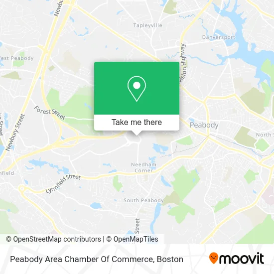
See Peabody Area Chamber Of Commerce on the map
Public Transportation to Peabody Area Chamber Of Commerce
Wondering how to get to Peabody Area Chamber Of Commerce? Moovit helps you find the best way to get to Peabody Area Chamber Of Commerce with step-by-step directions from the nearest public transit station.
Moovit provides free maps and live directions to help you navigate through your city. View schedules, routes, timetables, and find out how long does it take to get to Peabody Area Chamber Of Commerce in real time.
Looking for the nearest stop or station to Peabody Area Chamber Of Commerce? Check out this list of stops closest to your destination: Centennial Dr Opp Rt128 Ramp.
Bus: 436.
Want to see if there’s another route that gets you there at an earlier time? Moovit helps you find alternative routes or times. Get directions from and directions to Peabody Area Chamber Of Commerce easily from the Moovit App or Website.
We make riding to Peabody Area Chamber Of Commerce easy, which is why over 1.7 million users, including users in Peabody, trust Moovit as the best app for public transit. You don’t need to download an individual bus app or train app, Moovit is your all-in-one transit app that helps you find the best bus time or train time available.
For information on prices of bus and train, costs and ride fares to Peabody Area Chamber Of Commerce, please check the Moovit app.
Use the app to navigate to popular places including to the airport, hospital, stadium, grocery store, mall, coffee shop, school, college, and university.
Peabody Area Chamber Of Commerce Address: Gravoc, 10 Centennial Dr street in Peabody
- Boston Children's at Peabody,
- Boston Children's Hospital,
- Luisa Leach, Lmhc,
- Care For Children With Medical Complexity at Peabody,
- Audiology Program at Peabody,
- Division Of Genetics And Genomics at Peabody,
- Sports Medicine Division at Peabody | Boston Children's Hospital,
- Department Of Neurology at Peabody,
- Division Of Immunology at Peabody,
- Division Of Pediatric & Adolescent Gynecology at Peabody,
- Scouting Woods Disc Golf Course,
- Cosmetics & Wellness Md,
- Legal Sea Foods,
- Clenord Serenity Touch,
- JPC Support Service,
- Hair by Annie Chau,
- Wood And Associates Insurance Agency,
- Helco Electric,
- Boston Marriott Peabody,
- Lahey Clinic
Places Near Peabody Area Chamber Of Commerce
- Isabella Stewart Gardner Museum, Boston,
- North End, Boston,
- Mgm Music Hall, Boston,
- Leader Bank Pavilion (Leader Bank Pavillion), Boston,
- Quincy Market, Boston,
- Massachusetts General Hospital, Boston,
- Boston Convention & Exhibition Center, Boston,
- Castle Island, Boston,
- Museum Of Science, Boston,
- Td Garden, Boston,
- Faneuil Hall, Boston,
- House Of Blues, Boston,
- Boston Children's Hospital, Boston,
- Wang Theater, Boston,
- Cheers, Boston,
- Wilbur Theatre, Boston,
- Boston Medical Center, Boston,
- Boston Common, Boston,
- Seaport District, Boston,
- Prudential Center, Boston
How to get to popular places in Boston with public transit
Get around Peabody by public transit!
Traveling around Peabody has never been so easy. See step by step directions as you travel to any attraction, street or major public transit station. View bus and train schedules, arrival times, service alerts and detailed routes on a map, so you know exactly how to get to anywhere in Peabody.
When traveling to any destination around Peabody use Moovit's Live Directions with Get Off Notifications to know exactly where and how far to walk, how long to wait for your line, and how many stops are left. Moovit will alert you when it's time to get off — no need to constantly re-check whether yours is the next stop.
Wondering how to use public transit in Peabody or how to pay for public transit in Peabody? Moovit public transit app can help you navigate your way with public transit easily, and at minimum cost. It includes public transit fees, ticket prices, and costs. Looking for a map of Peabody public transit lines? Moovit public transit app shows all public transit maps in Peabody with all Bus, Train, Subway and Ferry routes and stops on an interactive map.
Boston has 4 transit type(s), including: Bus, Train, Subway and Ferry, operated by several transit agencies, including MBTA, Southeastern Regional Transit Authority, MetroWest Regional Transit Authority, Rhode Island Public Transit Authority, WRTA, Lowell Regional Transit Authority, Merrimack Valley Transit, Montachusett Regional Transit Authority, Cape Cod Regional Transit Authority, Brockton Area Transit Authority, Martha's Vineyard Transit Authority, the WAVE - Nantucket Regional Transit Authority, GATRA, Cape Ann Transportation Authority and Massport