Directions to Peak Physical Therapy And Sports Performance (Milton) with public transportation
The following transit lines have routes that pass near Peak Physical Therapy And Sports Performance
 Bus: 202, 21, 215, 201, MATTAPAN LINE SHUTTLE.
- Train: FAIRMOUNT.
- Subway: MATTAPAN LINE, RED LINE.
How to get to Peak Physical Therapy And Sports Performance by bus?
Click on the bus route to see step by step directions with maps, line arrival times and updated time schedules.
From Orpheum Theatre, Boston
79 minFrom Park Street MBTA Station - Green & Red Line, Boston
80 minFrom Intercontinental Boston Hotel Boston, Boston
83 minFrom Boston Marriott Cambridge, Cambridge
86 minFrom US Coast Guard Base Boston, Boston
89 minFrom The Westin Boston Waterfront, Boston
91 minFrom Old North Church, Boston
86 minFrom Goodwill Store, Boston
91 minFrom Paradise Rock Club, Boston
90 minFrom Silver Line Stop Terminal B, Boston
88 min
How to get to Peak Physical Therapy And Sports Performance by train?
Click on the train route to see step by step directions with maps, line arrival times and updated time schedules.
How to get to Peak Physical Therapy And Sports Performance by subway?
Click on the subway route to see step by step directions with maps, line arrival times and updated time schedules.
From Orpheum Theatre, Boston
40 minFrom Park Street MBTA Station - Green & Red Line, Boston
43 minFrom Silver Line Stop Terminal B, Boston
78 minFrom Intercontinental Boston Hotel Boston, Boston
42 minFrom Boston Marriott Cambridge, Cambridge
50 minFrom US Coast Guard Base Boston, Boston
56 minFrom The Westin Boston Waterfront, Boston
56 minFrom Old North Church, Boston
55 minFrom Goodwill Store, Boston
71 minFrom Paradise Rock Club, Boston
71 min
Bus stops near Peak Physical Therapy And Sports Performance in Milton
Subway stations near Peak Physical Therapy And Sports Performance in Milton
Bus lines to Peak Physical Therapy And Sports Performance in Milton
What are the closest stations to Peak Physical Therapy And Sports Performance?
The closest stations to Peak Physical Therapy And Sports Performance are:
- Hilltop St Opp Whitridge St is 13 yards away, 1 min walk.
- Hallet St @ Florian Hall is 324 yards away, 4 min walk.
- Adams St @ Milton St - Cedar Grove Sta is 332 yards away, 4 min walk.
- Granite Ave @ Hilltop St is 413 yards away, 5 min walk.
- Central Avenue is 799 yards away, 10 min walk.
- North Quincy is 2945 yards away, 35 min walk.
Which bus lines stop near Peak Physical Therapy And Sports Performance?
These bus lines stop near Peak Physical Therapy And Sports Performance: 202, 21, 215.
Which train line stops near Peak Physical Therapy And Sports Performance?
FAIRMOUNT (#1619 | Fairmount)
Which subway line stops near Peak Physical Therapy And Sports Performance?
MATTAPAN LINE (Mattapan)
What’s the nearest subway station to Peak Physical Therapy And Sports Performance in Milton?
The nearest subway station to Peak Physical Therapy And Sports Performance in Milton is Central Avenue. It’s a 10 min walk away.
What’s the nearest bus station to Peak Physical Therapy And Sports Performance in Milton?
The nearest bus station to Peak Physical Therapy And Sports Performance in Milton is Hilltop St Opp Whitridge St. It’s a 1 min walk away.
What time is the first subway to Peak Physical Therapy And Sports Performance in Milton?
The MATTAPAN LINE is the first subway that goes to Peak Physical Therapy And Sports Performance in Milton. It stops nearby at 5:04 AM.
What time is the last subway to Peak Physical Therapy And Sports Performance in Milton?
The MATTAPAN LINE is the last subway that goes to Peak Physical Therapy And Sports Performance in Milton. It stops nearby at 2:36 AM.
What time is the first bus to Peak Physical Therapy And Sports Performance in Milton?
The 215 is the first bus that goes to Peak Physical Therapy And Sports Performance in Milton. It stops nearby at 5:57 AM.
What time is the last bus to Peak Physical Therapy And Sports Performance in Milton?
The 215 is the last bus that goes to Peak Physical Therapy And Sports Performance in Milton. It stops nearby at 1:04 AM.
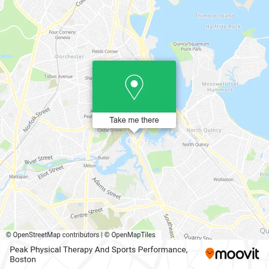
See Peak Physical Therapy And Sports Performance, Milton, on the map
Public Transit to Peak Physical Therapy And Sports Performance in Milton
Wondering how to get to Peak Physical Therapy And Sports Performance in Milton? Moovit helps you find the best way to get to Peak Physical Therapy And Sports Performance with step-by-step directions from the nearest public transit station.
Moovit provides free maps and live directions to help you navigate through your city. View schedules, routes, timetables, and find out how long does it take to get to Peak Physical Therapy And Sports Performance in real time.
Looking for the nearest stop or station to Peak Physical Therapy And Sports Performance? Check out this list of stops closest to your destination: Hilltop St Opp Whitridge St; Hallet St @ Florian Hall; Adams St @ Milton St - Cedar Grove Sta; Granite Ave @ Hilltop St; Central Avenue; North Quincy.
Bus: 202, 21, 215, 201, MATTAPAN LINE SHUTTLE, MATTAPAN LINE SHUTTLE, RED/MATTAPAN LINE SHUTTLE.Train: FAIRMOUNT.Subway: MATTAPAN LINE, RED LINE.
Want to see if there’s another route that gets you there at an earlier time? Moovit helps you find alternative routes or times. Get directions from and directions to Peak Physical Therapy And Sports Performance easily from the Moovit App or Website.
We make riding to Peak Physical Therapy And Sports Performance easy, which is why over 1.7 million users, including users in Milton, trust Moovit as the best app for public transit. You don’t need to download an individual bus app or train app, Moovit is your all-in-one transit app that helps you find the best bus time or train time available.
For information on prices of bus, subway and train, costs and ride fares to Peak Physical Therapy And Sports Performance, please check the Moovit app.
Use the app to navigate to popular places including to the airport, hospital, stadium, grocery store, mall, coffee shop, school, college, and university.
Peak Physical Therapy And Sports Performance Address: 2 Granite Ave street in Milton
- Topdog Law Personal Injury Lawyers,
- ATM,
- Milton Windows,
- Fidelity National,
- Granite Avenue Drawbridge,
- P+R Milton,
- USPS Collection Box - Blue Box,
- St Brendan's (St Brendan Catholic Church),
- Milton Park And Ride,
- Diamond Nails Spa,
- Florian Hall,
- Cedar Grove MBTA,
- Southie Apparel,
- Pope John Paul II Park,
- Adams Corner Cafe & Butcher Shop Market,
- Metabank,
- Speedway,
- Adams Village,
- Ace Locksmith,
- TD Bank
Places Near Peak Physical Therapy And Sports Performance (Milton)
- Boston Children's Hospital, Boston,
- Massachusetts General Hospital, Boston,
- Boston Convention & Exhibition Center, Boston,
- Wilbur Theatre, Boston,
- Quincy Market, Boston,
- Prudential Center, Boston,
- Faneuil Hall, Boston,
- Wang Theater, Boston,
- Museum Of Science, Boston,
- Td Garden, Boston,
- Boston Common, Boston,
- Seaport District, Boston,
- Cheers, Boston,
- North End, Boston,
- Castle Island, Boston,
- Leader Bank Pavilion (Leader Bank Pavillion), Boston,
- Isabella Stewart Gardner Museum, Boston,
- Boston Medical Center, Boston,
- House Of Blues, Boston,
- Mgm Music Hall, Boston
How to get to popular places in Boston with public transit
Get around Milton by public transit!
Traveling around Milton has never been so easy. See step by step directions as you travel to any attraction, street or major public transit station. View bus and train schedules, arrival times, service alerts and detailed routes on a map, so you know exactly how to get to anywhere in Milton.
When traveling to any destination around Milton use Moovit's Live Directions with Get Off Notifications to know exactly where and how far to walk, how long to wait for your line, and how many stops are left. Moovit will alert you when it's time to get off — no need to constantly re-check whether yours is the next stop.
Wondering how to use public transit in Milton or how to pay for public transit in Milton? Moovit public transit app can help you navigate your way with public transit easily, and at minimum cost. It includes public transit fees, ticket prices, and costs. Looking for a map of Milton public transit lines? Moovit public transit app shows all public transit maps in Milton with all Bus, Train, Subway and Ferry routes and stops on an interactive map.
Boston has 4 transit type(s), including: Bus, Train, Subway and Ferry, operated by several transit agencies, including MBTA, Southeastern Regional Transit Authority, MetroWest Regional Transit Authority, Rhode Island Public Transit Authority, WRTA, Lowell Regional Transit Authority, Merrimack Valley Transit, Montachusett Regional Transit Authority, Cape Cod Regional Transit Authority, Brockton Area Transit Authority, Martha's Vineyard Transit Authority, the WAVE - Nantucket Regional Transit Authority, GATRA, Cape Ann Transportation Authority and Massport