Directions to Peak Potential Institute (Wellesley) with public transportation
The following transit lines have routes that pass near Peak Potential Institute
 Bus: 01, MBRS.
- Train: FRAMINGHAM/WORCESTER.
How to get to Peak Potential Institute by bus?
Click on the bus route to see step by step directions with maps, line arrival times and updated time schedules.
From FOUR POINTS BY SHERATON Boston Newton, Newton
133 minFrom West Roxbury, Boston
142 minFrom The Mall At Chestnut Hill, Newton
143 minFrom SharkNinja Operating LLC, Needham
145 minFrom Heartbreak Hill, Newton
139 minFrom Boston Children's Hospital at Waltham, Waltham
127 minFrom Boston Dynamics, Waltham
121 minFrom VFW Parkway, Boston
136 minFrom Sanofi-Genzyme, Waltham
131 min
How to get to Peak Potential Institute by train?
Click on the train route to see step by step directions with maps, line arrival times and updated time schedules.
Bus stop near Peak Potential Institute in Wellesley
- Cross St (Central St/Cross St), 1 min walk,VIEW
Train station near Peak Potential Institute in Wellesley
- Wellesley Square, 5 min walk,VIEW
Bus lines to Peak Potential Institute in Wellesley
- 01, Natick Mall - Wegmans,VIEW
What are the closest stations to Peak Potential Institute?
The closest stations to Peak Potential Institute are:
- Cross St (Central St/Cross St) is 47 yards away, 1 min walk.
- Wellesley Square is 375 yards away, 5 min walk.
Which bus lines stop near Peak Potential Institute?
These bus lines stop near Peak Potential Institute: 01, MBRS.
Which train line stops near Peak Potential Institute?
FRAMINGHAM/WORCESTER (#521 | Worcester)
What’s the nearest train station to Peak Potential Institute in Wellesley?
The nearest train station to Peak Potential Institute in Wellesley is Wellesley Square. It’s a 5 min walk away.
What’s the nearest bus station to Peak Potential Institute in Wellesley?
The nearest bus station to Peak Potential Institute in Wellesley is Cross St (Central St/Cross St). It’s a 1 min walk away.
What time is the first train to Peak Potential Institute in Wellesley?
The FRAMINGHAM/WORCESTER is the first train that goes to Peak Potential Institute in Wellesley. It stops nearby at 5:09 AM.
What time is the last train to Peak Potential Institute in Wellesley?
The FRAMINGHAM/WORCESTER is the last train that goes to Peak Potential Institute in Wellesley. It stops nearby at 12:32 AM.
What time is the first bus to Peak Potential Institute in Wellesley?
The 01 is the first bus that goes to Peak Potential Institute in Wellesley. It stops nearby at 5:58 AM.
What time is the last bus to Peak Potential Institute in Wellesley?
The 01 is the last bus that goes to Peak Potential Institute in Wellesley. It stops nearby at 8:56 PM.
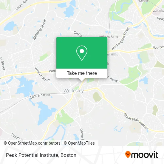
See Peak Potential Institute, Wellesley, on the map
Public Transit to Peak Potential Institute in Wellesley
Wondering how to get to Peak Potential Institute in Wellesley? Moovit helps you find the best way to get to Peak Potential Institute with step-by-step directions from the nearest public transit station.
Moovit provides free maps and live directions to help you navigate through your city. View schedules, routes, timetables, and find out how long does it take to get to Peak Potential Institute in real time.
Looking for the nearest stop or station to Peak Potential Institute? Check out this list of stops closest to your destination: Cross St (Central St/Cross St); Wellesley Square.
Bus: 01, MBRS.Train: FRAMINGHAM/WORCESTER.
Want to see if there’s another route that gets you there at an earlier time? Moovit helps you find alternative routes or times. Get directions from and directions to Peak Potential Institute easily from the Moovit App or Website.
We make riding to Peak Potential Institute easy, which is why over 1.7 million users, including users in Wellesley, trust Moovit as the best app for public transit. You don’t need to download an individual bus app or train app, Moovit is your all-in-one transit app that helps you find the best bus time or train time available.
For information on prices of bus, train and subway, costs and ride fares to Peak Potential Institute, please check the Moovit app.
Use the app to navigate to popular places including to the airport, hospital, stadium, grocery store, mall, coffee shop, school, college, and university.
Peak Potential Institute Address: 471 Washington St street in Wellesley
- Sacro Occipital Technique Education,
- Martin G. Rosen,
- Courtney Tritta Beauty,
- City Sports,
- Manifest Apothecary Studio,
- Pattyc Property Group,
- Jeffrey N Fink Esq.,
- Wellesley - Linden Street,
- Santander Bank Atm,
- Quinwell Travel Service,
- Chalifoux Paul R Dent,
- George F. Doherty & Sons Funeral Home,
- Wellesley Dental Arts - Linden St.,
- Sdss Martial Arts Of Wellesley,
- D'Arcy Wellness Center + Spa,
- Capello Design,
- Amazon Locker - Pseudoscience,
- The Cod Squad,
- Mati Brow & Beauty Studio,
- Santander Bank Branch
Places Near Peak Potential Institute (Wellesley)
- Museum Of Science, Boston,
- Td Garden, Boston,
- Leader Bank Pavilion (Leader Bank Pavillion), Boston,
- Massachusetts General Hospital, Boston,
- Boston Convention & Exhibition Center, Boston,
- Isabella Stewart Gardner Museum, Boston,
- House Of Blues, Boston,
- Seaport District, Boston,
- Wilbur Theatre, Boston,
- Quincy Market, Boston,
- Boston Medical Center, Boston,
- Prudential Center, Boston,
- North End, Boston,
- Cheers, Boston,
- Boston Common, Boston,
- Castle Island, Boston,
- Faneuil Hall, Boston,
- Boston Children's Hospital, Boston,
- Mgm Music Hall, Boston,
- Wang Theater, Boston
How to get to popular places in Boston with public transit
Get around Wellesley by public transit!
Traveling around Wellesley has never been so easy. See step by step directions as you travel to any attraction, street or major public transit station. View bus and train schedules, arrival times, service alerts and detailed routes on a map, so you know exactly how to get to anywhere in Wellesley.
When traveling to any destination around Wellesley use Moovit's Live Directions with Get Off Notifications to know exactly where and how far to walk, how long to wait for your line, and how many stops are left. Moovit will alert you when it's time to get off — no need to constantly re-check whether yours is the next stop.
Wondering how to use public transit in Wellesley or how to pay for public transit in Wellesley? Moovit public transit app can help you navigate your way with public transit easily, and at minimum cost. It includes public transit fees, ticket prices, and costs. Looking for a map of Wellesley public transit lines? Moovit public transit app shows all public transit maps in Wellesley with all Bus, Train, Subway and Ferry routes and stops on an interactive map.
Boston has 4 transit type(s), including: Bus, Train, Subway and Ferry, operated by several transit agencies, including MBTA, Southeastern Regional Transit Authority, MetroWest Regional Transit Authority, Rhode Island Public Transit Authority, WRTA, Lowell Regional Transit Authority, Merrimack Valley Transit, Montachusett Regional Transit Authority, Cape Cod Regional Transit Authority, Brockton Area Transit Authority, Martha's Vineyard Transit Authority, the WAVE - Nantucket Regional Transit Authority, GATRA, Cape Ann Transportation Authority and Massport