Directions to Pediatric Solid Tumor Center (Boston) with public transportation
The following transit lines have routes that pass near Pediatric Solid Tumor Center
 Bus: 39, 41, 35.
- Train: PROVIDENCE/STOUGHTON.
- Subway: ORANGE LINE, GREEN LINE E.
How to get to Pediatric Solid Tumor Center by bus?
Click on the bus route to see step by step directions with maps, line arrival times and updated time schedules.
From USS Constitution (USS Constitution Museum), Boston
68 minFrom Boston Tea Party - Ships And Museum, Boston
49 minFrom Uss Constitution, Boston
69 minFrom TownePlace Suites Boston Logan Airport/Chelsea, Chelsea
75 minFrom 415 Summer Street, Boston
55 minFrom Granite Links Golf Club at Quarry Hills, Quincy
82 minFrom Massport Bus 77 Chelsea Employee Parking, Chelsea
75 minFrom DoubleTree by Hilton Boston Logan Airport Chelsea, Chelsea
85 minFrom Embassy Suites Boston At Logan, Boston
59 min
How to get to Pediatric Solid Tumor Center by train?
Click on the train route to see step by step directions with maps, line arrival times and updated time schedules.
How to get to Pediatric Solid Tumor Center by subway?
Click on the subway route to see step by step directions with maps, line arrival times and updated time schedules.
From USS Constitution (USS Constitution Museum), Boston
49 minFrom Boston Tea Party - Ships And Museum, Boston
35 minFrom Uss Constitution, Boston
51 minFrom TownePlace Suites Boston Logan Airport/Chelsea, Chelsea
51 minFrom Embassy Suites Boston At Logan, Boston
43 minFrom 415 Summer Street, Boston
43 minFrom Massport Bus 77 Chelsea Employee Parking, Chelsea
52 min
Bus stops near Pediatric Solid Tumor Center in Boston
Subway stations near Pediatric Solid Tumor Center in Boston
Bus lines to Pediatric Solid Tumor Center in Boston
What are the closest stations to Pediatric Solid Tumor Center?
The closest stations to Pediatric Solid Tumor Center are:
- S Huntington Ave @ Va Hospital is 294 yards away, 4 min walk.
- Centre St @ Roseway St is 305 yards away, 4 min walk.
- Riverway is 892 yards away, 11 min walk.
- Stony Brook is 1480 yards away, 18 min walk.
Which bus lines stop near Pediatric Solid Tumor Center?
These bus lines stop near Pediatric Solid Tumor Center: 39, 41.
Which train line stops near Pediatric Solid Tumor Center?
PROVIDENCE/STOUGHTON (#825 | Providence)
Which subway line stops near Pediatric Solid Tumor Center?
ORANGE LINE (Forest Hills)
What’s the nearest subway station to Pediatric Solid Tumor Center in Boston?
The nearest subway station to Pediatric Solid Tumor Center in Boston is Riverway. It’s a 11 min walk away.
What’s the nearest bus station to Pediatric Solid Tumor Center in Boston?
The nearest bus stations to Pediatric Solid Tumor Center in Boston are S Huntington Ave @ Va Hospital and Centre St @ Roseway St. The closest one is a 4 min walk away.
What time is the first subway to Pediatric Solid Tumor Center in Boston?
The ORANGE LINE is the first subway that goes to Pediatric Solid Tumor Center in Boston. It stops nearby at 5:18 AM.
What time is the last subway to Pediatric Solid Tumor Center in Boston?
The GREEN LINE E is the last subway that goes to Pediatric Solid Tumor Center in Boston. It stops nearby at 2:00 AM.
What time is the first bus to Pediatric Solid Tumor Center in Boston?
The 39 is the first bus that goes to Pediatric Solid Tumor Center in Boston. It stops nearby at 4:43 AM.
What time is the last bus to Pediatric Solid Tumor Center in Boston?
The 39 is the last bus that goes to Pediatric Solid Tumor Center in Boston. It stops nearby at 1:27 AM.
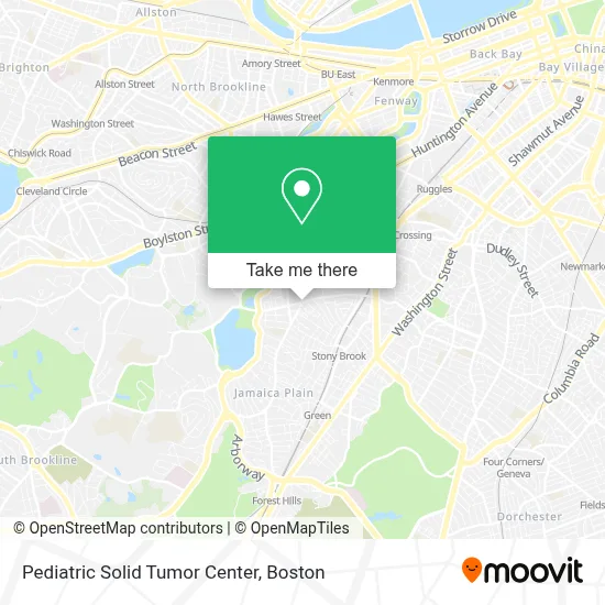
See Pediatric Solid Tumor Center, Boston, on the map
Public Transit to Pediatric Solid Tumor Center in Boston
Wondering how to get to Pediatric Solid Tumor Center in Boston? Moovit helps you find the best way to get to Pediatric Solid Tumor Center with step-by-step directions from the nearest public transit station.
Moovit provides free maps and live directions to help you navigate through your city. View schedules, routes, timetables, and find out how long does it take to get to Pediatric Solid Tumor Center in real time.
Looking for the nearest stop or station to Pediatric Solid Tumor Center? Check out this list of stops closest to your destination: S Huntington Ave @ Va Hospital; Centre St @ Roseway St; Riverway; Stony Brook.
Bus: 39, 41, 35.Train: PROVIDENCE/STOUGHTON.Subway: ORANGE LINE, GREEN LINE E.
Want to see if there’s another route that gets you there at an earlier time? Moovit helps you find alternative routes or times. Get directions from and directions to Pediatric Solid Tumor Center easily from the Moovit App or Website.
We make riding to Pediatric Solid Tumor Center easy, which is why over 1.7 million users, including users in Boston, trust Moovit as the best app for public transit. You don’t need to download an individual bus app or train app, Moovit is your all-in-one transit app that helps you find the best bus time or train time available.
For information on prices of bus, subway and train, costs and ride fares to Pediatric Solid Tumor Center, please check the Moovit app.
Use the app to navigate to popular places including to the airport, hospital, stadium, grocery store, mall, coffee shop, school, college, and university.
Pediatric Solid Tumor Center Address: 450 Brookline Ave street in Boston
- Harvard Real Estate,
- Up & Down- Opening Soon,
- Mike & Patty's,
- 24 Hr A Emergency Locksmith Service,
- Momo Masala,
- Viva Taco,
- Don Tequeno Y Dona Arepa,
- Jamaica Plain,
- Mario's,
- Hyde Square,
- Bella Luna Restaurant,
- MSPCA Angell Animal Medical Center,
- Amazon Locker-Jamaicaplain,
- Atomic Earrings,
- Fashion Style Salon,
- Angell Animal Medical Center (Mspca Angell),
- Mspca,
- Angell Animal Medical Center (Angell Veterinary Dermatology Service Phone),
- Angell Animal Medical Center: in Boston and Waltham,
- Journal Menu
Places Near Pediatric Solid Tumor Center (Boston)
- Prudential Center, Boston,
- Leader Bank Pavilion (Leader Bank Pavillion), Boston,
- Td Garden, Boston,
- Wang Theater, Boston,
- Massachusetts General Hospital, Boston,
- Isabella Stewart Gardner Museum, Boston,
- Museum Of Science, Boston,
- Boston Children's Hospital, Boston,
- Mgm Music Hall, Boston,
- Quincy Market, Boston,
- Wilbur Theatre, Boston,
- Boston Convention & Exhibition Center, Boston,
- North End, Boston,
- Cheers, Boston,
- Seaport District, Boston,
- Faneuil Hall, Boston,
- House Of Blues, Boston,
- Boston Medical Center, Boston,
- Boston Common, Boston,
- Castle Island, Boston
How to get to popular places in Boston with public transit
Get around Boston by public transit!
Traveling around Boston has never been so easy. See step by step directions as you travel to any attraction, street or major public transit station. View bus and train schedules, arrival times, service alerts and detailed routes on a map, so you know exactly how to get to anywhere in Boston.
When traveling to any destination around Boston use Moovit's Live Directions with Get Off Notifications to know exactly where and how far to walk, how long to wait for your line, and how many stops are left. Moovit will alert you when it's time to get off — no need to constantly re-check whether yours is the next stop.
Wondering how to use public transit in Boston or how to pay for public transit in Boston? Moovit public transit app can help you navigate your way with public transit easily, and at minimum cost. It includes public transit fees, ticket prices, and costs. Looking for a map of Boston public transit lines? Moovit public transit app shows all public transit maps in Boston with all Bus, Train, Subway and Ferry routes and stops on an interactive map.
Boston has 4 transit type(s), including: Bus, Train, Subway and Ferry, operated by several transit agencies, including MBTA, Southeastern Regional Transit Authority, MetroWest Regional Transit Authority, Rhode Island Public Transit Authority, WRTA, Lowell Regional Transit Authority, Merrimack Valley Transit, Montachusett Regional Transit Authority, Cape Cod Regional Transit Authority, Brockton Area Transit Authority, Martha's Vineyard Transit Authority, the WAVE - Nantucket Regional Transit Authority, GATRA, Cape Ann Transportation Authority and Massport