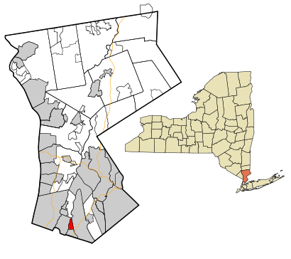
See Pelhamville, Pelham, Ny, on the map
Directions to Pelhamville (Pelham, Ny) with public transportation
The following transit lines have routes that pass near Pelhamville
 Bus:
Bus: - Train:
- Subway:
How to get to Pelhamville by bus?
Click on the bus route to see step by step directions with maps, line arrival times and updated time schedules.
How to get to Pelhamville by train?
Click on the train route to see step by step directions with maps, line arrival times and updated time schedules.
How to get to Pelhamville by subway?
Click on the subway route to see step by step directions with maps, line arrival times and updated time schedules.
Train stations near Pelhamville in Pelham, Ny
- Pelham ,14 min walk,
Bus stations near Pelhamville in Pelham, Ny
- North Ave @ Summit Ave,25 min walk,
Bus lines to Pelhamville in Pelham, Ny
- 45,Q - New Rochelle,
What are the closest stations to Pelhamville?
The closest stations to Pelhamville are:
- Pelham is 1170 yards away, 14 min walk.
- North Ave @ Summit Ave is 2041 yards away, 25 min walk.
Which bus line stops near Pelhamville?
7
Which train line stops near Pelhamville?
NEW HAVEN
Which subway lines stop near Pelhamville?
These subway lines stop near Pelhamville: 2, 5.
What’s the nearest train station to Pelhamville in Pelham, Ny?
The nearest train station to Pelhamville in Pelham, Ny is Pelham. It’s a 14 min walk away.
See Pelhamville, Pelham, Ny, on the map
Public Transit to Pelhamville in Pelham, Ny
Wondering how to get to Pelhamville in Pelham, Ny, United States? Moovit helps you find the best way to get to Pelhamville with step-by-step directions from the nearest public transit station.
Moovit provides free maps and live directions to help you navigate through your city. View schedules, routes, timetables, and find out how long does it take to get to Pelhamville in real time.
Looking for the nearest stop or station to Pelhamville? Check out this list of stops closest to your destination: Pelham ; North Ave @ Summit Ave.
Bus:Train:Subway:
Want to see if there’s another route that gets you there at an earlier time? Moovit helps you find alternative routes or times. Get directions from and directions to Pelhamville easily from the Moovit App or Website.
We make riding to Pelhamville easy, which is why over 1.5 million users, including users in Pelham, Ny, trust Moovit as the best app for public transit. You don’t need to download an individual bus app or train app, Moovit is your all-in-one transit app that helps you find the best bus time or train time available.
For information on prices of bus, train and subway, costs and ride fares to Pelhamville, please check the Moovit app.
Use the app to navigate to popular places including to the airport, hospital, stadium, grocery store, mall, coffee shop, school, college, and university.
Location: Pelham, Ny, New York - New Jersey
Attractions near Pelhamville
1,North Pelham,Newsome Fitness,Yvonne's,Tri-State Archery & Sports Inc,Kitchens By Malara & Sons Inc,88 6th St,ABC Locksmith,Argo Construction Corp,Classic Appraisals,Dierks Enterprises Inc,Colonial Electric,Westchester County Licensed,A C Elec Co,Premier Security Systems,Pelham Family Svce,M & J Auto and Truck Clinic,Tru Fit Orthopedics,Ammirati Inc,Alantic Coast RealtyHow to get to popular attractions in Pelham, Ny with public transit
The Biergarten at The Standard, Manhattan,Hair of the Dog, Manhattan,Joe's Shanghai 鹿嗚春, Manhattan,Sheep Meadow, Manhattan,Jackson Heights, NY, Queens,Ulysses Folk House, Manhattan,Gramercy Tavern, Manhattan,The Tippler, Manhattan,Barrage, Manhattan,Peter Luger Steak House,The 13th Step, Manhattan,Upper West Side, Manhattan,Tom & Jerry's, Manhattan,The Grey Dog, Manhattan,New Jersey, Nutley, Nj,Mission Dolores,J.G. Melon, Manhattan,Spring Lounge, Manhattan,Top of The Standard, Manhattan,Grimaldi's PizzeriaGet around Pelham, Ny by public transit!
Traveling around Pelham, Ny has never been so easy. See step by step directions as you travel to any attraction, street or major public transit station. View bus and train schedules, arrival times, service alerts and detailed routes on a map, so you know exactly how to get to anywhere in Pelham, Ny.
When traveling to any destination around Pelham, Ny use Moovit's Live Directions with Get Off Notifications to know exactly where and how far to walk, how long to wait for your line, and how many stops are left. Moovit will alert you when it's time to get off — no need to constantly re-check whether yours is the next stop.
Wondering how to use public transit in Pelham, Ny or how to pay for public transit in Pelham, Ny? Moovit public transit app can help you navigate your way with public transit easily, and at minimum cost. It includes public transit fees, ticket prices, and costs. Looking for a map of Pelham, Ny public transit lines? Moovit public transit app shows all public transit maps in Pelham, Ny with all bus, train or subway routes and stops on an interactive map.
Pelham, Ny has 3 transit type(s), including: bus, train or subway, operated by several transit agencies, including MTA Subway, Metro-North Railroad, LIRR, PATH, Shore Line East, MTA Bus Company, MTA New York City Transit - Express routes, MTA Bus, NJ Transit, NYC Ferry, NICE bus, Bee-Line Bus, NJ Transit Rail, NJ Transit Rail and Norwalk Transit District