Directions to Pen Pals For Jesus (Quincy) with public transportation
The following transit lines have routes that pass near Pen Pals For Jesus
 Bus: 210, 215, 211, 245, RED LINE SHUTTLE.
- Train: FALL RIVER/NEW BEDFORD, GREENBUSH.
- Subway: RED LINE, MATTAPAN LINE.
How to get to Pen Pals For Jesus by bus?
Click on the bus route to see step by step directions with maps, line arrival times and updated time schedules.
From Andrew Station - MBTA - Red Line, Boston
52 minFrom New England Law | Boston, Boston
80 minFrom Capo, Boston
67 minFrom Centre St, Boston
77 minFrom The Colonnade Hotel Boston, Boston
82 minFrom VA Medical Center, Boston (Jamaica Plain), Boston
72 minFrom Museum of Fine Arts (MFA), Boston
74 minFrom Copley Place, Boston
100 minFrom AMC Theatres, Boston
55 minFrom The Colonnade Hotel, Boston
82 min
How to get to Pen Pals For Jesus by train?
Click on the train route to see step by step directions with maps, line arrival times and updated time schedules.
How to get to Pen Pals For Jesus by subway?
Click on the subway route to see step by step directions with maps, line arrival times and updated time schedules.
From Andrew Station - MBTA - Red Line, Boston
17 minFrom New England Law | Boston, Boston
32 minFrom Capo, Boston
32 minFrom Centre St, Boston
40 minFrom The Colonnade Hotel Boston, Boston
38 minFrom VA Medical Center, Boston (Jamaica Plain), Boston
61 minFrom Museum of Fine Arts (MFA), Boston
48 minFrom Copley Place, Boston
29 minFrom AMC Theatres, Boston
28 minFrom The Colonnade Hotel, Boston
38 min
Bus stops near Pen Pals For Jesus in Quincy
Subway stations near Pen Pals For Jesus in Quincy
Bus lines to Pen Pals For Jesus in Quincy
- 210, Fields Corner,VIEW
- 211, Squantum,VIEW
- 245, Beale & Newport,VIEW
- RED LINE SHUTTLE, Ashmont - Braintree,VIEW
- RED LINE SHUTTLE, Braintree - Broadway,VIEW
- RED LINE SHUTTLE, Braintree - JFK/UMass (Shuttle),VIEW
- RED LINE SHUTTLE, Braintree - North Quincy (Shuttle),VIEW
- RED LINE SHUTTLE, Quincy Center - Broadway (Shuttle),VIEW
- 217, Bryant Ave & Upton St,VIEW
What are the closest stations to Pen Pals For Jesus?
The closest stations to Pen Pals For Jesus are:
- Hancock St @ Beach St is 144 yards away, 2 min walk.
- Beale St @ Farrington St is 258 yards away, 4 min walk.
- Beale St Opp Safford St is 308 yards away, 4 min walk.
- Newport Ave @ Beale St is 382 yards away, 5 min walk.
- Highland Ave @ N Central Ave is 657 yards away, 8 min walk.
- North Quincy is 1861 yards away, 22 min walk.
- Butler is 4665 yards away, 55 min walk.
Which bus lines stop near Pen Pals For Jesus?
These bus lines stop near Pen Pals For Jesus: 210, 215.
Which train lines stop near Pen Pals For Jesus?
These train lines stop near Pen Pals For Jesus: FALL RIVER/NEW BEDFORD, GREENBUSH.
Which subway line stops near Pen Pals For Jesus?
RED LINE (Ashmont/Braintree)
What’s the nearest subway station to Pen Pals For Jesus in Quincy?
The nearest subway station to Pen Pals For Jesus in Quincy is North Quincy. It’s a 22 min walk away.
What’s the nearest bus station to Pen Pals For Jesus in Quincy?
The nearest bus station to Pen Pals For Jesus in Quincy is Hancock St @ Beach St. It’s a 2 min walk away.
What time is the first subway to Pen Pals For Jesus in Quincy?
The MATTAPAN LINE is the first subway that goes to Pen Pals For Jesus in Quincy. It stops nearby at 5:07 AM.
What time is the last subway to Pen Pals For Jesus in Quincy?
The MATTAPAN LINE is the last subway that goes to Pen Pals For Jesus in Quincy. It stops nearby at 2:34 AM.
What time is the first bus to Pen Pals For Jesus in Quincy?
The 210 is the first bus that goes to Pen Pals For Jesus in Quincy. It stops nearby at 5:04 AM.
What time is the last bus to Pen Pals For Jesus in Quincy?
The 210 is the last bus that goes to Pen Pals For Jesus in Quincy. It stops nearby at 1:12 AM.
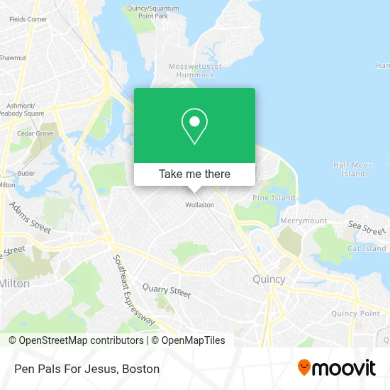
See Pen Pals For Jesus, Quincy, on the map
Public Transit to Pen Pals For Jesus in Quincy
Wondering how to get to Pen Pals For Jesus in Quincy? Moovit helps you find the best way to get to Pen Pals For Jesus with step-by-step directions from the nearest public transit station.
Moovit provides free maps and live directions to help you navigate through your city. View schedules, routes, timetables, and find out how long does it take to get to Pen Pals For Jesus in real time.
Looking for the nearest stop or station to Pen Pals For Jesus? Check out this list of stops closest to your destination: Hancock St @ Beach St; Beale St @ Farrington St; Beale St Opp Safford St; Newport Ave @ Beale St; Highland Ave @ N Central Ave; North Quincy; Butler.
Bus: 210, 215, 211, 245, RED LINE SHUTTLE, RED LINE SHUTTLE, RED LINE SHUTTLE, RED LINE SHUTTLE, RED LINE SHUTTLE.Train: FALL RIVER/NEW BEDFORD, GREENBUSH.Subway: RED LINE, MATTAPAN LINE.
Want to see if there’s another route that gets you there at an earlier time? Moovit helps you find alternative routes or times. Get directions from and directions to Pen Pals For Jesus easily from the Moovit App or Website.
We make riding to Pen Pals For Jesus easy, which is why over 1.7 million users, including users in Quincy, trust Moovit as the best app for public transit. You don’t need to download an individual bus app or train app, Moovit is your all-in-one transit app that helps you find the best bus time or train time available.
For information on prices of subway, bus and train, costs and ride fares to Pen Pals For Jesus, please check the Moovit app.
Use the app to navigate to popular places including to the airport, hospital, stadium, grocery store, mall, coffee shop, school, college, and university.
Pen Pals For Jesus Address: 273 Newport Ave street in Quincy
- Photos by Doc,
- Disciple of Christ Ministries,
- Dr Tao - Natural Healing Acupuncture & Herbal Clinic,
- Wealth Seafood Restaurant,
- Chaji Creamery,
- Shi Miao Dao,
- Thai Saap Rice & Noodles Kitchen,
- Zipcar,
- Ming Seafood Restaurant,
- Peg Cleaners & Alterations,
- Monster Movers & Storage,
- Jing Ying Wen Zhuang,
- Andres,
- Best Duck Cafe,
- Cheap Upholstery Cleaning Services,
- New England Workforce,
- Taiyoboston,
- Wollaston T Station,
- Your Turn Trading / Ceramic Dinnerware,
- Ben Or
Places Near Pen Pals For Jesus (Quincy)
- Td Garden, Boston,
- Museum Of Science, Boston,
- Massachusetts General Hospital, Boston,
- Cheers, Boston,
- Quincy Market, Boston,
- Boston Children's Hospital, Boston,
- Boston Convention & Exhibition Center, Boston,
- Isabella Stewart Gardner Museum, Boston,
- Wilbur Theatre, Boston,
- Leader Bank Pavilion (Leader Bank Pavillion), Boston,
- North End, Boston,
- Mgm Music Hall, Boston,
- Boston Medical Center, Boston,
- Seaport District, Boston,
- Faneuil Hall, Boston,
- Castle Island, Boston,
- Wang Theater, Boston,
- House Of Blues, Boston,
- Prudential Center, Boston,
- Boston Common, Boston
How to get to popular places in Boston with public transit
Get around Quincy by public transit!
Traveling around Quincy has never been so easy. See step by step directions as you travel to any attraction, street or major public transit station. View bus and train schedules, arrival times, service alerts and detailed routes on a map, so you know exactly how to get to anywhere in Quincy.
When traveling to any destination around Quincy use Moovit's Live Directions with Get Off Notifications to know exactly where and how far to walk, how long to wait for your line, and how many stops are left. Moovit will alert you when it's time to get off — no need to constantly re-check whether yours is the next stop.
Wondering how to use public transit in Quincy or how to pay for public transit in Quincy? Moovit public transit app can help you navigate your way with public transit easily, and at minimum cost. It includes public transit fees, ticket prices, and costs. Looking for a map of Quincy public transit lines? Moovit public transit app shows all public transit maps in Quincy with all Bus, Train, Subway and Ferry routes and stops on an interactive map.
Boston has 4 transit type(s), including: Bus, Train, Subway and Ferry, operated by several transit agencies, including MBTA, Southeastern Regional Transit Authority, MetroWest Regional Transit Authority, Rhode Island Public Transit Authority, WRTA, Lowell Regional Transit Authority, Merrimack Valley Transit, Montachusett Regional Transit Authority, Cape Cod Regional Transit Authority, Brockton Area Transit Authority, Martha's Vineyard Transit Authority, the WAVE - Nantucket Regional Transit Authority, GATRA, Cape Ann Transportation Authority and Massport