Directions to Penha with public transportation
The following transit lines have routes that pass near Penha
 Bus: 42, 488L, 497, 622, 910.
- Train: RAMAL SARACURUNA.
- Funicular: IGREJA DA PENHA.
How to get to Penha by bus?
Click on the bus route to see step by step directions with maps, line arrival times and updated time schedules.
From Maracanã
49 minFrom Setor Leste
49 minFrom Setor Sul
49 minFrom Hospital Quinta D'Or
45 minFrom Praça Seca
47 minFrom Hospital Central do Exército (HCE)
40 minFrom Policlínica Newton Alves Cardozo
57 minFrom Rua Arquias Cordeiro 1516
49 minFrom Estádio de São Januário (Estádio Vasco da Gama)
45 minFrom Hospital Municipal Barata Ribeiro
44 min
How to get to Penha by train?
Click on the train route to see step by step directions with maps, line arrival times and updated time schedules.
Bus stops near Penha
- Terminal Daniel Barata - Linha 497, 1 min walk,VIEW
- Terminal Daniel Barata (Estação Penha Circular), 2 min walk,VIEW
- Rua Indígena, 54, 3 min walk,VIEW
- Demillus, 7 min walk,VIEW
- R. Apiaí 67-77 - Penha Rio De Janeiro, 8 min walk,VIEW
- Rua Apiaí, 76, 8 min walk,VIEW
- Rua Delfina Enes, 37, 8 min walk,VIEW
- Pastor José Santos, 10 min walk,VIEW
- Avenida Braz De Pina, 334 | BRT Pastor José Santos, 11 min walk,VIEW
Funicular station near Penha
- Estação 3, 24 min walk,VIEW
Train station near Penha
- Penha, 25 min walk,VIEW
Bus lines to Penha
- 497, Penha (Via Central),VIEW
- 498, Largo Do Machado (Via Catumbi),VIEW
- 483, Penha (Via Central),VIEW
- SN 483, Ipanema,VIEW
- SV 483, Penha (Via Praia Do Flamengo),VIEW
- 431C, Mercado São Sebastião,VIEW
- 905, Bonsucesso,VIEW
- 906, Caju,VIEW
- 940, Ramos,VIEW
- 444L, Demillus → Piabetá,VIEW
- 718D, Madureira,VIEW
- 350, Castelo,VIEW
- 486L, Bar Dos Cavaleiros,VIEW
- 489L, Saens Peña,VIEW
- 910, Bananal,VIEW
- 928, Marechal Hermes,VIEW
- EXECUTIVO, Piabetá - Penha,VIEW
- 349, Rocha Miranda - Castelo (Brs 4 - Via Vista Alegre / Av. Pres. Vargas),VIEW
- 355, Madureira - Tiradentes (Brs 4 - Via Mercadão - Parador),VIEW
- SN 355, Madureira - Tiradentes (BRS 4 - Via Mercadão - Parador),VIEW
What are the closest stations to Penha?
The closest stations to Penha are:
- Terminal Daniel Barata - Linha 497 is 37 meters away, 1 min walk.
- Terminal Daniel Barata (Estação Penha Circular) is 124 meters away, 2 min walk.
- Rua Indígena, 54 is 190 meters away, 3 min walk.
- Demillus is 507 meters away, 7 min walk.
- R. Apiaí 67-77 - Penha Rio De Janeiro is 578 meters away, 8 min walk.
- Rua Apiaí, 76 is 578 meters away, 8 min walk.
- Rua Delfina Enes, 37 is 586 meters away, 8 min walk.
- Pastor José Santos is 724 meters away, 10 min walk.
- Avenida Braz De Pina, 334 | BRT Pastor José Santos is 784 meters away, 11 min walk.
- Estação 3 is 1875 meters away, 24 min walk.
- Penha is 1976 meters away, 25 min walk.
Which bus lines stop near Penha?
These bus lines stop near Penha: 42, 488L, 497, 622, 910.
Which train line stops near Penha?
RAMAL SARACURUNA (Gramacho)
What’s the nearest train station to Penha?
The nearest train station to Penha is Penha. It’s a 25 min walk away.
What’s the nearest bus station to Penha?
The nearest bus station to Penha is Terminal Daniel Barata - Linha 497. It’s a 1 min walk away.
What’s the nearest funicular station to Penha?
The nearest funicular station to Penha is Estação 3. It’s a 24 min walk away.
What time is the first train to Penha?
The RAMAL SARACURUNA is the first train that goes to Penha. It stops nearby at 4:45 AM.
What time is the last train to Penha?
The RAMAL SARACURUNA is the last train that goes to Penha. It stops nearby at 11:00 PM.
What time is the first bus to Penha?
The 497 is the first bus that goes to Penha. It stops nearby at 3:00 AM.
What time is the last bus to Penha?
The 918 is the last bus that goes to Penha. It stops nearby at 3:57 AM.
What time is the first funicular to Penha?
The IGREJA DA PENHA is the first funicular that goes to Penha. It stops nearby at 7:00 AM.
What time is the last funicular to Penha?
The IGREJA DA PENHA is the last funicular that goes to Penha. It stops nearby at 6:00 PM.
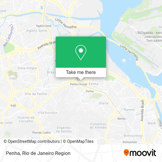
See Penha on the map
Public Transportation to Penha
Wondering how to get to Penha? Moovit helps you find the best way to get to Penha with step-by-step directions from the nearest public transit station.
Moovit provides free maps and live directions to help you navigate through your city. View schedules, routes, timetables, and find out how long does it take to get to Penha in real time.
Looking for the nearest stop or station to Penha? Check out this list of stops closest to your destination: Terminal Daniel Barata - Linha 497; Terminal Daniel Barata (Estação Penha Circular); Rua Indígena; Demillus; R. Apiaí 67-77 - Penha Rio De Janeiro; Rua Apiaí; Rua Delfina Enes; Pastor José Santos; Avenida Braz De Pina; Estação 3; Penha.
Bus: 42, 488L, 497, 622, 910, 498, 483, SN 483, SV 483, 431C, 905, 906, 940, 444L.Train: RAMAL SARACURUNA.Funicular: IGREJA DA PENHA.
Want to see if there’s another route that gets you there at an earlier time? Moovit helps you find alternative routes or times. Get directions from and directions to Penha easily from the Moovit App or Website.
We make riding to Penha easy, which is why over 1.5 million users, including users in Penha, trust Moovit as the best app for public transit. You don’t need to download an individual bus app or train app, Moovit is your all-in-one transit app that helps you find the best bus time or train time available.
For information on prices of bus and train, costs and ride fares to Penha, please check the Moovit app.
Use the app to navigate to popular places including to the airport, hospital, stadium, grocery store, mall, coffee shop, school, college, and university.
Penha Address: Penha, Rio de Janeiro - RJ, Brasil street in Penha
- Rua Magé, 32,
- Fabrica de Calcados Dukito,
- Terminal Daniel Barata,
- Avenida Lobo Júnior / Viaduto João XXIII,
- SuperVia - Estação Penha Circular,
- rua josé maria 150,
- C M N Representacoes,
- Padaria Esquina do Pão,
- S O S Rio Aguas,
- Rua Aurora 27,
- Rua Francisco Enes, 5,
- Pau Grande,
- Viação Nossa Senhora de Lourdes,
- Escola Municipal Pioneiras Sociais 12,
- Atento Brasil - Site Penha,
- Rua Capitão Vicente / Avenida Bráz de Pina,
- Rua Bento Cardoso,
- Viaduto Luis Carlos da Vila próximo ao N / D,
- Salao Angolana Medie,
- McDonald's
Places Near Penha
- Shopping Downtown, Barra Da Tijuca,
- Feira Livre da Gloria, Glória,
- Shopping RioSul, Botafogo,
- Hospital Pedro Ernesto, Vila Isabel,
- Praia do Arpoador, Ipanema,
- Rodoviária Novo Rio (Rodoviária do Rio de Janeiro), Santo Cristo,
- Hospital Federal Cardoso Fontes, Jacarepaguá,
- Rua Ulysses Guimarães 16, Cidade Nova,
- Shopping Nova América, Del Castilho,
- Rio De Janeiro,
- Hospital Municipal Ronaldo Gazolla, Acari,
- Rua Licínio Cardoso, São Francisco Xavier,
- Niterói, Niterói,
- Avenida Rio Branco, Centro,
- Feirão De Malhas, Duque De Caxias,
- Hospital Federal Do Andaraí, Andaraí,
- Norte Shopping, Cachambi,
- Museu Do Amanhã, Centro,
- Avenida Venezuela 134, Saúde,
- Shopping Rio Sul, Botafogo
How to get to popular places in Rio de Janeiro Region with public transit
Get around Penha by public transit!
Traveling around Penha has never been so easy. See step by step directions as you travel to any attraction, street or major public transit station. View bus and train schedules, arrival times, service alerts and detailed routes on a map, so you know exactly how to get to anywhere in Penha.
When traveling to any destination around Penha use Moovit's Live Directions with Get Off Notifications to know exactly where and how far to walk, how long to wait for your line, and how many stops are left. Moovit will alert you when it's time to get off — no need to constantly re-check whether yours is the next stop.
Wondering how to use public transit in Penha or how to pay for public transit in Penha? Moovit public transit app can help you navigate your way with public transit easily, and at minimum cost. It includes public transit fees, ticket prices, and costs. Looking for a map of Penha public transit lines? Moovit public transit app shows all public transit maps in Penha with all Bus, Train, Metro, Light Rail, Ferry, Cable Car, Gondola and Funicular routes and stops on an interactive map.
Rio de Janeiro Region has 8 transit type(s), including: Bus, Train, Metro, Light Rail, Ferry, Cable Car, Gondola and Funicular, operated by several transit agencies, including TrensRJ, Metrô Rio, VLT Carioca, Barcas Rio, BRT MOBI-Rio, Auto Viação Alpha, Auto Viação Tijuca, Gire Transportes, Transurb, Viação Nossa Senhora das Graças, Consórcio INTERSUL, Braso Lisboa (Municipal), Caprichosa Auto Ônibus, Auto Viação Três Amigos and Rodoviária Âncora Matias