Directions to Penha with public transportation
The following transit lines have routes that pass near Penha
 Bus: 622, 679, 621, 721.
- Train: RAMAL SARACURUNA.
- Funicular: IGREJA DA PENHA.
How to get to Penha by bus?
Click on the bus route to see step by step directions with maps, line arrival times and updated time schedules.
From Universidade Veiga de Almeida, Tijuca
61 minFrom Shopping Boulevard Rio
70 minFrom Shopping Tijuca
62 minFrom Hospital Memorial
60 minFrom Loja Riocard - Madureira
48 minFrom Avenida Getúlio de Moura
69 minFrom Rua Carvalho Alvim 261
75 minFrom Prontobaby
60 minFrom Hospital Da Mulher Heloneida Studart
71 minFrom Hospital Universitário Clementino Fraga Filho (HUCFF)
39 min
How to get to Penha by train?
Click on the train route to see step by step directions with maps, line arrival times and updated time schedules.
Bus stops near Penha
- Ponto Final - Grotão - Padaria Flor Do Grotão, 6 min walk,VIEW
- Ponto Final - Penha, 13 min walk,VIEW
- Estrada José Rucas, 712-800, 15 min walk,VIEW
- Estrada José Rucas, 1105-1175, 18 min walk,VIEW
- Avenida Vicente De Carvalho, 1368, 45 min walk,VIEW
- Av. Vicente De Carvalho 1326 - Penha Circular Rio De Janeiro, 46 min walk,VIEW
Train station near Penha
- Penha Circular, 15 min walk,VIEW
Funicular station near Penha
- Vila Cruzeiro - Largo Da Penha, 25 min walk,VIEW
Bus lines to Penha
- 679, Méier,VIEW
- 622, Saens Peña (Via Itararé / Meier / Grajaú),VIEW
- 621, Saens Peña (Via Uranos / Mangueira),VIEW
- 721, Vila Cruzeiro,VIEW
- 313, Penha (Via Uranos / Vila Cruzeiro),VIEW
- 355, Madureira - Tiradentes (Brs 4 - Via Mercadão - Parador),VIEW
- SN 355, Madureira - Tiradentes (BRS 4 - Via Mercadão - Parador),VIEW
- SR 355, Madureira - Tiradentes (Brs 4 - Via Mercadão - Rápido),VIEW
- 551, Nova Iguaçu - Penha (Via Rocha Miranda),VIEW
- 975, Madureira Shopping – Terminal Fundão (via Vicente de Carvalho),VIEW
- 718D, Alcântara,VIEW
What are the closest stations to Penha?
The closest stations to Penha are:
- Ponto Final - Grotão - Padaria Flor Do Grotão is 441 meters away, 6 min walk.
- Ponto Final - Penha is 943 meters away, 13 min walk.
- Penha Circular is 1112 meters away, 15 min walk.
- Estrada José Rucas, 712-800 is 1139 meters away, 15 min walk.
- Estrada José Rucas, 1105-1175 is 1331 meters away, 18 min walk.
- Vila Cruzeiro - Largo Da Penha is 1929 meters away, 25 min walk.
- Avenida Vicente De Carvalho, 1368 is 3532 meters away, 45 min walk.
- Av. Vicente De Carvalho 1326 - Penha Circular Rio De Janeiro is 3558 meters away, 46 min walk.
Which bus lines stop near Penha?
These bus lines stop near Penha: 622, 679.
Which train line stops near Penha?
RAMAL SARACURUNA (Gramacho)
What’s the nearest train station to Penha?
The nearest train station to Penha is Penha Circular. It’s a 15 min walk away.
What’s the nearest bus station to Penha?
The nearest bus station to Penha is Ponto Final - Grotão - Padaria Flor Do Grotão. It’s a 6 min walk away.
What’s the nearest funicular station to Penha?
The nearest funicular station to Penha is Vila Cruzeiro - Largo Da Penha. It’s a 25 min walk away.
What time is the first train to Penha?
The RAMAL SARACURUNA is the first train that goes to Penha. It stops nearby at 4:45 AM.
What time is the last train to Penha?
The RAMAL SARACURUNA is the last train that goes to Penha. It stops nearby at 11:00 PM.
What time is the first bus to Penha?
The SN 355 is the first bus that goes to Penha. It stops nearby at 3:18 AM.
What time is the last bus to Penha?
The SN 355 is the last bus that goes to Penha. It stops nearby at 2:53 AM.
What time is the first funicular to Penha?
The IGREJA DA PENHA is the first funicular that goes to Penha. It stops nearby at 7:00 AM.
What time is the last funicular to Penha?
The IGREJA DA PENHA is the last funicular that goes to Penha. It stops nearby at 6:00 PM.
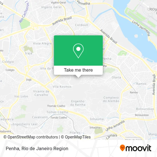
See Penha on the map
Public Transportation to Penha
Wondering how to get to Penha? Moovit helps you find the best way to get to Penha with step-by-step directions from the nearest public transit station.
Moovit provides free maps and live directions to help you navigate through your city. View schedules, routes, timetables, and find out how long does it take to get to Penha in real time.
Looking for the nearest stop or station to Penha? Check out this list of stops closest to your destination: Ponto Final - Grotão - Padaria Flor Do Grotão; Ponto Final - Penha; Penha Circular; Estrada José Rucas; Estrada José Rucas; Vila Cruzeiro - Largo Da Penha; Avenida Vicente De Carvalho; Av. Vicente De Carvalho 1326 - Penha Circular Rio De Janeiro.
Bus: 622, 679, 621, 721.Train: RAMAL SARACURUNA.Funicular: IGREJA DA PENHA.
Want to see if there’s another route that gets you there at an earlier time? Moovit helps you find alternative routes or times. Get directions from and directions to Penha easily from the Moovit App or Website.
We make riding to Penha easy, which is why over 1.5 million users, including users in Penha, trust Moovit as the best app for public transit. You don’t need to download an individual bus app or train app, Moovit is your all-in-one transit app that helps you find the best bus time or train time available.
For information on prices of bus and train, costs and ride fares to Penha, please check the Moovit app.
Use the app to navigate to popular places including to the airport, hospital, stadium, grocery store, mall, coffee shop, school, college, and university.
Penha Address: Rio de Janeiro-RJ street in Penha
- Rua Amadeu Rocha, 1227,
- Creche Municipal Betinho,
- Rua Gonçalves Magalhães / Rua Dois de Julho,
- Morro Do Grotão,
- Grotão,
- Rua Angra dos Reis, 238,
- Rua Dois de Julho,
- Parque Proletário Do Grotão,
- Rua do Cajá, Grotão,
- Rua do Cajá, 1207,
- Forró do Mineirinho,
- Espaço Sapê Festas & Eventos,
- Rua Tenente Luís Dorneles,
- Espaço Mix Festas,
- Piedade Island,
- Travessa Frei Gaspar,
- Rua Aimoré,
- Rua Santo Reis,
- Travessa Aimoré 508,
- Praça Poço da Fé
Places Near Penha
- Feirão De Malhas, Duque De Caxias,
- Praia do Arpoador, Ipanema,
- Museu Do Amanhã, Centro,
- Rua Ulysses Guimarães 16, Cidade Nova,
- Shopping Rio Sul, Botafogo,
- Shopping Nova América, Del Castilho,
- Hospital Municipal Ronaldo Gazolla, Acari,
- Niterói, Niterói,
- Norte Shopping, Cachambi,
- Shopping Downtown, Barra Da Tijuca,
- Hospital Pedro Ernesto, Vila Isabel,
- Avenida Venezuela 134, Saúde,
- Feira Livre da Gloria, Glória,
- Hospital Federal Do Andaraí, Andaraí,
- Rodoviária Novo Rio (Rodoviária do Rio de Janeiro), Santo Cristo,
- Shopping RioSul, Botafogo,
- Rio De Janeiro,
- Hospital Federal Cardoso Fontes, Jacarepaguá,
- Rua Licínio Cardoso, São Francisco Xavier,
- Avenida Rio Branco, Centro
How to get to popular places in Rio de Janeiro Region with public transit
Get around Penha by public transit!
Traveling around Penha has never been so easy. See step by step directions as you travel to any attraction, street or major public transit station. View bus and train schedules, arrival times, service alerts and detailed routes on a map, so you know exactly how to get to anywhere in Penha.
When traveling to any destination around Penha use Moovit's Live Directions with Get Off Notifications to know exactly where and how far to walk, how long to wait for your line, and how many stops are left. Moovit will alert you when it's time to get off — no need to constantly re-check whether yours is the next stop.
Wondering how to use public transit in Penha or how to pay for public transit in Penha? Moovit public transit app can help you navigate your way with public transit easily, and at minimum cost. It includes public transit fees, ticket prices, and costs. Looking for a map of Penha public transit lines? Moovit public transit app shows all public transit maps in Penha with all Bus, Train, Metro, Light Rail, Ferry, Cable Car, Gondola and Funicular routes and stops on an interactive map.
Rio de Janeiro Region has 8 transit type(s), including: Bus, Train, Metro, Light Rail, Ferry, Cable Car, Gondola and Funicular, operated by several transit agencies, including TrensRJ, Metrô Rio, VLT Carioca, Barcas Rio, BRT MOBI-Rio, Auto Viação Alpha, Auto Viação Tijuca, Gire Transportes, Transurb, Viação Nossa Senhora das Graças, Consórcio INTERSUL, Braso Lisboa (Municipal), Caprichosa Auto Ônibus, Auto Viação Três Amigos and Rodoviária Âncora Matias