See Pennsauken-TRANSIT Center on the map
Directions to Pennsauken-TRANSIT Center with public transportation
The following transit lines have routes that pass near Pennsauken-TRANSIT Center
 Bus:
Bus: - Train:
- Light Rail:
How to get to Pennsauken-TRANSIT Center by bus?
Click on the bus route to see step by step directions with maps, line arrival times and updated time schedules.
How to get to Pennsauken-TRANSIT Center by train?
Click on the train route to see step by step directions with maps, line arrival times and updated time schedules.
Bus stations near Pennsauken-TRANSIT Center
- Pennsauken Transit Center,3 min walk,
Light Rail stations near Pennsauken-TRANSIT Center
- Route 73/Pennsauken Light Rail Station,38 min walk,
Train stations near Pennsauken-TRANSIT Center
- Pennsauken Transit Center,58 min walk,
Bus lines to Pennsauken-TRANSIT Center
- 404,Philadelphia,
- 417,Willingboro Exp Mt Holly,
- 419,Camden Via Kroc Ctr,
What are the closest stations to Pennsauken-TRANSIT Center?
The closest stations to Pennsauken-TRANSIT Center are:
- Pennsauken Transit Center is 186 yards away, 3 min walk.
- Route 73/Pennsauken Light Rail Station is 3196 yards away, 38 min walk.
Which bus lines stop near Pennsauken-TRANSIT Center?
These bus lines stop near Pennsauken-TRANSIT Center: 404, 419.
Which train line stops near Pennsauken-TRANSIT Center?
ACRL
Which light rail line stops near Pennsauken-TRANSIT Center?
RLR
What’s the nearest bus stop to Pennsauken-TRANSIT Center?
The nearest bus stop to Pennsauken-TRANSIT Center is Pennsauken Transit Center. It’s a 3 min walk away.
What time is the first light rail to Pennsauken-TRANSIT Center?
The RLR is the first light rail that goes to Pennsauken-TRANSIT Center. It stops nearby at 5:27 AM.
What time is the last light rail to Pennsauken-TRANSIT Center?
The RLR is the last light rail that goes to Pennsauken-TRANSIT Center. It stops nearby at 10:03 PM.
What time is the first train to Pennsauken-TRANSIT Center?
The ACRL is the first train that goes to Pennsauken-TRANSIT Center. It stops nearby at 5:22 AM.
What time is the last train to Pennsauken-TRANSIT Center?
The ACRL is the last train that goes to Pennsauken-TRANSIT Center. It stops nearby at 1:11 AM.
What time is the first bus to Pennsauken-TRANSIT Center?
The 419 is the first bus that goes to Pennsauken-TRANSIT Center. It stops nearby at 3:52 AM.
What time is the last bus to Pennsauken-TRANSIT Center?
The 419 is the last bus that goes to Pennsauken-TRANSIT Center. It stops nearby at 1:15 AM.
How much is the bus fare to Pennsauken-TRANSIT Center?
The bus fare to Pennsauken-TRANSIT Center costs about $2.00.
How much is the subway fare to Pennsauken-TRANSIT Center?
The subway fare to Pennsauken-TRANSIT Center costs about $1.40 - $3.00.
See Pennsauken-TRANSIT Center on the map
Public Transportation to Pennsauken-TRANSIT Center
Wondering how to get to Pennsauken-TRANSIT Center, United States? Moovit helps you find the best way to get to Pennsauken-TRANSIT Center with step-by-step directions from the nearest public transit station.
Moovit provides free maps and live directions to help you navigate through your city. View schedules, routes, timetables, and find out how long does it take to get to Pennsauken-TRANSIT Center in real time.
Looking for the nearest stop or station to Pennsauken-TRANSIT Center? Check out this list of stops closest to your destination: Pennsauken Transit Center; Route 73/Pennsauken Light Rail Station.
Bus:Train:Light Rail:
Want to see if there’s another route that gets you there at an earlier time? Moovit helps you find alternative routes or times. Get directions from and directions to Pennsauken-TRANSIT Center easily from the Moovit App or Website.
We make riding to Pennsauken-TRANSIT Center easy, which is why over 1.5 million users, including users in Pennsauken, trust Moovit as the best app for public transit. You don’t need to download an individual bus app or train app, Moovit is your all-in-one transit app that helps you find the best bus time or train time available.
For information on prices of bus, subway, light rail and train, costs and ride fares to Pennsauken-TRANSIT Center, please check the Moovit app.
Use the app to navigate to popular places including to the airport, hospital, stadium, grocery store, mall, coffee shop, school, college, and university.
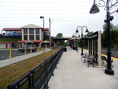
Pennsauken-TRANSIT Center Address: Derousse Ave street in Pennsauken
Attractions near Pennsauken-TRANSIT Center
Pennsauken Transit Center Parking Lot,NJ Transit: Pennsauken Transit Center,PENNSAUKEN TRANSIT CENTER station,Northeast Remseo Construction,Lazy Day Movie Day,Living Word Christian Assembly,Camden Water (Amer Water Operations and Maint),Calvary Baptist Church,Neter Naturals,Fastener Dimensions,American Food Company,American Food Trucking,Booker T Washington Alternative School,Flyers Skate Zone - Pennsauken,Liz & Jay Mini Market,Atm,Auto Parts Auto Plus Auto Parts Axle,Suburban Window Cleaning,ATM,Security Garage Door RepairsHow to get to popular attractions in Pennsauken with public transit
Five Points Intersection,Burlington Coat Factory Corporate Office,Geno's Steaks, Philadelphia,Honey's Sit 'n Eat, Philadelphia,Community College Of Philadelphia, Philadelphia,The Cheesecake Factory, Golden Triangle,NJT - Hamilton Station (NEC),Dalessandro’s Steaks and Hoagies, Philadelphia,Mantua, NJ,SEPTA Forest Hills Station, Philadelphia,Philadelphia Mills, Philadelphia,The College of New Jersey, Ewing,Gloucester City, NJ, Gloucester City,Hard Rock Cafe Philadelphia, Philadelphia,ShopRite, Hamilton Square,Hamilton Square, NJ, Hamilton Square,Voyeur, Philadelphia,Philadelphia Premium Outlets, Limerick,King Of Prussia Mall, King Of Prussia,Westville, NJ, WestvilleGet around Pennsauken by public transit!
Traveling around Pennsauken has never been so easy. See step by step directions as you travel to any attraction, street or major public transit station. View bus and train schedules, arrival times, service alerts and detailed routes on a map, so you know exactly how to get to anywhere in Pennsauken.
When traveling to any destination around Pennsauken use Moovit's Live Directions with Get Off Notifications to know exactly where and how far to walk, how long to wait for your line, and how many stops are left. Moovit will alert you when it's time to get off — no need to constantly re-check whether yours is the next stop.
Wondering how to use public transit in Pennsauken or how to pay for public transit in Pennsauken? Moovit public transit app can help you navigate your way with public transit easily, and at minimum cost. It includes public transit fees, ticket prices, and costs. Looking for a map of Pennsauken public transit lines? Moovit public transit app shows all public transit maps in Pennsauken with all bus, subway, light rail or train routes and stops on an interactive map.
Pennsauken has 4 transit type(s), including: bus, subway, light rail or train, operated by several transit agencies, including SEPTA Subway, SEPTA Trolley, SEPTA Rail, SEPTA, SEPTA, NJ TRANSIT RAIL-Rail, NJ TRANSIT RAIL-Tram, NJ TRANSIT BUS, Port Authority Transit Corporation, Navy Yard, Penn Transit, Drexel University, Pottstown Area Rapid Transit (PART), Fullington Tours and Chescobus