See Pennypack Creek, Philadelphia, on the map
Directions to Pennypack Creek (Philadelphia) with public transportation
The following transit lines have routes that pass near Pennypack Creek
 Bus:
Bus: - Train:
How to get to Pennypack Creek by bus?
Click on the bus route to see step by step directions with maps, line arrival times and updated time schedules.
How to get to Pennypack Creek by train?
Click on the train route to see step by step directions with maps, line arrival times and updated time schedules.
Bus stations near Pennypack Creek in Philadelphia
- Verree Rd & Bloomfield Av,8 min walk,
Bus lines to Pennypack Creek in Philadelphia
- 67,Philadelphia Mills Via Industrial,
What are the closest stations to Pennypack Creek?
The closest stations to Pennypack Creek are:
- Verree Rd & Bloomfield Av is 610 yards away, 8 min walk.
Which bus lines stop near Pennypack Creek?
These bus lines stop near Pennypack Creek: 67, 88.
Which train line stops near Pennypack Creek?
FOX CHASE LINE
What’s the nearest bus stop to Pennypack Creek in Philadelphia?
The nearest bus stop to Pennypack Creek in Philadelphia is Verree Rd & Bloomfield Av. It’s a 8 min walk away.
See Pennypack Creek, Philadelphia, on the map
Public Transit to Pennypack Creek in Philadelphia
Wondering how to get to Pennypack Creek in Philadelphia, United States? Moovit helps you find the best way to get to Pennypack Creek with step-by-step directions from the nearest public transit station.
Moovit provides free maps and live directions to help you navigate through your city. View schedules, routes, timetables, and find out how long does it take to get to Pennypack Creek in real time.
Looking for the nearest stop or station to Pennypack Creek? Check out this list of stops closest to your destination: Verree Rd & Bloomfield Av.
Bus:Train:
Want to see if there’s another route that gets you there at an earlier time? Moovit helps you find alternative routes or times. Get directions from and directions to Pennypack Creek easily from the Moovit App or Website.
We make riding to Pennypack Creek easy, which is why over 1.5 million users, including users in Philadelphia, trust Moovit as the best app for public transit. You don’t need to download an individual bus app or train app, Moovit is your all-in-one transit app that helps you find the best bus time or train time available.
For information on prices of bus, train, light rail and subway, costs and ride fares to Pennypack Creek, please check the Moovit app.
Use the app to navigate to popular places including to the airport, hospital, stadium, grocery store, mall, coffee shop, school, college, and university.
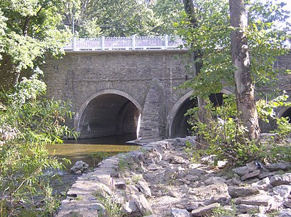
Pennypack Creek Address: PA street in Philadelphia
Attractions near Pennypack Creek
veere dam,Bird Blind,Friends of Pennypack Park,Pennypack Creek Park,Verree Rd & Bloomfield Av - 1 MBFS,Phila City & County Special Facilities,8600 Verree Rd,Pennypack Environmental Center,Vereeville,Pennypack Park Verree to Pine trail,Penny Pack Park,St Stephen's Orthodox Catholic Church,Bloomfield Avenue,Cirone General Contractor,Benches,Verree Road,8598 Verree Road,Norvelt Drive,St Stephens Orthodox Cathedral,Rich's MancaveHow to get to popular attractions in Philadelphia with public transit
Gloucester City, NJ, Gloucester City,Malvern, PA, Malvern,Geno's Steaks, Philadelphia,Adelphia Restaurant,Sampan, Philadelphia,The Franklin Fountain, Philadelphia,Croydon, PA, Croydon,Westville, NJ, Westville,SEI Investments, Upper Providence,Wegmans,Wayne, PA, Radnor,Aloft Philadelphia Airport, Philadelphia,Woody's, Philadelphia,Pottstown, PA, Pottstown,Three Monkeys Café, Philadelphia,Burlington Coat Factory Corporate Office,Our Lady of Lourdes Hospital, Camden,Fado Irish Pub, Philadelphia,Chickie's & Pete's, Philadelphia,Lockheed Martin Rotary and Mission SystemsGet around Philadelphia by public transit!
Traveling around Philadelphia has never been so easy. See step by step directions as you travel to any attraction, street or major public transit station. View bus and train schedules, arrival times, service alerts and detailed routes on a map, so you know exactly how to get to anywhere in Philadelphia.
When traveling to any destination around Philadelphia use Moovit's Live Directions with Get Off Notifications to know exactly where and how far to walk, how long to wait for your line, and how many stops are left. Moovit will alert you when it's time to get off — no need to constantly re-check whether yours is the next stop.
Wondering how to use public transit in Philadelphia or how to pay for public transit in Philadelphia? Moovit public transit app can help you navigate your way with public transit easily, and at minimum cost. It includes public transit fees, ticket prices, and costs. Looking for a map of Philadelphia public transit lines? Moovit public transit app shows all public transit maps in Philadelphia with all bus, train, light rail or subway routes and stops on an interactive map.
Philadelphia has 4 transit type(s), including: bus, train, light rail or subway, operated by several transit agencies, including SEPTA Subway, SEPTA Trolley, SEPTA Rail, SEPTA, SEPTA, NJ TRANSIT RAIL-Rail, NJ TRANSIT RAIL-Tram, NJ TRANSIT BUS, Port Authority Transit Corporation, Navy Yard, Penn Transit, Drexel University, Pottstown Area Rapid Transit (PART), Fullington Tours and Chescobus