How to get to Pensoutelhas by bus?
Click on the bus route to see step by step directions with maps, line arrival times and updated time schedules.
From Hospital Estadual Adão Pereira Nunes, Duque De Caxias
51 minFrom Morro do Garibaldi, Duque De Caxias
70 minFrom Monte do Azeite, Duque De Caxias
55 minFrom Campos Elíseos, Duque De Caxias
55 minFrom Ponto Final TREL - PETRÓPOLIS X PIABETÁ, Petrópolis
115 minFrom Refinaria Duque de Caxias (REDUC), Duque De Caxias
46 minFrom Sítio Primorosa, Nova Iguaçu
183 minFrom Jardim Anhangá, Duque De Caxias
70 minFrom Chácaras Rio-Petrópolis, Duque De Caxias
40 minFrom Figueira, Duque De Caxias
56 min
Bus stops near Pensoutelhas in Duque De Caxias
Bus lines to Pensoutelhas in Duque De Caxias
- TZ11, Tinguá,VIEW
- 31, Amapá,VIEW
- POLO XERÉM - SANTA CRUZ DA SERRA, Polo Xerém - Santa Cruz da Serra,VIEW
- 01, Caxias - Xerém,VIEW
- 154N, Petrópolis - Xerém,VIEW
- 417T, Xerém - Barra da Tijuca (via Linha Vermelha / Washington Luiz),VIEW
- 445I, Nova Iguaçu - Xerém (Via Lote Xv),VIEW
- 486C, Xerém - Central (Via Av. Brasil),VIEW
- 554I, Caxias - Mantiquira (Via Lote Xv),VIEW
- 637T, Xerém - Leblon (via Av. Brasil / Lapa / Lagoa),VIEW
- 765I, Piabetá - Xerém (Via Nova Campinas / Imbariê),VIEW
- 2417T, Xerém - Barra da Tijuca (Executivo),VIEW
What are the closest stations to Pensoutelhas?
The closest stations to Pensoutelhas are:
- Estrada Rio D'Ouro, 1097-1137 is 82 meters away, 2 min walk.
- Praça Da Mantiquira (Sentido Br-040) is 326 meters away, 5 min walk.
Which bus lines stop near Pensoutelhas?
These bus lines stop near Pensoutelhas: 01, 31, 445I, 486C, 765I.
What’s the nearest bus station to Pensoutelhas in Duque De Caxias?
The nearest bus station to Pensoutelhas in Duque De Caxias is Estrada Rio D'Ouro, 1097-1137. It’s a 2 min walk away.
What time is the first bus to Pensoutelhas in Duque De Caxias?
The 417T is the first bus that goes to Pensoutelhas in Duque De Caxias. It stops nearby at 4:05 AM.
What time is the last bus to Pensoutelhas in Duque De Caxias?
The 486C is the last bus that goes to Pensoutelhas in Duque De Caxias. It stops nearby at 12:58 AM.
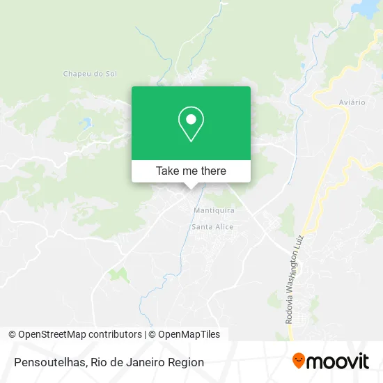
See Pensoutelhas, Duque De Caxias, on the map
Public Transit to Pensoutelhas in Duque De Caxias
Wondering how to get to Pensoutelhas in Duque De Caxias? Moovit helps you find the best way to get to Pensoutelhas with step-by-step directions from the nearest public transit station.
Moovit provides free maps and live directions to help you navigate through your city. View schedules, routes, timetables, and find out how long does it take to get to Pensoutelhas in real time.
Looking for the nearest stop or station to Pensoutelhas? Check out this list of stops closest to your destination: Estrada Rio D'Ouro; Praça Da Mantiquira (Sentido Br-040).
Bus: 01, 31, 445I, 486C, 765I, TZ11, POLO XERÉM - SANTA CRUZ DA SERRA, 154N, 417T.
Want to see if there’s another route that gets you there at an earlier time? Moovit helps you find alternative routes or times. Get directions from and directions to Pensoutelhas easily from the Moovit App or Website.
We make riding to Pensoutelhas easy, which is why over 1.5 million users, including users in Duque De Caxias, trust Moovit as the best app for public transit. You don’t need to download an individual bus app or train app, Moovit is your all-in-one transit app that helps you find the best bus time or train time available.
For information on prices of bus, costs and ride fares to Pensoutelhas, please check the Moovit app.
Use the app to navigate to popular places including to the airport, hospital, stadium, grocery store, mall, coffee shop, school, college, and university.
Pensoutelhas Address: Estrada Rio D'Ouro, 103 Mantiquira Duque de Caxias-RJ 25245-810 street in Duque De Caxias
- Adriane Comercio Imobiliária e Turismo,
- Estrada Rio d'Ouro Km 51 Loja Jéssica Decorações de Festa N:3021,
- Artemanha Adesivos,
- Rede Dois Amigos Gas,
- Auto Escola Imbariê - Xerém,
- Jamal Refrigeracao,
- Mfe Artefatos de Concretos,
- Wr S Transporte,
- Bodart Assessoria e Treinamento,
- Luviane Móveis Eletrodomesticos,
- Cemitério,
- Pousada Costa Verde,
- Xlog Brasil,
- Nosso Bosque,
- Motorbus Carrocerias,
- Minimercado Quebra Galho,
- Rd Expresso Transportes,
- Green Leaf Naturals,
- Portobello S/a,
- Companhia Brasileira de Cerâmica
Places Near Pensoutelhas (Duque De Caxias)
- Rodoviária Novo Rio (Rodoviária do Rio de Janeiro), Santo Cristo,
- Niterói, Niterói,
- Rio De Janeiro,
- Avenida Venezuela 134, Saúde,
- Shopping Downtown, Barra Da Tijuca,
- Rua Licínio Cardoso, São Francisco Xavier,
- Norte Shopping, Cachambi,
- Hospital Municipal Ronaldo Gazolla, Acari,
- Hospital Federal Do Andaraí, Andaraí,
- Shopping RioSul, Botafogo,
- Feira Livre da Gloria, Glória,
- Rua Ulysses Guimarães 16, Cidade Nova,
- Feirão De Malhas, Duque De Caxias,
- Museu Do Amanhã, Centro,
- Praia do Arpoador, Ipanema,
- Hospital Federal Cardoso Fontes, Jacarepaguá,
- Hospital Pedro Ernesto, Vila Isabel,
- Avenida Rio Branco, Centro,
- Shopping Rio Sul, Botafogo,
- Shopping Nova América, Del Castilho
How to get to popular places in Rio de Janeiro Region with public transit
Get around Duque De Caxias by public transit!
Traveling around Duque De Caxias has never been so easy. See step by step directions as you travel to any attraction, street or major public transit station. View bus and train schedules, arrival times, service alerts and detailed routes on a map, so you know exactly how to get to anywhere in Duque De Caxias.
When traveling to any destination around Duque De Caxias use Moovit's Live Directions with Get Off Notifications to know exactly where and how far to walk, how long to wait for your line, and how many stops are left. Moovit will alert you when it's time to get off — no need to constantly re-check whether yours is the next stop.
Wondering how to use public transit in Duque De Caxias or how to pay for public transit in Duque De Caxias? Moovit public transit app can help you navigate your way with public transit easily, and at minimum cost. It includes public transit fees, ticket prices, and costs. Looking for a map of Duque De Caxias public transit lines? Moovit public transit app shows all public transit maps in Duque De Caxias with all Bus, Train, Metro, Light Rail, Ferry, Cable Car, Gondola and Funicular routes and stops on an interactive map.
Rio de Janeiro Region has 8 transit type(s), including: Bus, Train, Metro, Light Rail, Ferry, Cable Car, Gondola and Funicular, operated by several transit agencies, including TrensRJ, Metrô Rio, VLT Carioca, Barcas Rio, BRT MOBI-Rio, Auto Viação Alpha, Auto Viação Tijuca, Gire Transportes, Transurb, Viação Nossa Senhora das Graças, Consórcio INTERSUL, Braso Lisboa (Municipal), Caprichosa Auto Ônibus, Auto Viação Três Amigos and Rodoviária Âncora Matias