Directions to People In Love Photo (Arlington) with public transportation
The following transit lines have routes that pass near People In Love Photo
 Bus: 77, 80, 83, 87, 95.
- Train: LOWELL.
- Subway: RED LINE, GREEN LINE B, GREEN LINE C, GREEN LINE E.
How to get to People In Love Photo by bus?
Click on the bus route to see step by step directions with maps, line arrival times and updated time schedules.
From WGBH, Boston
55 minFrom Embassy Suites by Hilton Boston Waltham, Waltham
161 minFrom Brigham & Women's Hospital, Boston
71 minFrom Wang Theater, Boston
66 minFrom Revolution Hotel, Boston
67 minFrom MBTA-Aquarium, Boston
68 minFrom East Boston, Boston
91 minFrom Pizzeria Regina, Boston
49 minFrom Charlestown Navy Yard, Boston
44 minFrom Courtyard Marriott Lobby, Boston
66 min
How to get to People In Love Photo by train?
Click on the train route to see step by step directions with maps, line arrival times and updated time schedules.
How to get to People In Love Photo by subway?
Click on the subway route to see step by step directions with maps, line arrival times and updated time schedules.
From WGBH, Boston
72 minFrom Brigham & Women's Hospital, Boston
86 minFrom Wang Theater, Boston
66 minFrom Revolution Hotel, Boston
74 minFrom MBTA-Aquarium, Boston
67 minFrom East Boston, Boston
85 minFrom Pizzeria Regina, Boston
71 minFrom Charlestown Navy Yard, Boston
90 minFrom Courtyard Marriott Lobby, Boston
67 min
Bus stops near People In Love Photo in Arlington
Subway stations near People In Love Photo in Arlington
Train station near People In Love Photo in Arlington
- West Medford, 53 min walk,VIEW
Bus lines to People In Love Photo in Arlington
What are the closest stations to People In Love Photo?
The closest stations to People In Love Photo are:
- Medford St @ Webcowet Rd is 260 yards away, 4 min walk.
- Mystic St @ Russell St is 264 yards away, 4 min walk.
- Massachusetts Ave @ Medford St is 308 yards away, 4 min walk.
- Broadway @ Massachusetts Ave is 435 yards away, 6 min walk.
- Alewife is 3588 yards away, 42 min walk.
- West Medford is 4488 yards away, 53 min walk.
- Medford/Tufts Station is 4687 yards away, 55 min walk.
Which bus lines stop near People In Love Photo?
These bus lines stop near People In Love Photo: 77, 80, 83, 87, 95.
Which train line stops near People In Love Photo?
LOWELL (#327 | Lowell)
Which subway line stops near People In Love Photo?
RED LINE (Alewife)
What’s the nearest bus station to People In Love Photo in Arlington?
The nearest bus stations to People In Love Photo in Arlington are Medford St @ Webcowet Rd, Mystic St @ Russell St and Massachusetts Ave @ Medford St. The closest one is a 4 min walk away.
What time is the first subway to People In Love Photo in Arlington?
The GREEN LINE E is the first subway that goes to People In Love Photo in Arlington. It stops nearby at 4:57 AM.
What time is the last subway to People In Love Photo in Arlington?
The GREEN LINE E is the last subway that goes to People In Love Photo in Arlington. It stops nearby at 2:41 AM.
What time is the first train to People In Love Photo in Arlington?
The LOWELL is the first train that goes to People In Love Photo in Arlington. It stops nearby at 5:29 AM.
What time is the last train to People In Love Photo in Arlington?
The LOWELL is the last train that goes to People In Love Photo in Arlington. It stops nearby at 12:20 AM.
What time is the first bus to People In Love Photo in Arlington?
The 77 is the first bus that goes to People In Love Photo in Arlington. It stops nearby at 4:54 AM.
What time is the last bus to People In Love Photo in Arlington?
The 87 is the last bus that goes to People In Love Photo in Arlington. It stops nearby at 1:43 AM.
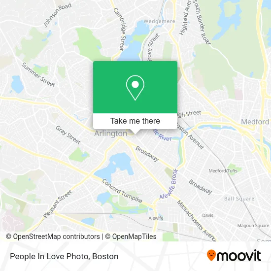
See People In Love Photo, Arlington, on the map
Public Transit to People In Love Photo in Arlington
Wondering how to get to People In Love Photo in Arlington? Moovit helps you find the best way to get to People In Love Photo with step-by-step directions from the nearest public transit station.
Moovit provides free maps and live directions to help you navigate through your city. View schedules, routes, timetables, and find out how long does it take to get to People In Love Photo in real time.
Looking for the nearest stop or station to People In Love Photo? Check out this list of stops closest to your destination: Medford St @ Webcowet Rd; Mystic St @ Russell St; Massachusetts Ave @ Medford St; Broadway @ Massachusetts Ave; Alewife; West Medford; Medford/Tufts Station.
Bus: 77, 80, 83, 87, 95, 350.Train: LOWELL.Subway: RED LINE, GREEN LINE B, GREEN LINE C, GREEN LINE E.
Want to see if there’s another route that gets you there at an earlier time? Moovit helps you find alternative routes or times. Get directions from and directions to People In Love Photo easily from the Moovit App or Website.
We make riding to People In Love Photo easy, which is why over 1.7 million users, including users in Arlington, trust Moovit as the best app for public transit. You don’t need to download an individual bus app or train app, Moovit is your all-in-one transit app that helps you find the best bus time or train time available.
For information on prices of bus, subway and train, costs and ride fares to People In Love Photo, please check the Moovit app.
Use the app to navigate to popular places including to the airport, hospital, stadium, grocery store, mall, coffee shop, school, college, and university.
People In Love Photo Address: 155 Warren St street in Arlington
- Affordable Locksmith,
- Klassical Kidz Music Studio,
- St Agnes Grammar School (Saint Agnes School Arlington, MA),
- Mls Property Information Network, Inc.,
- Arlington Catholic High School,
- Charlie's Barkery,
- Real Money Casino. Play Online Slots with Real Money,
- Citizens Bank & Trust,
- Thai Style Combination,
- Regent Theatre,
- SCK Painting,
- Carpet Cleaning,
- STARBUCKS,
- Arlington Civil War Monument,
- Locksmith Store In Arlington,
- Age Against the Machine,
- Arlington, Ma Fire,
- Mind's Eye Yarns,
- Pasciuto Frank - FFP Realty Corporation,
- Nails by Carly
Places Near People In Love Photo (Arlington)
- Wilbur Theatre, Boston,
- Massachusetts General Hospital, Boston,
- Boston Medical Center, Boston,
- Quincy Market, Boston,
- Boston Children's Hospital, Boston,
- North End, Boston,
- Mgm Music Hall, Boston,
- Boston Convention & Exhibition Center, Boston,
- Faneuil Hall, Boston,
- Boston Common, Boston,
- Prudential Center, Boston,
- Leader Bank Pavilion (Leader Bank Pavillion), Boston,
- Castle Island, Boston,
- Cheers, Boston,
- Td Garden, Boston,
- House Of Blues, Boston,
- Wang Theater, Boston,
- Museum Of Science, Boston,
- Seaport District, Boston,
- Isabella Stewart Gardner Museum, Boston
How to get to popular places in Boston with public transit
Get around Arlington by public transit!
Traveling around Arlington has never been so easy. See step by step directions as you travel to any attraction, street or major public transit station. View bus and train schedules, arrival times, service alerts and detailed routes on a map, so you know exactly how to get to anywhere in Arlington.
When traveling to any destination around Arlington use Moovit's Live Directions with Get Off Notifications to know exactly where and how far to walk, how long to wait for your line, and how many stops are left. Moovit will alert you when it's time to get off — no need to constantly re-check whether yours is the next stop.
Wondering how to use public transit in Arlington or how to pay for public transit in Arlington? Moovit public transit app can help you navigate your way with public transit easily, and at minimum cost. It includes public transit fees, ticket prices, and costs. Looking for a map of Arlington public transit lines? Moovit public transit app shows all public transit maps in Arlington with all Bus, Train, Subway and Ferry routes and stops on an interactive map.
Boston has 4 transit type(s), including: Bus, Train, Subway and Ferry, operated by several transit agencies, including MBTA, Southeastern Regional Transit Authority, MetroWest Regional Transit Authority, Rhode Island Public Transit Authority, WRTA, Lowell Regional Transit Authority, Merrimack Valley Transit, Montachusett Regional Transit Authority, Cape Cod Regional Transit Authority, Brockton Area Transit Authority, Martha's Vineyard Transit Authority, the WAVE - Nantucket Regional Transit Authority, GATRA, Cape Ann Transportation Authority and Massport