Directions to Pep Boys Auto Service & Tires (Boston) with public transportation
The following transit lines have routes that pass near Pep Boys Auto Service & Tires
 Bus: 1, 71, R.
- Train: PROVIDENCE/STOUGHTON, FOXBORO EVENT SERVICE, ACELA, NORTHEAST REGIONAL, PROVIDENCE LINE SHUTTLE.
How to get to Pep Boys Auto Service & Tires by bus?
Click on the bus route to see step by step directions with maps, line arrival times and updated time schedules.
How to get to Pep Boys Auto Service & Tires by train?
Click on the train route to see step by step directions with maps, line arrival times and updated time schedules.
Bus stops near Pep Boys Auto Service & Tires in Boston
Train stations near Pep Boys Auto Service & Tires in Boston
Bus lines to Pep Boys Auto Service & Tires in Boston
- R, Broad Street Terminal (Providence),VIEW
- 71, Stop&Shop (Cumberland),VIEW
- 1, South Attleboro Station Via Hope St,VIEW
- PETER PAN, CAPE COD - PROVIDENCE - NEW YORK,VIEW
- PETER PAN, PROVIDENCE - NEW YORK Express Service,VIEW
- PETER PAN, PROVIDENCE - BOSTON - BOSTON LOGAN AIRPORT,VIEW
- PETER PAN, BOSTON LOGAN AIRPORT - BOSTON - PROVIDENCE,VIEW
- PETER PAN, NEW YORK - PROVIDENCE - CAPE COD,VIEW
- PETER PAN, PROVIDENCE - SPRINGFIELD - ALBANY,VIEW
- PETER PAN, ALBANY - SPRINGFIELD - PROVIDENCE,VIEW
- PETER PAN, NEW YORK - PROVIDENCE Express Service,VIEW
What are the closest stations to Pep Boys Auto Service & Tires?
The closest stations to Pep Boys Auto Service & Tires are:
- Grenville Street is 451 yards away, 6 min walk.
- N Main After Ann Mary is 511 yards away, 7 min walk.
- Hope Before Overhill is 566 yards away, 7 min walk.
- Pawtucket/Central Falls is 792 yards away, 10 min walk.
- Peter Pan Bus Terminal Providence Ri is 1201 yards away, 15 min walk.
- Providence is 1774 yards away, 22 min walk.
Which bus lines stop near Pep Boys Auto Service & Tires?
These bus lines stop near Pep Boys Auto Service & Tires: 1, 71, R.
Which train line stops near Pep Boys Auto Service & Tires?
PROVIDENCE/STOUGHTON (#819 | Providence)
What’s the nearest train station to Pep Boys Auto Service & Tires in Boston?
The nearest train station to Pep Boys Auto Service & Tires in Boston is Pawtucket/Central Falls. It’s a 10 min walk away.
What’s the nearest bus station to Pep Boys Auto Service & Tires in Boston?
The nearest bus station to Pep Boys Auto Service & Tires in Boston is Grenville Street. It’s a 6 min walk away.
What time is the first train to Pep Boys Auto Service & Tires in Boston?
The PROVIDENCE/STOUGHTON is the first train that goes to Pep Boys Auto Service & Tires in Boston. It stops nearby at 4:10 AM.
What time is the last train to Pep Boys Auto Service & Tires in Boston?
The NORTHEAST REGIONAL is the last train that goes to Pep Boys Auto Service & Tires in Boston. It stops nearby at 9:17 AM.
What time is the first bus to Pep Boys Auto Service & Tires in Boston?
The R is the first bus that goes to Pep Boys Auto Service & Tires in Boston. It stops nearby at 5:23 AM.
What time is the last bus to Pep Boys Auto Service & Tires in Boston?
The R is the last bus that goes to Pep Boys Auto Service & Tires in Boston. It stops nearby at 12:51 AM.
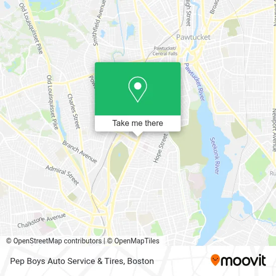
See Pep Boys Auto Service & Tires, Boston, on the map
Public Transit to Pep Boys Auto Service & Tires in Boston
Wondering how to get to Pep Boys Auto Service & Tires in Boston? Moovit helps you find the best way to get to Pep Boys Auto Service & Tires with step-by-step directions from the nearest public transit station.
Moovit provides free maps and live directions to help you navigate through your city. View schedules, routes, timetables, and find out how long does it take to get to Pep Boys Auto Service & Tires in real time.
Looking for the nearest stop or station to Pep Boys Auto Service & Tires? Check out this list of stops closest to your destination: Grenville Street; N Main After Ann Mary; Hope Before Overhill; Pawtucket/Central Falls; Peter Pan Bus Terminal Providence Ri; Providence.
Bus: 1, 71, R.Train: PROVIDENCE/STOUGHTON, FOXBORO EVENT SERVICE, ACELA, NORTHEAST REGIONAL, PROVIDENCE LINE SHUTTLE, PROVIDENCE LINE SHUTTLE, PROVIDENCE LINE SHUTTLE.
Want to see if there’s another route that gets you there at an earlier time? Moovit helps you find alternative routes or times. Get directions from and directions to Pep Boys Auto Service & Tires easily from the Moovit App or Website.
We make riding to Pep Boys Auto Service & Tires easy, which is why over 1.7 million users, including users in Boston, trust Moovit as the best app for public transit. You don’t need to download an individual bus app or train app, Moovit is your all-in-one transit app that helps you find the best bus time or train time available.
For information on prices of bus and train, costs and ride fares to Pep Boys Auto Service & Tires, please check the Moovit app.
Use the app to navigate to popular places including to the airport, hospital, stadium, grocery store, mall, coffee shop, school, college, and university.
Pep Boys Auto Service & Tires Address: 1246 N Main St street in Boston
- AutoZone,
- DUNKIN',
- Jim Gillen Teen Center,
- Empire Loan,
- Music Mindy,
- Straymond S CH,
- Ri4ctv Studio,
- Wholesale Jewelry Supply Co.,
- Gyan Pareek MD,
- Lane, Shannon - Miriam Hospital Outpatient Rehabilitation Services,
- University Medical Center,
- Jewish Collaborative Services of Ri,
- Sullivan Painting,
- Amazon Locker-Theatre,
- Coast Locksmith,
- Foster Forward Community Storefront,
- Arch Paging,
- Phohorn's Restaurant,
- City Line Pub,
- Amazon Locker-Llop
Places Near Pep Boys Auto Service & Tires (Boston)
- Isabella Stewart Gardner Museum, Boston,
- House Of Blues, Boston,
- Boston Common, Boston,
- Cheers, Boston,
- Leader Bank Pavilion (Leader Bank Pavillion), Boston,
- Wang Theater, Boston,
- Quincy Market, Boston,
- Boston Convention & Exhibition Center, Boston,
- Massachusetts General Hospital, Boston,
- Mgm Music Hall, Boston,
- Seaport District, Boston,
- Wilbur Theatre, Boston,
- Castle Island, Boston,
- Boston Medical Center, Boston,
- Prudential Center, Boston,
- North End, Boston,
- Museum Of Science, Boston,
- Boston Children's Hospital, Boston,
- Td Garden, Boston,
- Faneuil Hall, Boston
How to get to popular places in Boston with public transit
Get around Boston by public transit!
Traveling around Boston has never been so easy. See step by step directions as you travel to any attraction, street or major public transit station. View bus and train schedules, arrival times, service alerts and detailed routes on a map, so you know exactly how to get to anywhere in Boston.
When traveling to any destination around Boston use Moovit's Live Directions with Get Off Notifications to know exactly where and how far to walk, how long to wait for your line, and how many stops are left. Moovit will alert you when it's time to get off — no need to constantly re-check whether yours is the next stop.
Wondering how to use public transit in Boston or how to pay for public transit in Boston? Moovit public transit app can help you navigate your way with public transit easily, and at minimum cost. It includes public transit fees, ticket prices, and costs. Looking for a map of Boston public transit lines? Moovit public transit app shows all public transit maps in Boston with all Bus, Train, Subway and Ferry routes and stops on an interactive map.
Boston has 4 transit type(s), including: Bus, Train, Subway and Ferry, operated by several transit agencies, including MBTA, Southeastern Regional Transit Authority, MetroWest Regional Transit Authority, Rhode Island Public Transit Authority, WRTA, Lowell Regional Transit Authority, Merrimack Valley Transit, Montachusett Regional Transit Authority, Cape Cod Regional Transit Authority, Brockton Area Transit Authority, Martha's Vineyard Transit Authority, the WAVE - Nantucket Regional Transit Authority, GATRA, Cape Ann Transportation Authority and Massport