See Perelman Building, Philadelphia, on the map
Directions to Perelman Building (Philadelphia) with public transportation
The following transit lines have routes that pass near Perelman Building
 Bus:
Bus: - Train:
- Subway:
How to get to Perelman Building by bus?
Click on the bus route to see step by step directions with maps, line arrival times and updated time schedules.
How to get to Perelman Building by train?
Click on the train route to see step by step directions with maps, line arrival times and updated time schedules.
How to get to Perelman Building by subway?
Click on the subway route to see step by step directions with maps, line arrival times and updated time schedules.
Bus stations near Perelman Building in Philadelphia
- Pennsylvania Av & 27th St - Mbns,1 min walk,
- Pennsylvania Av & 26th St,3 min walk,
- Art Museum Dr & Kelly Dr 3 - 1 Mbns,3 min walk,
- Aspen St & Taney St,3 min walk,
Light Rail stations near Perelman Building in Philadelphia
- Girard Av & 24th St,3 min walk,
Bus lines to Perelman Building in Philadelphia
- 7,Pier 70 to 33rd-Dauphin,
- 32,Broad-Carpenter to Ridge-Lyceum,
- 49,33rd-Dauphin to 29th-Snyder,
- MANNLP,Mann Center,
- 38,5th-Market,
- 48,27th-Allegheny,
What are the closest stations to Perelman Building?
The closest stations to Perelman Building are:
- Pennsylvania Av & 27th St - Mbns is 45 yards away, 1 min walk.
- Pennsylvania Av & 26th St is 160 yards away, 3 min walk.
- Girard Av & 24th St is 186 yards away, 3 min walk.
- Art Museum Dr & Kelly Dr 3 - 1 Mbns is 189 yards away, 3 min walk.
- Aspen St & Taney St is 192 yards away, 3 min walk.
Which bus lines stop near Perelman Building?
These bus lines stop near Perelman Building: 32, 38, 43, 49.
Which train lines stop near Perelman Building?
These train lines stop near Perelman Building: CHESTNUT HILL EAST, MANAYUNK/NORRISTOWN, MEDIA/WAWA, PAOLI/THORNDALE, WARMINSTER.
Which subway line stops near Perelman Building?
BSL
What’s the nearest light rail station to Perelman Building in Philadelphia?
The nearest light rail station to Perelman Building in Philadelphia is Girard Av & 24th St. It’s a 3 min walk away.
What’s the nearest bus stop to Perelman Building in Philadelphia?
The nearest bus stop to Perelman Building in Philadelphia is Pennsylvania Av & 27th St - Mbns. It’s a 1 min walk away.
What time is the first light rail to Perelman Building in Philadelphia?
The 15 is the first light rail that goes to Perelman Building in Philadelphia. It stops nearby at 3:08 AM.
What time is the last light rail to Perelman Building in Philadelphia?
The 15 is the last light rail that goes to Perelman Building in Philadelphia. It stops nearby at 3:08 AM.
What time is the first bus to Perelman Building in Philadelphia?
The 49 is the first bus that goes to Perelman Building in Philadelphia. It stops nearby at 5:19 AM.
What time is the last bus to Perelman Building in Philadelphia?
The 7 is the last bus that goes to Perelman Building in Philadelphia. It stops nearby at 1:41 AM.
How much is the train fare to Perelman Building?
The train fare to Perelman Building costs about $3.75 - $9.25.
How much is the bus fare to Perelman Building?
The bus fare to Perelman Building costs about $2.00.
How much is the subway fare to Perelman Building?
The subway fare to Perelman Building costs about $2.00.
See Perelman Building, Philadelphia, on the map
Public Transit to Perelman Building in Philadelphia
Wondering how to get to Perelman Building in Philadelphia, United States? Moovit helps you find the best way to get to Perelman Building with step-by-step directions from the nearest public transit station.
Moovit provides free maps and live directions to help you navigate through your city. View schedules, routes, timetables, and find out how long does it take to get to Perelman Building in real time.
Looking for the nearest stop or station to Perelman Building? Check out this list of stops closest to your destination: Pennsylvania Av & 27th St - Mbns; Pennsylvania Av & 26th St; Girard Av & 24th St; Art Museum Dr & Kelly Dr 3 - 1 Mbns; Aspen St & Taney St.
Bus:Train:Subway:
Want to see if there’s another route that gets you there at an earlier time? Moovit helps you find alternative routes or times. Get directions from and directions to Perelman Building easily from the Moovit App or Website.
We make riding to Perelman Building easy, which is why over 1.5 million users, including users in Philadelphia, trust Moovit as the best app for public transit. You don’t need to download an individual bus app or train app, Moovit is your all-in-one transit app that helps you find the best bus time or train time available.
For information on prices of bus, train and subway, costs and ride fares to Perelman Building, please check the Moovit app.
Use the app to navigate to popular places including to the airport, hospital, stadium, grocery store, mall, coffee shop, school, college, and university.
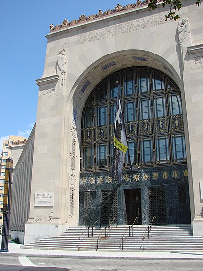
Perelman Building Address: 2525 Pennsylvania Ave street in Philadelphia
Attractions near Perelman Building
Philadelphia Museum of Art, Perelman Building , Philadelphia, PA,Bulldog Park,16th & Market,Kristine Killingsworth,The Sands Group,Berkshire Hathaway Homeservices,Feargus McCaughey - BHHS Fox & Roach, Realtors,G2philly,Joan of Arc,MaxAesthetics,2512 Aspen St,2401 Pennsylvania Ave,American Justice Network,System Failures File System Corruption,Ellis Leonard Rubin CPA,Richard Cohen MD,Fabulous Faces Face Painting and Balloon Twisting,Kevin Kuehlwein, Psyd, Act,Owners Associates Philadelphn,Leonardo Magran MDHow to get to popular attractions in Philadelphia with public transit
Honey's Sit 'n Eat, Philadelphia,Wegmans,Hard Rock Cafe Philadelphia, Philadelphia,Quaker Bridge Mall,Talula's Garden, Philadelphia,Vedge, Philadelphia,West Chester, PA, West Chester,Burlington, NJ, Burlington,Target,Morimoto, Philadelphia,Lockheed Martin Rotary and Mission Systems,West Oak Lane, Philadelphia,Malvern, PA, Malvern,Voyeur, Philadelphia,Mantua, NJ,Three Monkeys Café, Philadelphia,King Of Prussia Mall, King Of Prussia,ShopRite,Starbucks, Philadelphia,Amada, PhiladelphiaGet around Philadelphia by public transit!
Traveling around Philadelphia has never been so easy. See step by step directions as you travel to any attraction, street or major public transit station. View bus and train schedules, arrival times, service alerts and detailed routes on a map, so you know exactly how to get to anywhere in Philadelphia.
When traveling to any destination around Philadelphia use Moovit's Live Directions with Get Off Notifications to know exactly where and how far to walk, how long to wait for your line, and how many stops are left. Moovit will alert you when it's time to get off — no need to constantly re-check whether yours is the next stop.
Wondering how to use public transit in Philadelphia or how to pay for public transit in Philadelphia? Moovit public transit app can help you navigate your way with public transit easily, and at minimum cost. It includes public transit fees, ticket prices, and costs. Looking for a map of Philadelphia public transit lines? Moovit public transit app shows all public transit maps in Philadelphia with all bus, train or subway routes and stops on an interactive map.
Philadelphia has 3 transit type(s), including: bus, train or subway, operated by several transit agencies, including SEPTA Subway, SEPTA Trolley, SEPTA Rail, SEPTA, SEPTA, NJ TRANSIT RAIL-Rail, NJ TRANSIT RAIL-Tram, NJ TRANSIT BUS, Port Authority Transit Corporation, Navy Yard, Penn Transit, Drexel University, Pottstown Area Rapid Transit (PART), Fullington Tours and Chescobus