How to get to Perenyi Transporte by bus?
Click on the bus route to see step by step directions with maps, line arrival times and updated time schedules.
From Bairro Amapá, Duque de Caxias, Duque De Caxias
88 minFrom Morro do Garibaldi, Duque De Caxias
80 minFrom Outlet Premium Rio de Janeiro, Duque De Caxias
47 minFrom Caxias x Magé, Duque De Caxias
41 minFrom Campos Elíseos, Duque De Caxias
52 minFrom Xerém, Duque De Caxias
58 minFrom Figueira, Duque De Caxias
39 minFrom Sítio H20, Duque De Caxias
81 minFrom Refinaria Duque de Caxias (REDUC), Duque De Caxias
46 minFrom Feirão De Malhas, Duque De Caxias
41 min
Bus stops near Perenyi Transporte in Duque De Caxias
Train station near Perenyi Transporte in Duque De Caxias
- Morabi, 21 min walk,VIEW
Bus lines to Perenyi Transporte in Duque De Caxias
What are the closest stations to Perenyi Transporte?
The closest stations to Perenyi Transporte are:
- Campo De Futebol is 331 meters away, 5 min walk.
- Avenida Automóvel Clube, 1609 is 588 meters away, 8 min walk.
- Monte Do Azeite is 723 meters away, 10 min walk.
- Rua Schiller, 186 is 1423 meters away, 19 min walk.
- Morabi is 1608 meters away, 21 min walk.
Which bus lines stop near Perenyi Transporte?
These bus lines stop near Perenyi Transporte: 022, 510, 513.
What’s the nearest train station to Perenyi Transporte in Duque De Caxias?
The nearest train station to Perenyi Transporte in Duque De Caxias is Morabi. It’s a 21 min walk away.
What’s the nearest bus station to Perenyi Transporte in Duque De Caxias?
The nearest bus station to Perenyi Transporte in Duque De Caxias is Campo De Futebol. It’s a 5 min walk away.
What time is the first train to Perenyi Transporte in Duque De Caxias?
The EXTENSÃO VILA INHOMIRIM is the first train that goes to Perenyi Transporte in Duque De Caxias. It stops nearby at 5:25 AM.
What time is the last train to Perenyi Transporte in Duque De Caxias?
The EXTENSÃO VILA INHOMIRIM is the last train that goes to Perenyi Transporte in Duque De Caxias. It stops nearby at 10:08 PM.
What time is the first bus to Perenyi Transporte in Duque De Caxias?
The 46 is the first bus that goes to Perenyi Transporte in Duque De Caxias. It stops nearby at 4:04 AM.
What time is the last bus to Perenyi Transporte in Duque De Caxias?
The 510 is the last bus that goes to Perenyi Transporte in Duque De Caxias. It stops nearby at 1:00 AM.
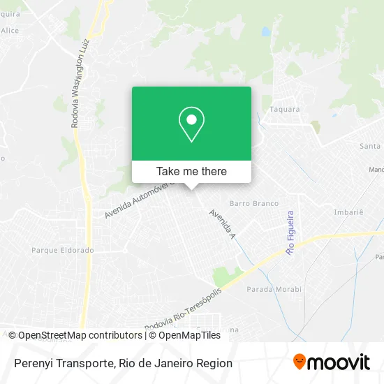
See Perenyi Transporte, Duque De Caxias, on the map
Public Transit to Perenyi Transporte in Duque De Caxias
Wondering how to get to Perenyi Transporte in Duque De Caxias? Moovit helps you find the best way to get to Perenyi Transporte with step-by-step directions from the nearest public transit station.
Moovit provides free maps and live directions to help you navigate through your city. View schedules, routes, timetables, and find out how long does it take to get to Perenyi Transporte in real time.
Looking for the nearest stop or station to Perenyi Transporte? Check out this list of stops closest to your destination: Campo De Futebol; Avenida Automóvel Clube; Monte Do Azeite; Rua Schiller; Morabi.
Bus: 022, 510, 513, TZ08, TZ19, 46, 413, 571C, 765I, 031, 70.Train: EXTENSÃO VILA INHOMIRIM.
Want to see if there’s another route that gets you there at an earlier time? Moovit helps you find alternative routes or times. Get directions from and directions to Perenyi Transporte easily from the Moovit App or Website.
We make riding to Perenyi Transporte easy, which is why over 1.5 million users, including users in Duque De Caxias, trust Moovit as the best app for public transit. You don’t need to download an individual bus app or train app, Moovit is your all-in-one transit app that helps you find the best bus time or train time available.
For information on prices of bus, costs and ride fares to Perenyi Transporte, please check the Moovit app.
Use the app to navigate to popular places including to the airport, hospital, stadium, grocery store, mall, coffee shop, school, college, and university.
Perenyi Transporte Address: Cidade Parque Paulista Duque de Caxias-RJ 25268-010 street in Duque De Caxias
- Marcusviniciusda,
- Desenvolvedor Tigas,
- Jaquelinegomesdos,
- Foto Real,
- Wa Cosmeticos,
- Unhas e Artes Esmalteria,
- Evandro Rodrig,
- Banho & Tosa Turma da Monica,
- Rua Projetada A Ac Maria Horta Cantao 127,
- Rua Júlio Ribeiro,
- Associação Desportiva Scorpion,
- Nova Campinas,
- Igreja Metodista Renovada Ministerio Jeova Nissi,
- Rogeriobernardori,
- Ahsilk,
- C. I. E. P. 227 Procopio Ferreira,
- L&L Perfil,
- Casa dos Sonhos,
- Cris Coiffeur Macedo,
- Discípulos de Oxalá
Places Near Perenyi Transporte (Duque De Caxias)
- Rua Ulysses Guimarães 16, Cidade Nova,
- Shopping Rio Sul, Botafogo,
- Rua Licínio Cardoso, São Francisco Xavier,
- Shopping Downtown, Barra Da Tijuca,
- Avenida Rio Branco, Centro,
- Hospital Federal Do Andaraí, Andaraí,
- Praia do Arpoador, Ipanema,
- Feira Livre da Gloria, Glória,
- Hospital Federal Cardoso Fontes, Jacarepaguá,
- Shopping Nova América, Del Castilho,
- Rodoviária Novo Rio (Rodoviária do Rio de Janeiro), Santo Cristo,
- Niterói, Niterói,
- Hospital Pedro Ernesto, Vila Isabel,
- Norte Shopping, Cachambi,
- Hospital Municipal Ronaldo Gazolla, Acari,
- Museu Do Amanhã, Centro,
- Avenida Venezuela 134, Saúde,
- Rio De Janeiro,
- Feirão De Malhas, Duque De Caxias,
- Shopping RioSul, Botafogo
How to get to popular places in Rio de Janeiro Region with public transit
Get around Duque De Caxias by public transit!
Traveling around Duque De Caxias has never been so easy. See step by step directions as you travel to any attraction, street or major public transit station. View bus and train schedules, arrival times, service alerts and detailed routes on a map, so you know exactly how to get to anywhere in Duque De Caxias.
When traveling to any destination around Duque De Caxias use Moovit's Live Directions with Get Off Notifications to know exactly where and how far to walk, how long to wait for your line, and how many stops are left. Moovit will alert you when it's time to get off — no need to constantly re-check whether yours is the next stop.
Wondering how to use public transit in Duque De Caxias or how to pay for public transit in Duque De Caxias? Moovit public transit app can help you navigate your way with public transit easily, and at minimum cost. It includes public transit fees, ticket prices, and costs. Looking for a map of Duque De Caxias public transit lines? Moovit public transit app shows all public transit maps in Duque De Caxias with all Bus, Train, Metro, Light Rail, Ferry, Cable Car, Gondola and Funicular routes and stops on an interactive map.
Rio de Janeiro Region has 8 transit type(s), including: Bus, Train, Metro, Light Rail, Ferry, Cable Car, Gondola and Funicular, operated by several transit agencies, including TrensRJ, Metrô Rio, VLT Carioca, Barcas Rio, BRT MOBI-Rio, Auto Viação Alpha, Auto Viação Tijuca, Gire Transportes, Transurb, Viação Nossa Senhora das Graças, Consórcio INTERSUL, Braso Lisboa (Municipal), Caprichosa Auto Ônibus, Auto Viação Três Amigos and Rodoviária Âncora Matias