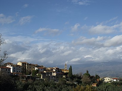
Directions to Pergine Valdarno (Arezzo) with public transportation
The following transit lines have routes that pass near Pergine Valdarno
How to get to Pergine Valdarno by bus?
Click on the bus route to see step by step directions with maps, line arrival times and updated time schedules.
How to get to Pergine Valdarno by train?
Click on the train route to see step by step directions with maps, line arrival times and updated time schedules.
Bus stops near Pergine Valdarno in Arezzo
- Via Del Bagno Nc.6, 1 min walk,
Train stations near Pergine Valdarno in Arezzo
- Ponticino, 48 min walk,
Bus lines to Pergine Valdarno in Arezzo
- MIV12, (Tmp) Vecchia Autostazione Montevarchi,
- SI330, Arezzo Terminal (Interno),
What are the closest stations to Pergine Valdarno?
The closest stations to Pergine Valdarno are:
- Via Del Bagno Nc.6 is 13 meters away, 1 min walk.
- Ponticino is 3738 meters away, 48 min walk.
Which bus line stops near Pergine Valdarno?
SI330
Which train line stops near Pergine Valdarno?
R
What’s the nearest bus stop to Pergine Valdarno in Arezzo?
The nearest bus stop to Pergine Valdarno in Arezzo is Via Del Bagno Nc.6. It’s a 1 min walk away.
What time is the first train to Pergine Valdarno in Arezzo?
The R is the first train that goes to Pergine Valdarno in Arezzo. It stops nearby at 7:09 AM.
What time is the last train to Pergine Valdarno in Arezzo?
The R is the last train that goes to Pergine Valdarno in Arezzo. It stops nearby at 12:36 AM.
See Pergine Valdarno, Arezzo, on the map
Public Transit to Pergine Valdarno in Arezzo
Wondering how to get to Pergine Valdarno in Arezzo, Italy? Moovit helps you find the best way to get to Pergine Valdarno with step-by-step directions from the nearest public transit station.
Moovit provides free maps and live directions to help you navigate through your city. View schedules, routes, timetables, and find out how long does it take to get to Pergine Valdarno in real time.
Looking for the nearest stop or station to Pergine Valdarno? Check out this list of stops closest to your destination: Via Del Bagno Nc.6; Ponticino.
Bus: SI330, MIV12.Train: R.
Want to see if there’s another route that gets you there at an earlier time? Moovit helps you find alternative routes or times. Get directions from and directions to Pergine Valdarno easily from the Moovit App or Website.
We make riding to Pergine Valdarno easy, which is why over 1.5 million users, including users in Arezzo, trust Moovit as the best app for public transit. You don’t need to download an individual bus app or train app, Moovit is your all-in-one transit app that helps you find the best bus time or train time available.
For information on prices of bus and train, costs and ride fares to Pergine Valdarno, please check the Moovit app.
Use the app to navigate to popular places including to the airport, hospital, stadium, grocery store, mall, coffee shop, school, college, and university.
Pergine Valdarno Address: 52019 Laterina Pergine Valdarno street in Arezzo
Attractions near Pergine Valdarno
Ufficio Relazioni con il Pubblico,Lala,Villa Fracassini,Aociazione Auser Volontariato Verde Soccorso Argento-Progetto Anchi,Impresa Funebre Fratelli Nannicini,Gastronomia Lok le,Pavimental,Parrocchia S. Maria,Proloco Pergin,Az. Agricola Santa Vittoria,Primo Console,Lui e Lei di Magrini Federico,Arma dei Carabinieri-Comando Stazione di Pergine Valdarno,Parrocchia di S.Pietro Apostolo,Edil B.F. di Butteri M. e Fiorentino C.,Comune di Laterina Pergine Valdarno,Pergine Valdarno (le Due Vie),Oratorio Santa Rita - Bettolino di Pogliano Milanese,A. De Gasperi,Uovo di CampagnaHow to get to popular attractions in Arezzo with public transit
Palazzo Pitti, Firenze,Scandicci, Scandicci,Alamanni - Stazione Santa Maria Novella, Firenze,Trattoria 13 Gobbi, Firenze,Calenzano, Calenzano,Piazza Santa Maria Novella, Firenze,Firenze, Firenze,CENTRO*PonteaGreve, Firenze, Firenze,Piazza Di Santo Spirito, Firenze,Piazzale Michelangiolo, Firenze,Istituto Di Istruzione Superiore Gobetti Volta, Bagno A Ripoli,Lastra A Signa, Lastra A Signa,Giardino Di Boboli, Firenze,San Marco, Firenze,Stazione Firenze Statuto, Firenze,Nelson Mandela Forum, Firenze,Centro Commerciale ""I Gigli"", Campi Bisenzio,CENTRO*Gavinana, Firenze,Stazione Sesto Fiorentino, Sesto Fiorentino,Virgin Active, FirenzeGet around Florence by public transit!
Traveling around Florence has never been so easy. See step by step directions as you travel to any attraction, street or major public transit station. View bus and train schedules, arrival times, service alerts and detailed routes on a map, so you know exactly how to get to anywhere in Florence.
When traveling to any destination around Florence use Moovit's Live Directions with Get Off Notifications to know exactly where and how far to walk, how long to wait for your line, and how many stops are left. Moovit will alert you when it's time to get off — no need to constantly re-check whether yours is the next stop.
Wondering how to use public transit in Florence or how to pay for public transit in Florence? Moovit public transit app can help you navigate your way with public transit easily, and at minimum cost. It includes public transit fees, ticket prices, and costs. Looking for a map of Florence public transit lines? Moovit public transit app shows all public transit maps in Florence with all Bus, Train, Light Rail, Ferry and Funicular routes and stops on an interactive map.
Florence has 5 transit type(s), including: Bus, Train, Light Rail, Ferry and Funicular, operated by several transit agencies, including Firenze urbano - Autolinee Toscane, GEST, Firenze e provincia - Autolinee Toscane, Firenze, Prato e province - Autolinee Toscane, Livorno e provincia - Autolinee Toscane, Arezzo, Firenze e province - Autolinee Toscane, Pistoia e provincia - Autolinee Toscane, Lucca e provincia - Autolinee Toscane, Prato e provincia - Autolinee Toscane, Massa, Carrara e provincia - Autolinee Toscane, Pisa e provincia - Autolinee Toscane, Arezzo, Siena e province - Autolinee Toscane, Grosseto, Siena e province - Autolinee Toscane, Grosseto e provincia - Autolinee Toscane, Siena e provincia - Autolinee Toscane