Directions to Peri Formwork Systems Inc. (Boston) with public transportation
The following transit lines have routes that pass near Peri Formwork Systems Inc.
 Bus: 10, 7, 9, SL3, 11.
- Train: FAIRMOUNT, FRAMINGHAM/WORCESTER, KINGSTON.
- Subway: RED LINE.
- Ferry: QUINCY FERRY, WINTHROP FERRY, WINTHROP/QUINCY FERRY, EAST, LOVEJOY - FAN PIER - PIER 10.
How to get to Peri Formwork Systems Inc. by bus?
Click on the bus route to see step by step directions with maps, line arrival times and updated time schedules.
From Quincy Center Station, Quincy
105 minFrom Codman Square, Boston
68 minFrom Fenway Park (Fenway Park, Home of the Boston Red Sox), Boston
59 minFrom Beth Israel Deaconess Hospital-Milton, Milton
120 minFrom Micro Center (Micro Elecronics), Cambridge
68 minFrom Terrace Room, Paige Hall, Medford
77 minFrom Danehy Park, Cambridge
91 minFrom Brighton, Boston
70 minFrom Belle Isle Lobster & Seafood, Winthrop Town
78 minFrom Hood Park, Boston
53 min
How to get to Peri Formwork Systems Inc. by train?
Click on the train route to see step by step directions with maps, line arrival times and updated time schedules.
How to get to Peri Formwork Systems Inc. by subway?
Click on the subway route to see step by step directions with maps, line arrival times and updated time schedules.
From Quincy Center Station, Quincy
46 minFrom Codman Square, Boston
55 minFrom Fenway Park (Fenway Park, Home of the Boston Red Sox), Boston
62 minFrom Beth Israel Deaconess Hospital-Milton, Milton
85 minFrom Micro Center (Micro Elecronics), Cambridge
59 minFrom Terrace Room, Paige Hall, Medford
68 minFrom Danehy Park, Cambridge
65 minFrom Brighton, Boston
82 minFrom Belle Isle Lobster & Seafood, Winthrop Town
69 minFrom Hood Park, Boston
51 min
Bus stops near Peri Formwork Systems Inc. in Boston
Ferry stations near Peri Formwork Systems Inc. in Boston
Subway station near Peri Formwork Systems Inc. in Boston
- Broadway, 10 min walk,VIEW
Bus lines to Peri Formwork Systems Inc. in Boston
What are the closest stations to Peri Formwork Systems Inc.?
The closest stations to Peri Formwork Systems Inc. are:
- Summer St @ E 1st St is 178 yards away, 3 min walk.
- Seaport (Fan Pier) is 400 yards away, 5 min walk.
- L St @ Broadway is 441 yards away, 6 min walk.
- E Broadway @ L St is 506 yards away, 7 min walk.
- City Point Bus Terminal is 595 yards away, 7 min walk.
- Broadway is 805 yards away, 10 min walk.
- World Trade Center Pier, Boston, MA is 3320 yards away, 39 min walk.
Which bus lines stop near Peri Formwork Systems Inc.?
These bus lines stop near Peri Formwork Systems Inc.: 10, 7, 9, SL3.
Which train lines stop near Peri Formwork Systems Inc.?
These train lines stop near Peri Formwork Systems Inc.: FAIRMOUNT, FRAMINGHAM/WORCESTER, KINGSTON.
Which subway line stops near Peri Formwork Systems Inc.?
RED LINE (Alewife)
What’s the nearest subway station to Peri Formwork Systems Inc. in Boston?
The nearest subway station to Peri Formwork Systems Inc. in Boston is Broadway. It’s a 10 min walk away.
What’s the nearest bus station to Peri Formwork Systems Inc. in Boston?
The nearest bus station to Peri Formwork Systems Inc. in Boston is Summer St @ E 1st St. It’s a 3 min walk away.
What’s the nearest ferry station to Peri Formwork Systems Inc. in Boston?
The nearest ferry station to Peri Formwork Systems Inc. in Boston is Seaport (Fan Pier). It’s a 5 min walk away.
What time is the first subway to Peri Formwork Systems Inc. in Boston?
The RED LINE is the first subway that goes to Peri Formwork Systems Inc. in Boston. It stops nearby at 5:28 AM.
What time is the last subway to Peri Formwork Systems Inc. in Boston?
The RED LINE is the last subway that goes to Peri Formwork Systems Inc. in Boston. It stops nearby at 1:51 AM.
What time is the first bus to Peri Formwork Systems Inc. in Boston?
The 10 is the first bus that goes to Peri Formwork Systems Inc. in Boston. It stops nearby at 4:50 AM.
What time is the last bus to Peri Formwork Systems Inc. in Boston?
The 10 is the last bus that goes to Peri Formwork Systems Inc. in Boston. It stops nearby at 1:41 AM.
What time is the first ferry to Peri Formwork Systems Inc. in Boston?
The EAST is the first ferry that goes to Peri Formwork Systems Inc. in Boston. It stops nearby at 6:01 AM.
What time is the last ferry to Peri Formwork Systems Inc. in Boston?
The FAST FERRY is the last ferry that goes to Peri Formwork Systems Inc. in Boston. It stops nearby at 9:05 PM.
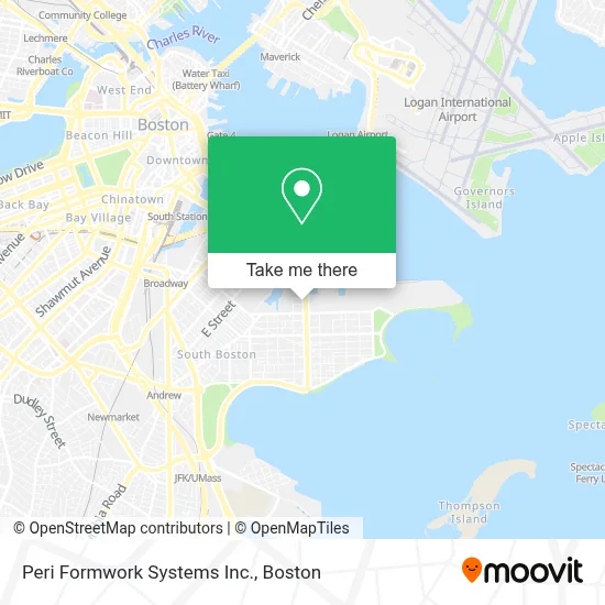
See Peri Formwork Systems Inc., Boston, on the map
Public Transit to Peri Formwork Systems Inc. in Boston
Wondering how to get to Peri Formwork Systems Inc. in Boston? Moovit helps you find the best way to get to Peri Formwork Systems Inc. with step-by-step directions from the nearest public transit station.
Moovit provides free maps and live directions to help you navigate through your city. View schedules, routes, timetables, and find out how long does it take to get to Peri Formwork Systems Inc. in real time.
Looking for the nearest stop or station to Peri Formwork Systems Inc.? Check out this list of stops closest to your destination: Summer St @ E 1st St; Seaport (Fan Pier); L St @ Broadway; E Broadway @ L St; City Point Bus Terminal; Broadway; World Trade Center Pier.
Bus: 10, 7, 9, SL3, 11.Train: FAIRMOUNT, FRAMINGHAM/WORCESTER, KINGSTON.Subway: RED LINE.Ferry: QUINCY FERRY, WINTHROP FERRY, WINTHROP/QUINCY FERRY, EAST, LOVEJOY - FAN PIER - PIER 10.
Want to see if there’s another route that gets you there at an earlier time? Moovit helps you find alternative routes or times. Get directions from and directions to Peri Formwork Systems Inc. easily from the Moovit App or Website.
We make riding to Peri Formwork Systems Inc. easy, which is why over 1.7 million users, including users in Boston, trust Moovit as the best app for public transit. You don’t need to download an individual bus app or train app, Moovit is your all-in-one transit app that helps you find the best bus time or train time available.
For information on prices of bus, subway and train, costs and ride fares to Peri Formwork Systems Inc., please check the Moovit app.
Use the app to navigate to popular places including to the airport, hospital, stadium, grocery store, mall, coffee shop, school, college, and university.
Peri Formwork Systems Inc. Address: 11 Elkins St street in Boston
- BSC Group (BSC Companies),
- 775 Summer Street,
- Murphy's Law,
- Ethel and Andy's Sandwich Shop (Ethel & Andy's Sub Shop),
- Greyhound Bus Garage,
- FedEx,
- Kim Davidson,
- Edic Pier,
- Babe Cave,
- The Hub,
- 647 Summer Street,
- Boston Cruise Port,
- The Distillery Gallery,
- Flynn Cruiseport Boston,
- Hampton Inn Boston Seaport District (Hampton Inn-Hampton Inn Boston),
- Hampton Inn-Boston Seaport District,
- 5-11 Dry Dock Avenue,
- Cruiseport Boston's Black Falcon Cruise Terminal,
- Identogo,
- Drydock
Places Near Peri Formwork Systems Inc. (Boston)
- Museum Of Science, Boston,
- Cheers, Boston,
- Prudential Center, Boston,
- Faneuil Hall, Boston,
- Boston Medical Center, Boston,
- Wilbur Theatre, Boston,
- Boston Convention & Exhibition Center, Boston,
- Massachusetts General Hospital, Boston,
- Boston Common, Boston,
- Wang Theater, Boston,
- Mgm Music Hall, Boston,
- Td Garden, Boston,
- Castle Island, Boston,
- Boston Children's Hospital, Boston,
- Isabella Stewart Gardner Museum, Boston,
- House Of Blues, Boston,
- Quincy Market, Boston,
- Seaport District, Boston,
- North End, Boston,
- Leader Bank Pavilion (Leader Bank Pavillion), Boston
How to get to popular places in Boston with public transit
Get around Boston by public transit!
Traveling around Boston has never been so easy. See step by step directions as you travel to any attraction, street or major public transit station. View bus and train schedules, arrival times, service alerts and detailed routes on a map, so you know exactly how to get to anywhere in Boston.
When traveling to any destination around Boston use Moovit's Live Directions with Get Off Notifications to know exactly where and how far to walk, how long to wait for your line, and how many stops are left. Moovit will alert you when it's time to get off — no need to constantly re-check whether yours is the next stop.
Wondering how to use public transit in Boston or how to pay for public transit in Boston? Moovit public transit app can help you navigate your way with public transit easily, and at minimum cost. It includes public transit fees, ticket prices, and costs. Looking for a map of Boston public transit lines? Moovit public transit app shows all public transit maps in Boston with all Bus, Train, Subway and Ferry routes and stops on an interactive map.
Boston has 4 transit type(s), including: Bus, Train, Subway and Ferry, operated by several transit agencies, including MBTA, Southeastern Regional Transit Authority, MetroWest Regional Transit Authority, Rhode Island Public Transit Authority, WRTA, Lowell Regional Transit Authority, Merrimack Valley Transit, Montachusett Regional Transit Authority, Cape Cod Regional Transit Authority, Brockton Area Transit Authority, Martha's Vineyard Transit Authority, the WAVE - Nantucket Regional Transit Authority, GATRA, Cape Ann Transportation Authority and Massport