Directions to Periférico Oriente (Iztapalapa) with public transportation
The following transit lines have routes that pass near Periférico Oriente
How to get to Periférico Oriente by bus?
Click on the bus route to see step by step directions with maps, line arrival times and updated time schedules.
How to get to Periférico Oriente by metro?
Click on the metro route to see step by step directions with maps, line arrival times and updated time schedules.
Bus stops near Periférico Oriente in Iztapalapa
- Av. Tlahuac - Periférico Oriente, 1 min walk,
- Av. Tláhuac - Metro Periférico Ote., 1 min walk,
- Av. Tlahuac - Metro Periférico Ote., 1 min walk,
- Av. Tláhuac - Anillo Periférico Canal de Garay, 1 min walk,
- Avenida Tlahuac 1324, 2 min walk,
- Callejón I. Zaragoza 12, 2 min walk,
- Avenida Tlahuac, 68, 3 min walk,
- Av. San Lorenzo - Av. Tláhuac, 3 min walk,
- Av. Tláhuac - Plaza Tulyehualco/Zaragoza, 3 min walk,
- Av. Tláhuac, 4 min walk,
- Anillo Periférico - Adolfo López Mateos, 4 min walk,
Metro station near Periférico Oriente in Iztapalapa
- Tezonco, 25 min walk,
Bus lines to Periférico Oriente in Iztapalapa
- CAMIÓN, Pantitlán Rojo Gomez Plaza Oriente Panteón Civil Chalco Tlahuac,
- METRO OLIVOS-BUENA SUERTE TLÁHUAC, Metro Olivos-Buena Suerte Tláhuac,
- 14, ,
- RUTA 35, San Lorenzo - Unidad Tezonco,
- RUTA 35, Metro Tezonco-Centro de Salud-Hospital de Especialidades-UACM-10 de mayo,
- RUTA 37, Metro Constitución - San José,
- RUTA 37, Metro Olivos - Metro Constitución,
- RUTA 56, Metro Merced - Tulyehualco,
- Z3H, Base Av. 4 Uacm Tezonco,
- RUTA 21, El Vergel,
- 112, Metro Universidad,
- 128, 10 Mayo,
- 336, Uacm San Lorenzo Tezonco,
- 162, C. C. Metro Constitución de 1917 - Cetram Constitución de 1917 Anden B,
- RUTA 112, Metro Constitución,
- B04, Bombas,
- RUTA 37, Metro Constitución,
- L7, Ciudad Universitaria,
- Z3G, Base Av. 4 Uacm Tezonco,
- RUTA 35, San Lorenzo - Canal de Chalco,
What are the closest stations to Periférico Oriente?
The closest stations to Periférico Oriente are:
- Av. Tlahuac - Periférico Oriente is 14 meters away, 1 min walk.
- Av. Tláhuac - Metro Periférico Ote. is 24 meters away, 1 min walk.
- Av. Tlahuac - Metro Periférico Ote. is 37 meters away, 1 min walk.
- Av. Tláhuac - Anillo Periférico Canal de Garay is 52 meters away, 1 min walk.
- Avenida Tlahuac 1324 is 132 meters away, 2 min walk.
- Callejón I. Zaragoza 12 is 134 meters away, 2 min walk.
- Avenida Tlahuac, 68 is 157 meters away, 3 min walk.
- Av. San Lorenzo - Av. Tláhuac is 177 meters away, 3 min walk.
- Av. Tláhuac - Plaza Tulyehualco/Zaragoza is 178 meters away, 3 min walk.
- Av. Tláhuac is 255 meters away, 4 min walk.
- Anillo Periférico - Adolfo López Mateos is 260 meters away, 4 min walk.
- Tezonco is 1927 meters away, 25 min walk.
Which bus lines stop near Periférico Oriente?
These bus lines stop near Periférico Oriente: 14, CAMIÓN, RUTA 35.
Which metro lines stop near Periférico Oriente?
These metro lines stop near Periférico Oriente: 12, 8.
What’s the nearest metro station to Periférico Oriente in Iztapalapa?
The nearest metro station to Periférico Oriente in Iztapalapa is Tezonco. It’s a 25 min walk away.
What’s the nearest bus station to Periférico Oriente in Iztapalapa?
The nearest bus stations to Periférico Oriente in Iztapalapa are Av. Tlahuac - Periférico Oriente, Av. Tláhuac - Metro Periférico Ote., Av. Tlahuac - Metro Periférico Ote. and Av. Tláhuac - Anillo Periférico Canal de Garay. The closest one is a 1 min walk away.
What time is the first metro to Periférico Oriente in Iztapalapa?
The 12 is the first metro that goes to Periférico Oriente in Iztapalapa. It stops nearby at 7:14 AM.
What time is the last metro to Periférico Oriente in Iztapalapa?
The 12 is the last metro that goes to Periférico Oriente in Iztapalapa. It stops nearby at 12:34 AM.
What time is the first bus to Periférico Oriente in Iztapalapa?
The 57-A is the first bus that goes to Periférico Oriente in Iztapalapa. It stops nearby at 3:04 AM.
What time is the last bus to Periférico Oriente in Iztapalapa?
The 47-A is the last bus that goes to Periférico Oriente in Iztapalapa. It stops nearby at 3:58 AM.
See Periférico Oriente, Iztapalapa, on the map
Public Transit to Periférico Oriente in Iztapalapa
Wondering how to get to Periférico Oriente in Iztapalapa, México? Moovit helps you find the best way to get to Periférico Oriente with step-by-step directions from the nearest public transit station.
Moovit provides free maps and live directions to help you navigate through your city. View schedules, routes, timetables, and find out how long does it take to get to Periférico Oriente in real time.
Looking for the nearest stop or station to Periférico Oriente? Check out this list of stops closest to your destination: Av. Tlahuac - Periférico Oriente; Av. Tláhuac - Metro Periférico Ote.; Av. Tlahuac - Metro Periférico Ote.; Av. Tláhuac - Anillo Periférico Canal de Garay; Avenida Tlahuac 1324; Callejón I. Zaragoza 12; Avenida Tlahuac; Av. San Lorenzo - Av. Tláhuac; Av. Tláhuac - Plaza Tulyehualco/Zaragoza; Av. Tláhuac; Anillo Periférico - Adolfo López Mateos; Tezonco.
Bus: 14, CAMIÓN, RUTA 35, METRO OLIVOS-BUENA SUERTE TLÁHUAC, Z3H, RUTA 21, 112, 128, 336, 162, RUTA 112.Metro: 12, 8.
Want to see if there’s another route that gets you there at an earlier time? Moovit helps you find alternative routes or times. Get directions from and directions to Periférico Oriente easily from the Moovit App or Website.
We make riding to Periférico Oriente easy, which is why over 1.5 million users, including users in Iztapalapa, trust Moovit as the best app for public transit. You don’t need to download an individual bus app or train app, Moovit is your all-in-one transit app that helps you find the best bus time or train time available.
For information on prices of bus and metro, costs and ride fares to Periférico Oriente, please check the Moovit app.
Use the app to navigate to popular places including to the airport, hospital, stadium, grocery store, mall, coffee shop, school, college, and university.
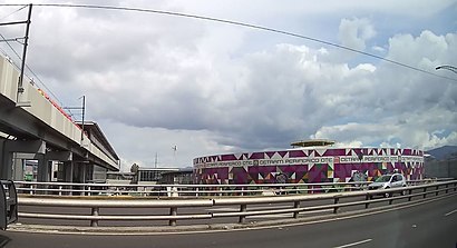
Periférico Oriente Address: Avenida Tláhuac street in Iztapalapa
Places Near Periférico Oriente (Iztapalapa)
How to get to popular places in Ciudad de Mexico with public transit
Get around Iztapalapa by public transit!
Traveling around Iztapalapa has never been so easy. See step by step directions as you travel to any attraction, street or major public transit station. View bus and train schedules, arrival times, service alerts and detailed routes on a map, so you know exactly how to get to anywhere in Iztapalapa.
When traveling to any destination around Iztapalapa use Moovit's Live Directions with Get Off Notifications to know exactly where and how far to walk, how long to wait for your line, and how many stops are left. Moovit will alert you when it's time to get off — no need to constantly re-check whether yours is the next stop.
Wondering how to use public transit in Iztapalapa or how to pay for public transit in Iztapalapa? Moovit public transit app can help you navigate your way with public transit easily, and at minimum cost. It includes public transit fees, ticket prices, and costs. Looking for a map of Iztapalapa public transit lines? Moovit public transit app shows all public transit maps in Iztapalapa with all Bus, Train, Metro, Cable Car and Gondola routes and stops on an interactive map.
Ciudad de Mexico has 5 transit type(s), including: Bus, Train, Metro, Cable Car and Gondola, operated by several transit agencies, including STC (Metro CDMX), Metrobús, RTP, Trolebús elevado, Trolebús, Tren El Insurgente, Tren Ligero, Cablebús, Corredores Concesionados, Ferrocarriles Suburbanos, Mexibus, Mexicable, Puma Bus, Peseros and Autobuses / Combis